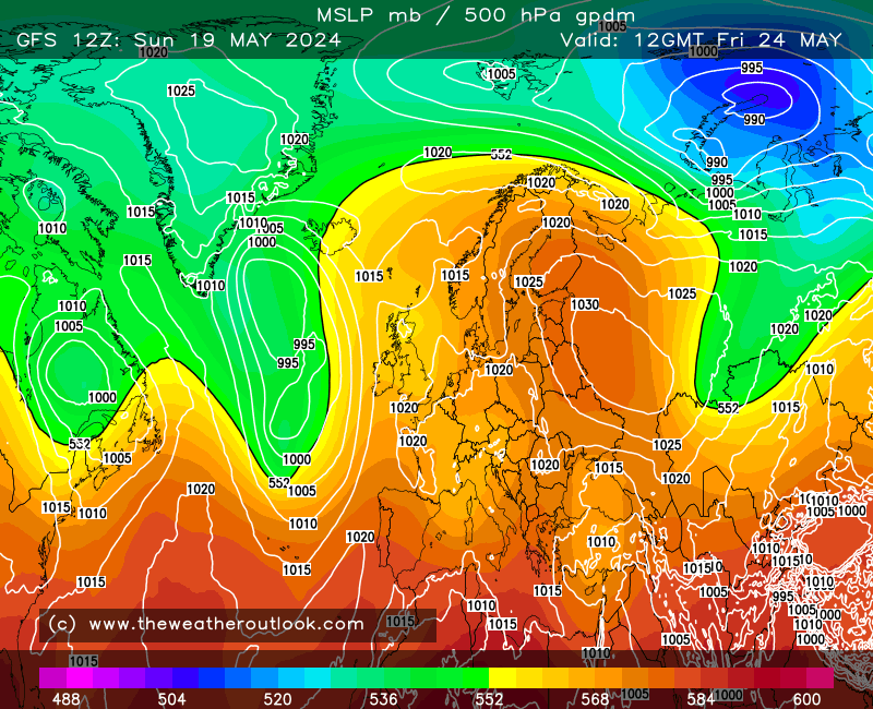

At day 5 we see where GFS (upper-left) goes wrong (I prefer to go with this terminology when speaking of GFS... ha); the Atlantic jet is flatter (the thick black line can be a loose guide here - note how it runs closer to W-E rather than SW-NE) and so a trailing front down west of the Azores is unable to remain intact, splitting apart with a shallow low becoming cut-off just west of the Azores (the loop of 1020 mb isobar).
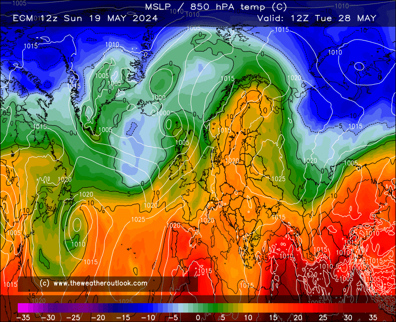
ECM, GEM and UKMO all align the jet more SW-NE with the trailing front staying intact, at least until a day or so later in time. This is enough that the strong ridge from the Azores would find it harder to retract west, and in any case the different jet alignment puts the low passing by Iceland on a trajectory more to the E or NE as opposed to being able to turn quite sharply SE as GFS goes with.
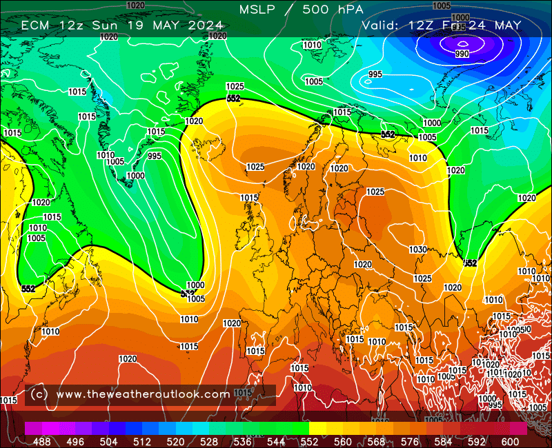
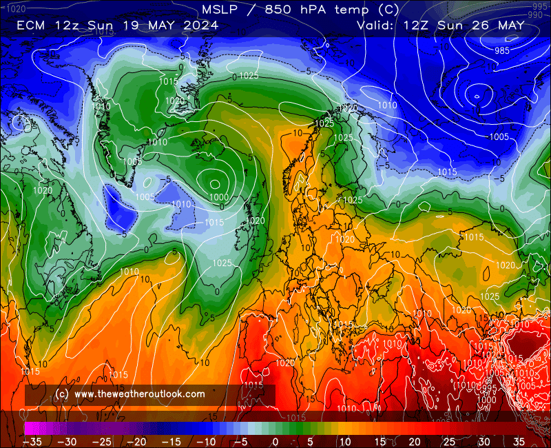
So the majority vote is for the ridge to drift slowly east instead, with the ECM 12z illustrating this very nicely for days 6-7;
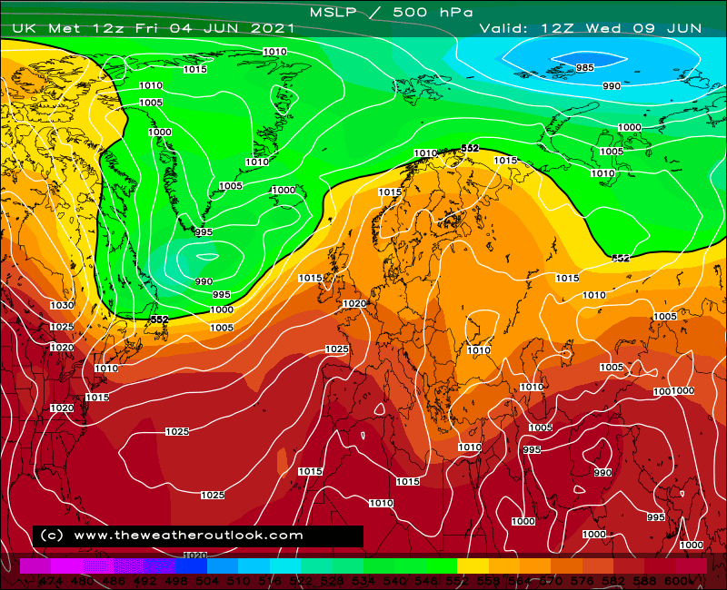
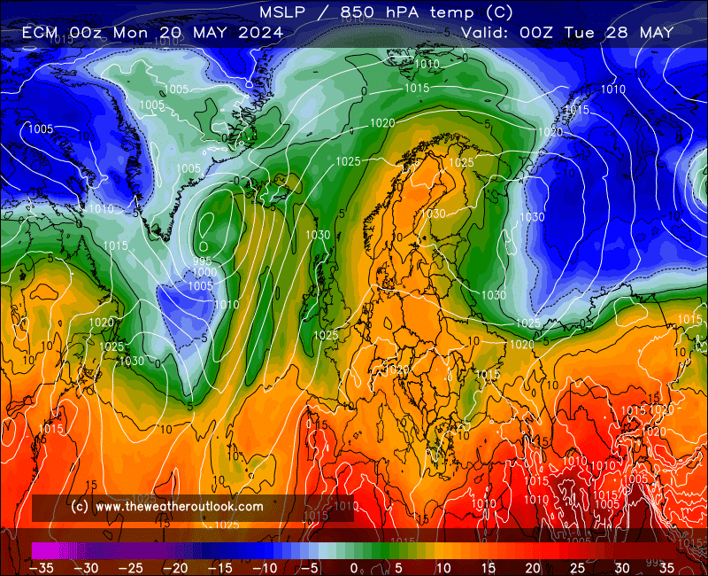
This is very similar indeed to GEM, while UKMO is a little more clunky as the jet does not retain as much SW-NE orientation so LP passes rather close to the N, but the trailing front does its job to prevent the ridge going west, and the low heading for Scandinavia loses most of its strength before it gets there, such that it's unable to directly drive any cooler air across the UK.
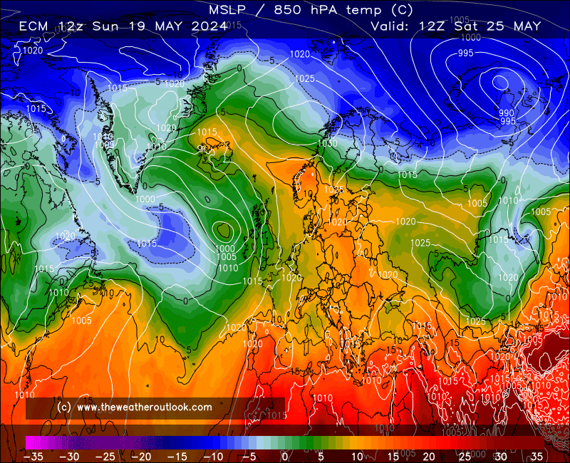
The ECM 12z then goes a little tricky in terms of the evolution; the bubble of HP scooting across is not something I can recall seeing very often;
It;s a neat trick for the south but not so for the north where the polar boundary could produce some spells of rain. Too far ahead to worry about such details though, and for all we know GEM is still leading the way with its dramatic take on events;


This has changed from the past two runs in that it breaks things down a little faster and before the dangerous levels of heat have really managed to establish themselves, but the thunderstorm potential with this is pretty serious. I'd personally be happier with the ECM 12z run but for northerners' sake a stronger ridge to the north of the plume is kindly requested  .
.
Edited by user
12 June 2017 19:30:41
|
Reason: Two-stage post for safety; this forum really needs an autosave function for posts!
If you have any problems or queries relating to TWO you can Email
[email protected] 🙂
https://twitter.com/peacockreports 2021's Homeland Extremes:
T-Max: 30.4°C 21st Jul | T-Min: -6.8°C New Years Day! | Wettest Day: 34.1mm 2nd Oct | Ice Days: 2 (27th Jan & 8th Feb)
Keep Calm and Forecast On