Hungry Tiger
08 October 2017 10:22:04

Originally Posted by: Bertwhistle 


This morning's ECM offers 564dam over SW England coupled with a near 15C 850mb temp.next Sunday. That's a rare thing for mid-October.


Phew 564 thickness in mid October - what sort of temperatures could we see with the likes of that 25C to 27C would be my guess.


Gavin S. FRmetS.
TWO Moderator.
Contact the TWO team - [email protected]
South Cambridgeshire. 93 metres or 302.25 feet ASL.


Brian Gaze
08 October 2017 10:22:37

Here's the ECM00z blowtorch chart:


Brian Gaze
Berkhamsted
TWO Buzz - get the latest news and views 
"I'm not socialist, I know that. I don't believe in sharing my money." - Gary Numan
Hungry Tiger
08 October 2017 10:26:34

Originally Posted by: Brian Gaze 


Here's the ECM00z blowtorch chart:


I have to say I've never seen the likes of that before - I'd hazard a guess we could see mid to high 20s out of the likes of that.


Gavin S. FRmetS.
TWO Moderator.
Contact the TWO team - [email protected]
South Cambridgeshire. 93 metres or 302.25 feet ASL.


08 October 2017 10:47:10

Originally Posted by: Hungry Tiger 


I have to say I've never seen the likes of that before - I'd hazard a guess we could see mid to high 20s out of the likes of that.


This chart shows the op run 850s for all the models at today's 0z run with figures of between 10C and 15C next weekend.


http://www.wetterzentrale.de/de/show_diagrams.php?model=multi&var=2&geoid=1140&lid=OP&bw=


However, the de Bilt data for the ECM model below shows that 2m temperatures do not exceed 18C next weekend based on the op run (red line). Some of the other ENS members do get up to around 21-22C. So I think mid 20's is probably unlikely. The UK date records for next weekend are around 23C.


https://meteoijsselmuiden.nl/knmipluim


So my guess is that if the ECM chart verified then temperatures of 22-23C are possible next weekend. Outside chance of 25C but very low probability of that I think.

Retron
08 October 2017 10:57:59

This morning's ECM had 22C as the high for next Sunday:


https://weather.us/model-charts/euro/c5defaf8681fe37cf1796186a2884a08/temperature/20171015-1200z.html


(County set  to Suffolk on the above link, you can choose your own).


Looking through the individual ensemble members - also available on the link above - it looks like that's at the top end of the ensembles. There are a few others with 21s and 22s, quite a few more with 20s, then the rest have mid to high teens.


Leysdown, north Kent
Stormchaser
09 October 2017 09:53:51

It's tricky with a long-fetch flow from the subtropics to anticipate just how far local variations might go in the lee of high ground, say. It looks like it could be a fine setup for producing localised exceptionally high temperatures in the vicinity of Hawarden in N. Wales for example, but it will depend on the exact direction of the flow, on which there remain considerable differences between GFS and ECM, as the latter has a stronger Euro High plus makes more of TC Ophelia as it moves to a point a little west of Iberia by Sunday.


Given that TD 17 - the likely precursor to Ophelia - has this morning been aligning its low-level circulation with deep convection, and that the NHC calls for intensification to a 60 mph storm with some scope in the model spreads for a hurricane, I'm inclined to side with the greater development depicted by ECM (along with UKMO and GEM for that matter). With that seems to come better support for the Euro High and the subtropical air transport on the NW flank of that. 


This also brings me nicely onto the risk of being swiped by ex-Ophelia as it lifts north Sun/Mon to pass over or just west of the UK. Because of the unusual path taken and that this is from the fairly warm waters west of Iberia, the system may not long have lost tropical characteristics when it arrives, so the potential exists for some very strong winds and a lot of rain to affect either part or most of the UK.
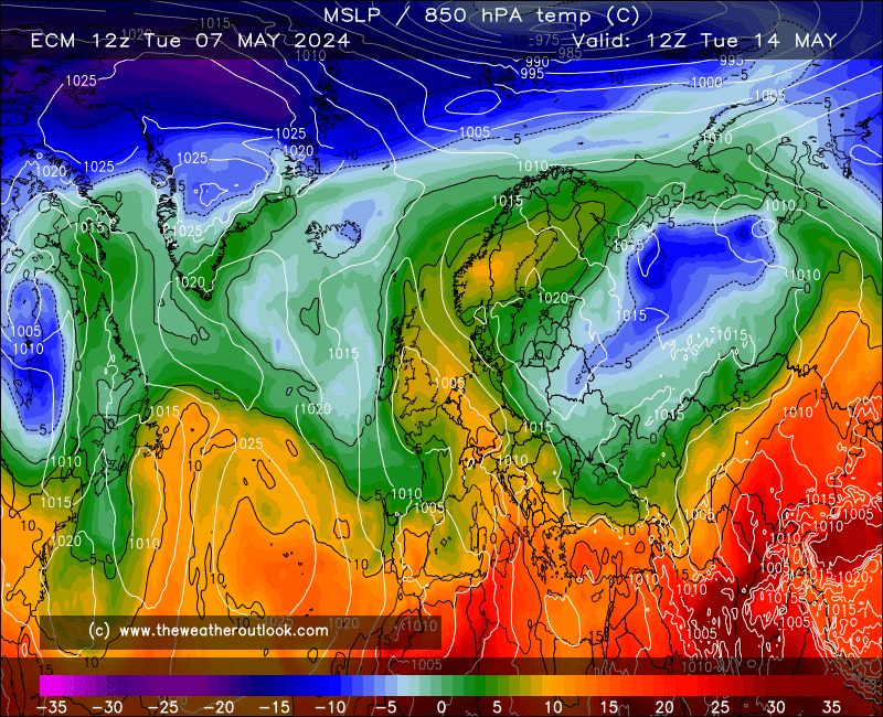
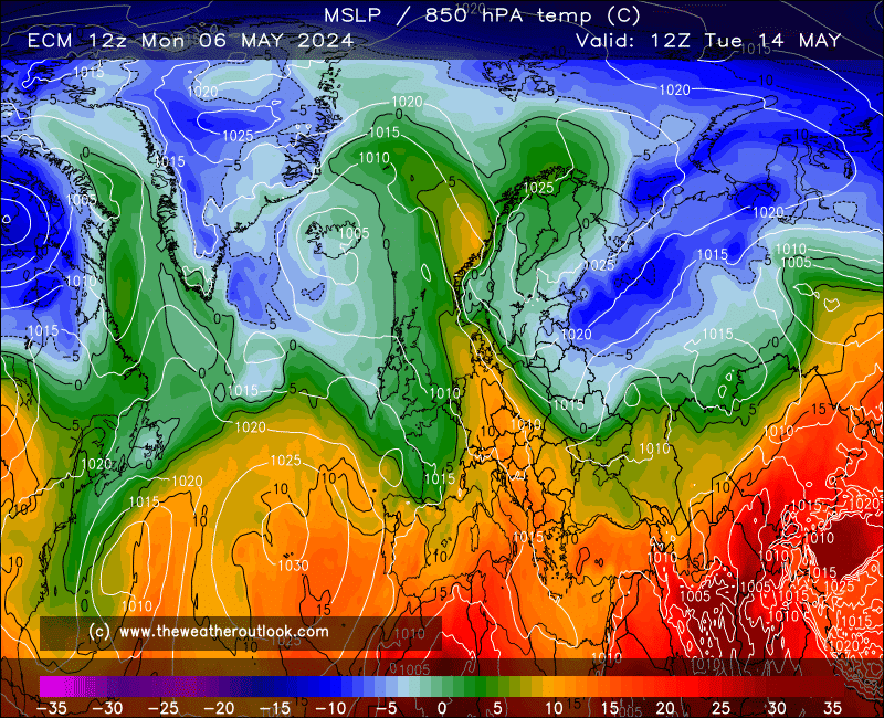


Looks to me that ECM is slow enough with this to allow another unusually warm day on Monday, with Monday night then proving exceptionally mild but increasingly wet and windy.


GEM is some 24 hours faster having kept the jet stream a bit more vigorous (with the plume not reaching as far NW) during the weekend, but just look at those 850s... could quite widely be in the high-teens all night under that setup.


This is all very speculative though given it's still a week away - GFS' lack of tropical development, with Monday simply dry and cooler than of late, remains a plausible outcome.


If you have any problems or queries relating to TWO you can Email [email protected] 🙂
https://twitter.com/peacockreports 
2021's Homeland Extremes:
T-Max: 30.4°C 21st Jul | T-Min: -6.8°C New Years Day! | Wettest Day: 34.1mm 2nd Oct | Ice Days: 2 (27th Jan & 8th Feb)
Keep Calm and Forecast On
Hippydave
09 October 2017 12:16:44
Re SC's post above that little feature caught my eye too. Has the potential to be quite interesting i'd have thought although more runs obviously needed before it's worth more than a quirked eyebrow. Still It's an unusual area for it arrive from and a bit different to our usual L.P. origin and track. Sort of reminds me of Oct 87 in a vaguely similar way (not suggesting anything like that obviously just similar area of development etc.)

Home: Tunbridge Wells
Work: Tonbridge
some faraway beach
09 October 2017 13:54:09

The ECM op run is very much at the windiest end of its ensemble regarding that feature next Monday. Even then, it doesn't look excessively windy at all:


On the other hand, that is for the eastern side of the country, and I take the point that its source and track could lead to more exciting conditions on the ground in places, if it did come off.


2 miles west of Taunton, 32 m asl, where "milder air moving in from the west" becomes SNOWMAGEDDON.
Well, two or three times a decade it does, anyway.
Devonian
09 October 2017 15:29:37

Originally Posted by: Stormchaser 


It's tricky with a long-fetch flow from the subtropics to anticipate just how far local variations might go in the lee of high ground, say. It looks like it could be a fine setup for producing localised exceptionally high temperatures in the vicinity of Hawarden in N. Wales for example, but it will depend on the exact direction of the flow, on which there remain considerable differences between GFS and ECM, as the latter has a stronger Euro High plus makes more of TC Ophelia as it moves to a point a little west of Iberia by Sunday.


Given that TD 17 - the likely precursor to Ophelia - has this morning been aligning its low-level circulation with deep convection, and that the NHC calls for intensification to a 60 mph storm with some scope in the model spreads for a hurricane, I'm inclined to side with the greater development depicted by ECM (along with UKMO and GEM for that matter). With that seems to come better support for the Euro High and the subtropical air transport on the NW flank of that. 


This also brings me nicely onto the risk of being swiped by ex-Ophelia as it lifts north Sun/Mon to pass over or just west of the UK. Because of the unusual path taken and that this is from the fairly warm waters west of Iberia, the system may not long have lost tropical characteristics when it arrives, so the potential exists for some very strong winds and a lot of rain to affect either part or most of the UK.


...


That would be something!


But, the last 18 months have seen far more rainfall fails than wins here (we're running at about 80% of normal 12 month rainfall atm) , so I wont hold my breath.


"When it takes nearly 900,000 votes to elect one party’s MP, and just 26,000 for another, you know something is deeply wrong."

The electoral reform society, 14,12,19
ballamar
09 October 2017 17:14:40
Nice little shock to the system on the very end of GFS - would feel very cold!
Hungry Tiger
09 October 2017 19:21:51

Originally Posted by: ballamar 

Nice little shock to the system on the very end of GFS - would feel very cold!


And - which is...........


Gavin S. FRmetS.
TWO Moderator.
Contact the TWO team - [email protected]
South Cambridgeshire. 93 metres or 302.25 feet ASL.


Stormchaser
09 October 2017 19:59:50


The trend from ECM and GEM with Ophelia is slower and further west, but still lifting out N. by Tuesday.


So lowering risk of strong winds and even the heavy rain risk looks restricted to the west, if even there.


It also serves to prolong the unusually warm conditions by an extra day (note that GFS has almost caught up with respect to Sunday... just making a little too much of that shortwave low still... or is it the only one making enough of it? Hmm!).


If you have any problems or queries relating to TWO you can Email [email protected] 🙂
https://twitter.com/peacockreports 
2021's Homeland Extremes:
T-Max: 30.4°C 21st Jul | T-Min: -6.8°C New Years Day! | Wettest Day: 34.1mm 2nd Oct | Ice Days: 2 (27th Jan & 8th Feb)
Keep Calm and Forecast On
Gavin D
10 October 2017 08:32:18

Not bad for mid October


Maunder Minimum
10 October 2017 09:30:26

Originally Posted by: Gavin D 


Not bad for mid October


Great for mid-October. Would be nice to see the same values with a "-" in  front when it comes to mid-January.


New world order coming.
Rob K
10 October 2017 09:46:48
Could well be some new date records over the weekend or Monday. Of course, 22C was even recorded in early November back in 2015!
Yateley, NE Hampshire, 73m asl
"But who wants to be foretold the weather? It is bad enough when it comes, without our having the misery of knowing about it beforehand." — Jerome K. Jerome
Stormchaser
10 October 2017 10:42:19


If we can manage such a brisk and direct flow form the anomalously warm seas west of Iberia and the Bay of Biscay, the temps shown here seem pretty realistic. Then again, GEM has a habit of moving airmasses around with too little modification, which implies that 21-22*C widely with a localised 23, perhaps 24*C in the warmest spot or two, is the best bet.


...or is it? On the one hand, ECM has not backed down on a more focused and as a result intense plume arriving during Sunday, although it does look to peak overnight into Monday so it's not an ideal outcome for breaking the date records - but we might not need that given the extreme nature of the airmass being imported. On the other hand, GFS continues to keep Ophelia further SW with the flow alignment angled more toward SW than SSW by a ridge nosing in from the SW having passes north of the tropical cyclone.


Funny thing is, GFS is now trying for the better alignment taking shape early next week;


...but by this time the airmass has undergone some moderation and so we'd be looking at low-20s tops and that's if the sun finds its way through the clouds. This setup in contrast to the 00z ECM which brings ex-Ophelia right across the UK on Monday. GEM takes it across far-western parts on the same day.


So the options on the table are currently a three-day spell of increasingly warm conditions that peaks at an exceptional level before a wet and windy breakdown on Monday, or a three-day spell that doesn't reach such exceptional levels but is followed by a brief freshening up on Monday (though still quite warm by the afternoon on the 00z) and then a reload on Tuesday before the proper breakdown on Wednesday.


Either way, it looks to be an impressive run of high temperatures for mid-Oct, particularly when considering both day and night values combined 


If you have any problems or queries relating to TWO you can Email [email protected] 🙂
https://twitter.com/peacockreports 
2021's Homeland Extremes:
T-Max: 30.4°C 21st Jul | T-Min: -6.8°C New Years Day! | Wettest Day: 34.1mm 2nd Oct | Ice Days: 2 (27th Jan & 8th Feb)
Keep Calm and Forecast On
briggsy6
10 October 2017 15:07:54

We're overdue some warm temps after such an underwhelming Aug/Sept period.


Location: Uxbridge
Gusty
10 October 2017 18:59:17

A potentially very interesting development.


http://old.wetterzentrale.de/pics/Recm1441.gif


Steve - Folkestone, Kent
Current conditions from my Davis Vantage Vue
https://www.wunderground.com/dashboard/pws/IFOLKE11 
Join Kent Weather on Facebook.
https://www.facebook.com/stevewall69/ 


Stormchaser
10 October 2017 19:27:22


Something I've noticed during plume events this year is that GFS is persistently lower with the 850s reaching the UK than ECM. Most times the actual has been closer to ECM once the event gets within 5 days range and the overall patterns match up closely - so I'm expecting to see the 15*C isotherm crossing the S. Coast by Sunday afternoon.


As Gusty has already alluded to, Monday is looking very interesting indeed on these latest runs, as Ophelia's movement has come together one something akin to recent ECM runs for timing but west of the ECM 00z for track, which serves to keep the UK in the unusually warm airmass through Monday. 


It's a bit of a close call with probably-ex-but-only-just-Ophelia though;


Gusts to just shy of hurricane force brush past the SW tip of Ireland on the 12z GFS run, and just beyond the left limit of the chart area there are actually some sustained winds of over 60 mph with gusts to over 80 mph.


Currently the jet stream looks to be positioned too far west for a direct hit on the UK to bring an extreme wind threat - just a heavy dose of rain as the storm loses intensity due to being too far from the jet stream (00z ECM depicted this outcome) but even with the chances of an eastward adjustment reducing steadily with each new run now, we're still seeing the most credible threat from a tropical cyclone since at least 2012 (perhaps longer) - yet still not on a par with the setup that produced the '87 storm with its nasty sting jet. Well, most likely not... best not rule anything out at this stage (but we should be able to by the evening beforehand... ha).


Signs are the absorption of Ophelia will result in a deep quasi-stationary trough somewhere near or over the UK during the rest of the week. GFS wants it moving right overhead but ECM keeps it to the NW so a wide spread of possible temperatures to figure out. 


If you have any problems or queries relating to TWO you can Email [email protected] 🙂
https://twitter.com/peacockreports 
2021's Homeland Extremes:
T-Max: 30.4°C 21st Jul | T-Min: -6.8°C New Years Day! | Wettest Day: 34.1mm 2nd Oct | Ice Days: 2 (27th Jan & 8th Feb)
Keep Calm and Forecast On
Gusty
10 October 2017 19:44:50

Hmmm. 16th October ..that date rings a bell...30 years to the day too ! 


Steve - Folkestone, Kent
Current conditions from my Davis Vantage Vue
https://www.wunderground.com/dashboard/pws/IFOLKE11 
Join Kent Weather on Facebook.
https://www.facebook.com/stevewall69/ 


Users browsing this topic

Ads