The chart below shows the rainfall pattern for the next 10 days across the UK, and shows how wet it is generally expected to be.
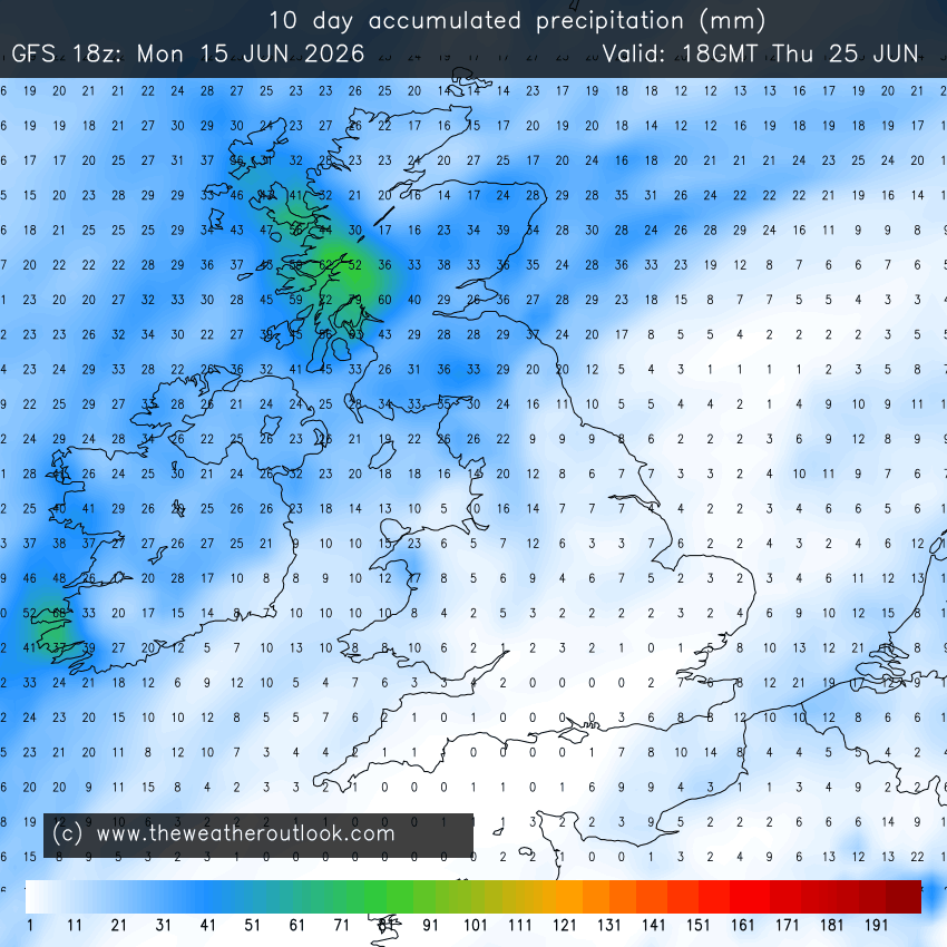
However, you will probably have noticed in that map that the driest area appears to in SE Scotland once again.
One thing which I have kept on mentioning in both the Current Conditions thread and the Precipitation Watch Thread is the manner in we are just not getting as much rain here in this part of the world just now as what the rest of the UK appears to be getting according to what everyone else is reporting on those threads, even though we are getting more rain than what we have been getting for a while. The above chart shows clearly, how this is likely to be the case for the next 10 days as well, resulting in that rainfall gap between here and the rest of the UK getting even bigger over that time.
Yet we in this part of the world have one of the biggest rainfall deficits in the UK to have built up over the course of the year. Last month was wetter than average here, though not by much and whilst the rest of the UK is running much wetter than average just now, our rainfall totals during this month so far are running at no more than average. This means that whilst the rainfall deficit may well be getting made up in the rest of the UK, that just isn't happening here in SE Scotland, and doesn't look like happening during the next 10 days either, going by the above chart.
I therefore find it weird that mother nature appears to be picking on this area of the UK in particular, for not giving us as much rainfall as the rest of the UK although I'm sure than anyone who is more knowledgeable than me, will be able to give a very good reason for why this is the case.
Originally Posted by: johncs2016