The Weather Outlook

Remove ads from site

johncs2016
20 October 2018 08:39:21

My concern here is the lack of rainfall spikes on this chart during the more reliable time frame.

850hPa temperatures, precipitation and the snow row

As it is, we have not had any measureable rainfall here in Edinburgh since that really wet day which we had on Saturday 13 October 2018 and so, today is already our 7th day in a row without any measureable rainfall.

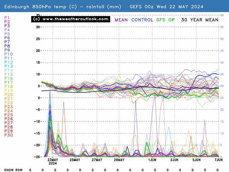
The chart below shows that there is not likely to be any significant rainfall during the more reliable timeframe and whilst some rainfall spikes do appear further down the line, these are all in the unreliable timeframe.

As a result of that, there is the danger that we could well be heading into what would then be our third absolute drought of this year.

On the other hand, the guidlines from SEPA suggest that this is the time of year when we should be starting to see groundwater levels recover from those summer droughts and so, the fact that we could end up with yet another drought going forward is very worrying indeed, as we really need to start seeing some serious rainfall here in order for those groundwater levels to properly recover. If that doesn't happen, this could become very critical and serious next year by the time that we go into next summer.


The north of Edinburgh, usually always missing out on snow events which occur not just within the rest of Scotland or the UK, but also within the rest of Edinburgh.

doctormog
20 October 2018 08:49:49
Surely you just need the hills/Borders to get rain John? I’m not sure a water shortage would be likely in Edinburgh.
some faraway beach
20 October 2018 09:04:02

The EC 46 more or less has us locked into +height anomalies to our N/NE throughout its entire run, now I’m not its biggest fan but if proven correct we could be looking at a well below average period of weather.

Originally Posted by: Solar Cycles 

Looking at those 15-day GEFS graphs posted above, the theme is similar. There's the scatter once you get into the second week, which is inevitable, but the very general theme is a strikingly cold and blocky one. And in my experience, once you do get the blocking and the initial cold shot in place, then they're a lot more persistent than the graphics suggest at this stage.


2 miles west of Taunton, 32 m asl, where "milder air moving in from the west" becomes SNOWMAGEDDON.

Well, two or three times a decade it does, anyway.

johncs2016
20 October 2018 09:05:35

Surely you just need the hills/Borders to get rain John? I’m not sure a water shortage would be likely in Edinburgh.

Originally Posted by: doctormog 

If we get a cold northerly plunge next week though as some models are indicating, any wintry showers which result from that would be unlikely to reach the Borders (with the exception of possibly, the Berwickshire coastline and even there, you're usually only talking about an odd isolated shower in these conditions), so we would need to be relying on these showers getting to the hills just to the north of here. Even here though, I doubt that these showers would reach those areas to the same extent as they would in the likes of the north of Scotland and since we are only talking about showery conditions anyway, the amounts of equivalent rainfall from that is always much smaller than what you would get from there being some more persistent rain around.

Because of that, I'm not convinced that the amount of equivalent rainfall from any wintry showers which occur over the hills just to the north of here, would be enough to alleviate the drought situation if such a northerly outbreak was to arise next week.

I agree that it is true that a water shortage here in Edinburgh is historically unlikely on paper. However, we are in a rapidly changing world due to climate change and various other factors which makes the current period which we are living through just now, even more of an occasion than before, where we can never rule anything out when it comes to the weather. That in turn means that you can never actually say that we will never actually get any water shortages here in Edinburgh in the future (not that I was implying that you were suggesting otherwise, anyway).


The north of Edinburgh, usually always missing out on snow events which occur not just within the rest of Scotland or the UK, but also within the rest of Edinburgh.

David M Porter
20 October 2018 09:17:32

The EC 46 more or less has us locked into +height anomalies to our N/NE throughout its entire run, now I’m not its biggest fan but if proven correct we could be looking at a well below average period of weather.

Originally Posted by: Solar Cycles 

Interesting!


Lenzie, Glasgow

"A body of men holding themselves accountable to nobody ought not to be trusted by anybody." – Thomas Paine

Maunder Minimum
20 October 2018 10:59:38

If only this were for December or January - direct northerly on the 6z:

http://www.meteociel.fr/modeles/gfse_cartes.php?&ech=150&mode=0

For next weekend.


New world order coming.
tallyho_83
20 October 2018 11:19:53

A decade on: Something looks familiar - how can I forget the rain, sleet, snow, hail and freak floods and thundersnow of east Devon end of October 2008? - as I almost got washed away in floods! - Must take a look back for contrasting purposes!? 10 years on we could see a Deja vu just hope there are no floods with this one this time!

28th 0ctober 2008's chart 


28th October 2018 - (notice the similarities!?)


Home Location - Vixen Tor Close, Okehampton, Devon (221m ASL)

---------------------------------------

Sean Moon

Magical Moon

www.magical-moon.com

Maunder Minimum
20 October 2018 17:52:54

Similar, but the position of the HP and the fetch of the wind makes 28th October 2018 more interesting (should the forecast verify of course).

GFS 12Z also looking interesting for next weekend.


New world order coming.
Steve Murr
20 October 2018 19:11:15
ECM brings a belt of Wintry PPN SSE over the UK T192 wrapped in -6 air-

Chance for snow over the hills...

ballamar
20 October 2018 19:15:36
http://www.wetterzentrale.de/maps/ECMOPEU12_240_1.png 

To me something quite different and an early cold outbreak akin to 2010 looks possible

White Meadows
20 October 2018 20:50:13

http://www.wetterzentrale.de/maps/ECMOPEU12_240_1.png

To me something quite different and an early cold outbreak akin to 2010 looks possible

Originally Posted by: ballamar 

I don’t disagree - it definitely looks interesting but waaaaayyyy too early to be drawing comparisons to winter proper let alone December 2010 the month the snow gods blessed this normally wet & windy isle. 

As long as it stays dry for the next couple of months while my roof is fixed the temperature can do whatever it likes. 

tallyho_83
20 October 2018 22:43:56


Home Location - Vixen Tor Close, Okehampton, Devon (221m ASL)

---------------------------------------

Sean Moon

Magical Moon

www.magical-moon.com

The Beast from the East
20 October 2018 23:56:48

Is this the start of another "winter of discontent"? The last one broke the post war consensus, perhaps this one will break the Thatcherite neo-liberal consensus


Purley, Surrey, 70m ASL

"We have some alternative facts for you"

Kelly-Ann Conway - former special adviser to the President

White Meadows
21 October 2018 04:33:10

Is this the start of another "winter of discontent"? The last one broke the post war consensus, perhaps this one will break the Thatcherite neo-liberal consensus


Originally Posted by: The Beast from the East 

eh?

nsrobins
21 October 2018 05:05:24
Well it looks like the season of proper ‘weather’ is about to get underway in decent style next weekend.
Neil

Fareham, Hampshire 28m ASL (near estuary)

Stormchaser, Member TORRO

Ally Pally Snowman
21 October 2018 06:46:27

Yes a big cold plunge next weekend and not a bad snow row for London in October. Early winter signs look good with the Atlantic pretty much dead and HLB evident.


Bishop's Stortford 85m ASL.
White Meadows
21 October 2018 06:55:38
Anyone have a good direct link to London ensembles? The one I normally use won’t refresh & stuck on 17.10.18

http://old.wetterzentrale.de/pics/MT8_London_ens.png 

Ally Pally Snowman
21 October 2018 07:11:53

Anyone have a good direct link to London ensembles? The one I normally use won’t refresh & stuck on 17.10.18

http://old.wetterzentrale.de/pics/MT8_London_ens.png

Originally Posted by: White Meadows 


Use the TWO charts they're great as above. Just click in Charts - GEFS - London 


Bishop's Stortford 85m ASL.
DEW
  • DEW
  • Advanced Member
21 October 2018 07:15:29

Yes a big cold plunge next weekend and not a bad snow row for London in October. Early winter signs look good with the Atlantic pretty much dead and HLB evident.

Originally Posted by: Ally Pally Snowman 

It doesn't show on the ensembles, but the northerly plunge next weekend shown on GFS0z looks like a rehearsal -affecting mainly the east coast - for the main event a week later, which involves a major depression bringing arctic air to the whole country. See T+276


War is God's way of teaching Americans geography - Ambrose Bierce

Chichester 12m asl

doctormog
21 October 2018 07:37:01


It doesn't show on the ensembles, but the northerly plunge next weekend shown on GFS0z looks like a rehearsal -affecting mainly the east coast - for the main event a week later, which involves a major depression bringing arctic air to the whole country. See T+276

Originally Posted by: DEW 

That latter chart shows unsettled conditions rather than anything overly cold. For example there is no sub 528dam air (500-1000hPa thickness) anywhere on the chart to which you refer. Compare that with next Saturday when essentially the entire country is covered in a sub 528dam airmass: http://www.wetterzentrale.de/maps/GFSOPEU00_150_33.png 

Chilly and unstable sums up next weekend nicely (sunshine and showers with a frost risk in places). After that it is too early to say but unsettled seems the main theme with cooler conditions at times.


Bertwhistle
21 October 2018 07:45:32


ECM view this morning: after today's near-miss with the 564dam and the little blip tomorrow, a swathe of warm air covers much of the country by Wednesday, with 850s up to 14C in parts of the spine of the country.

https://www.theweatheroutlook.com/twodata/chart.aspx?chart=///www.theweatheroutlook.com/charts/ecm/72_thickuk.png?cb=761

What a contrast 5 days later, with central England under -6C uppers and as Doc says, sub-528 over many.

https://www.theweatheroutlook.com/twodata/chart.aspx?chart=///www.theweatheroutlook.com/charts/ecm/192_thickuk.png?cb=688


Bertie, Itchen Valley.

Retire while you can still press the 'retire now' button.

DEW
  • DEW
  • Advanced Member
21 October 2018 07:53:23


That latter chart shows unsettled conditions rather than anything overly cold. For example there is no sub 528dam air (500-1000hPa thickness) anywhere on the chart to which you refer. Compare that with next Saturday when essentially the entire country is covered in a sub 528dam airmass: http://www.wetterzentrale.de/maps/GFSOPEU00_150_33.png 

Chilly and unstable sums up next weekend nicely (sunshine and showers with a frost risk in places). After that it is too early to say but unsettled seems the main theme with cooler conditions at times.

Originally Posted by: doctormog 

The chart to which I referred is on https://www.theweatheroutlook.com/twodata/datmdlout.aspx and that looks cold, not just chilly


War is God's way of teaching Americans geography - Ambrose Bierce

Chichester 12m asl

doctormog
21 October 2018 08:10:13

If you’re referring to the 276hr time period (mentioned in your earlier post) I have already explained that it is not overly cold in terms of airmass. Average at most for the time of year. Are you referring to the blues on the 500hPa charts which often than not indicate unsettled conditions rather rather than cold? A glance at partial thickness or t850hPa data will confirm that in this case.

The link above in your post just shows the GFS run as a whole?

Here are the modelled maxima for +276hr on the 00z GFS run http://www.theweatheroutlook.com/charts/gfs/00_276_uk2mtmp.png?cb=548 


Bertwhistle
21 October 2018 08:11:27


The chart to which I referred is on https://www.theweatheroutlook.com/twodata/datmdlout.aspx and that looks cold, not just chilly

Originally Posted by: DEW 

That link gives today's default 500mb chart. If you click on the chart you're referring to the open it, then ctrl + C the address bar, you'll be able to paste the actual chart you want.


Bertie, Itchen Valley.

Retire while you can still press the 'retire now' button.

ballamar
21 October 2018 10:40:21
If you like the theory of patterns repeating GFS 6Z is a nice run for winter prospects if you like Easterly Synoptics

Remove ads from site