Whether Idle
10 September 2018 18:17:58

Originally Posted by: Gusty 


Nothing sustained in terms of warmth though. A mobile signature with spikes indicative of warm sector and cooler incursions. 


I see nothing in the output currently to suggest a colder than average September for the CET area, I see average to a little warmer than average conditions in the offing as things stand this evening.


Dover, 5m asl. Half a mile from the south coast.
Solar Cycles
10 September 2018 18:54:42

Originally Posted by: Whether Idle 


I see nothing in the output currently to suggest a colder than average September for the CET area, I see average to a little warmer than average conditions in the offing as things stand this evening.


Average to slightly below would be my punt but either side of average isn’t out of the question. Nothing in any of the output screaming well below average.

Gusty
10 September 2018 20:02:34

Originally Posted by: Whether Idle 


I see nothing in the output currently to suggest a colder than average September for the CET area, I see average to a little warmer than average conditions in the offing as things stand this evening.


I wasn't referring to temperatures in the CET area. It was an observation of the sine wave nature of the upper air profiles and rainfall spikes on the London ensembles. 


The CET is another discussion for another thread. As we all know any ensemble comparisons should be drawn with somewhere like Manchester for that ! 


Steve - Folkestone, Kent
Current conditions from my Davis Vantage Vue
https://www.wunderground.com/dashboard/pws/IFOLKE11 
Join Kent Weather on Facebook.
https://www.facebook.com/stevewall69/ 


David M Porter
10 September 2018 21:06:22

Originally Posted by: Gusty 


Nothing sustained in terms of warmth though. A mobile signature with spikes indicative of warm sector and cooler incursions. 


Indeed, Steve. For one thing, I sure can't see any suggestion from any of the models just now of a repeat of the exceptionally warm spell that large parts of England had around this time in September 2016; IIRC 34C was reached somewhere during that spell before it finally broke and the atlantic woke up.


Lenzie, Glasgow

"Let us not take ourselves too seriously. None of us has a monopoly on wisdom, and we must always be ready to listen and respect other points of view."- Queen Elizabeth II 1926-2022
DEW
  • DEW
  • Advanced Member
11 September 2018 05:51:52

Up it pops again! GFS0z and ECM have the remains of a hurricane (Helene?) approaching Britain on 17/18 Sept, disturbing the normal westerly in operation until then, and combining with an Atlantic depression to give a powerful storm off NW Britain a couple of days later. ECM is especially keen on developing this feature, with what looks like hurricane force winds within touching distance of Cornwall before the jet stream re-asserts itself.


War does not determine who is right, only who is left - Bertrand Russell

Chichester 12m asl
Sevendust
11 September 2018 11:47:38
ECM showing a nice plume next week, backed up by GEFS ensembles
some faraway beach
11 September 2018 15:36:32

Originally Posted by: Sevendust 

ECM showing a nice plume next week, backed up by GEFS ensembles


Right at the top end of the ECM ensemble, but still plenty of support of support for warmth one way or another next week, even if not necessarily the scorchio of the op run.


2 miles west of Taunton, 32 m asl, where "milder air moving in from the west" becomes SNOWMAGEDDON.
Well, two or three times a decade it does, anyway.
Ally Pally Snowman
11 September 2018 18:47:18

ECM once again goes scorchio next week 17c 850s this time next week remarkable heat for so late.


Bishop's Stortford 85m ASL.
cultman1
12 September 2018 17:24:14
Is the scorchio / mini heatwave still being modelled for next week? There seems to be very little build up to this weather event so far
Ally Pally Snowman
12 September 2018 18:14:24


Warm up definitely still on Cultman1 , exceptional 850s for the time of year will feel very balmy. 


Bishop's Stortford 85m ASL.
Hungry Tiger
13 September 2018 13:25:38

Where is everyone?  Any clues to next week warm weather. ?


Gavin S. FRmetS.
TWO Moderator.
Contact the TWO team - [email protected]
South Cambridgeshire. 93 metres or 302.25 feet ASL.


severnside
13 September 2018 15:35:31

All depends on how much cloud we get, otherwise its just mild to humid, since August there has been many completely cloudy days

Arcus
13 September 2018 19:07:51

Was just going to post "more runs needed", but we'll have a little looks at next week's prospects on Helene et al(i):


12z UKMO really doesn't want to make much of it (but has wobbled considerably in recent runs):
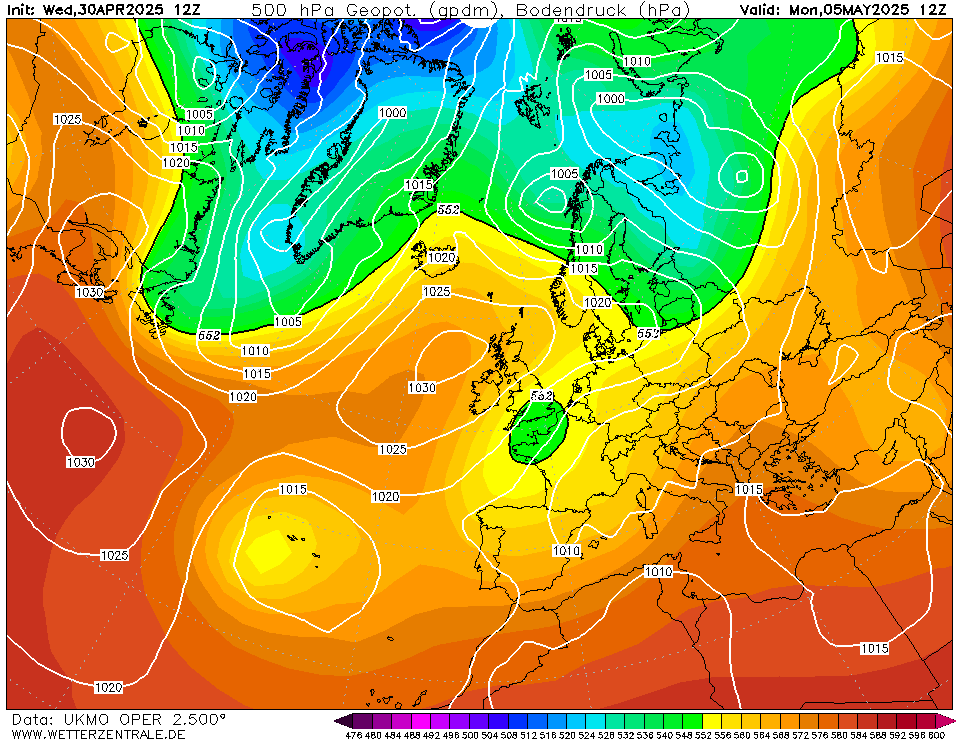


ICON not really interested either:


GEM pumps up the volume somewhat:
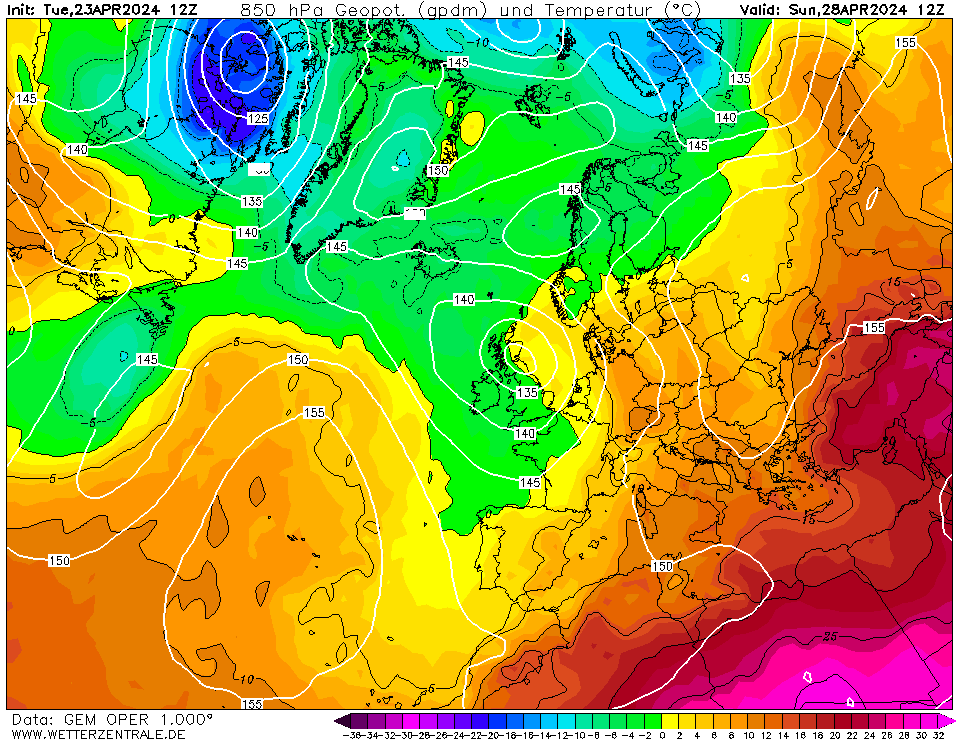


GFS does the same. But more. 


ECM similarly looks perilous for some:
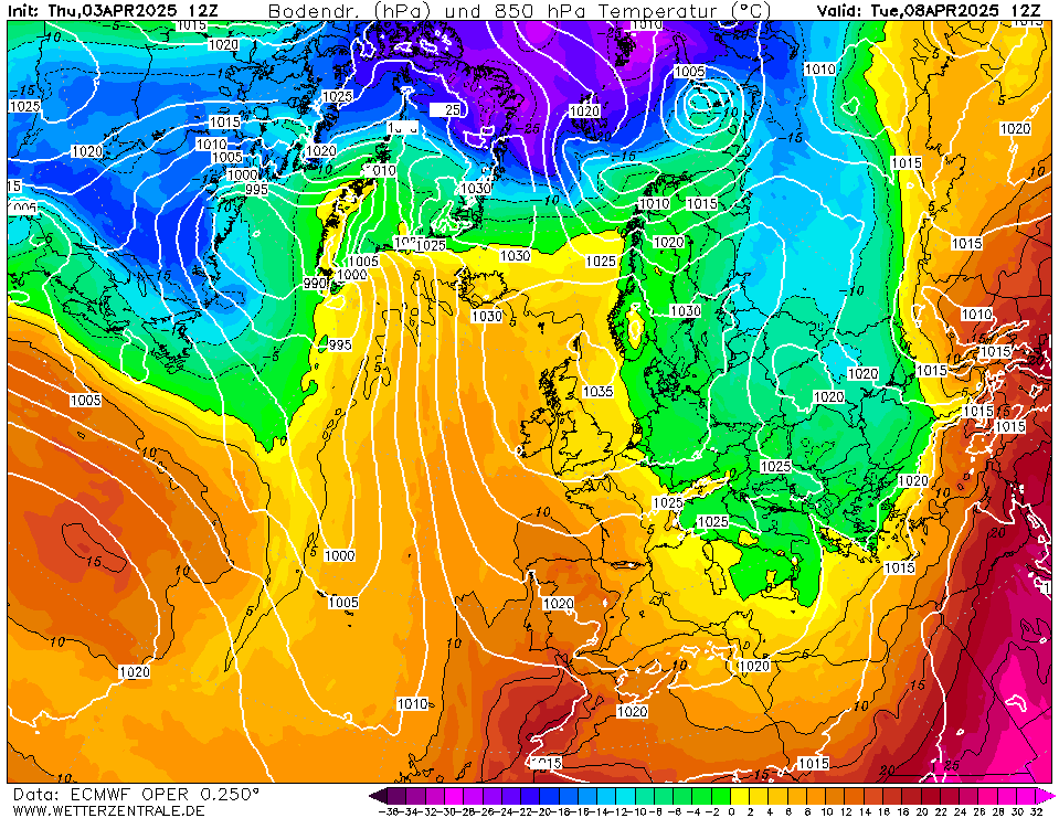


Given the spread, much to be resolved. But interesting to see the swings in output as ever.


Ben,
Nr. Easingwold, North Yorkshire
30m asl
DEW
  • DEW
  • Advanced Member
14 September 2018 06:58:10

NHC places Helene firmly in the Irish Sea as a tropical storm


https://www.nhc.noaa.gov/graphics_at3.shtml?cone#contents


War does not determine who is right, only who is left - Bertrand Russell

Chichester 12m asl
White Meadows
14 September 2018 07:52:12
A hurricane heatwave for the uk next week?
Interesting...
marco 79
14 September 2018 08:00:05
Quite a lot of perts hold fairly warm and dry for southern UK over next ten days from early next week on GEFS...as per usual more unsettled for the North and West ...longer term pattern currently showing HP wants to dominate UK wide..
Home : Mid Leicestershire ...135m ASL
Rob K
14 September 2018 14:40:22
GFS 6Z has HP all the way once the storm passes by... potential for high 20s mid next week?
Yateley, NE Hampshire, 73m asl
"But who wants to be foretold the weather? It is bad enough when it comes, without our having the misery of knowing about it beforehand." — Jerome K. Jerome
Bertwhistle
14 September 2018 15:58:06

Beautiful for late September; 1895.


https://www.theweatheroutlook.com/twodata/chart.aspx?chart=///www.theweatheroutlook.com/charts/gefs/19_258_850tmp.png?cb=17


Bertie, Itchen Valley.
'We'll never see 40 celsius in this country'.
Brian Gaze
14 September 2018 16:32:02


Brian Gaze
Berkhamsted
TWO Buzz - get the latest news and views 
"I'm not socialist, I know that. I don't believe in sharing my money." - Gary Numan
picturesareme
14 September 2018 17:28:16

Originally Posted by: DEW 


NHC places Helene firmly in the Irish Sea as a tropical storm


https://www.nhc.noaa.gov/graphics_at3.shtml?cone#contents


Not on that link it doesn't..  A post tropical was to the southwest of Ireland.

Users browsing this topic

Ads