Donate to browse the TWO website without adverts until 31st December 2024. You'll also get access to extra features and supporting our ongoing development.
For full details please see Advert free access on our website.
The outlook seems quite mixed. I'd not be surprised to see significant snowfall over the Scottish Highlands at times and there's a low chance of a a longer cold period developing in early March.
Plenty of hill snow in prospect in the range of possibilities offered in the ensembles.
However, for this flatlander the thoughts are now, especially after today's offering, firmly in the spring channel.
backdoor easterly looking possible to start "spring"
ECM doesn't quite make it but quite a lot of interest in the GEFS.
http://www.meteociel.fr/modeles/ecmwf/runs/2017022012/ECM1-72.GIF?20-0
before that, a potentially nasty little low showing up for thursday
After yesterday's interesting charts seems to be a bit of a downgrade (story of this Winter!) so ECM having none of the height rises now so we have GFS @ 192:
http://www.meteociel.fr/modeles/gfse_cartes.php?&ech=192&mode=0
Vs ECM
http://www.meteociel.fr/modeles/ecmwf.php?ech=192&mode=1&map=0&type=0&archive=0
Quite a difference there though both will feel a lot colder than it has been, maybe later runs will bring back the blocking to the north of the UK but if we get the high pressure further south and to the east, we might end up with quite a potent warm spell in March as we have had in February. Early days yet and the way the models have been this Winter I wouldn't rule anything out at this stage.
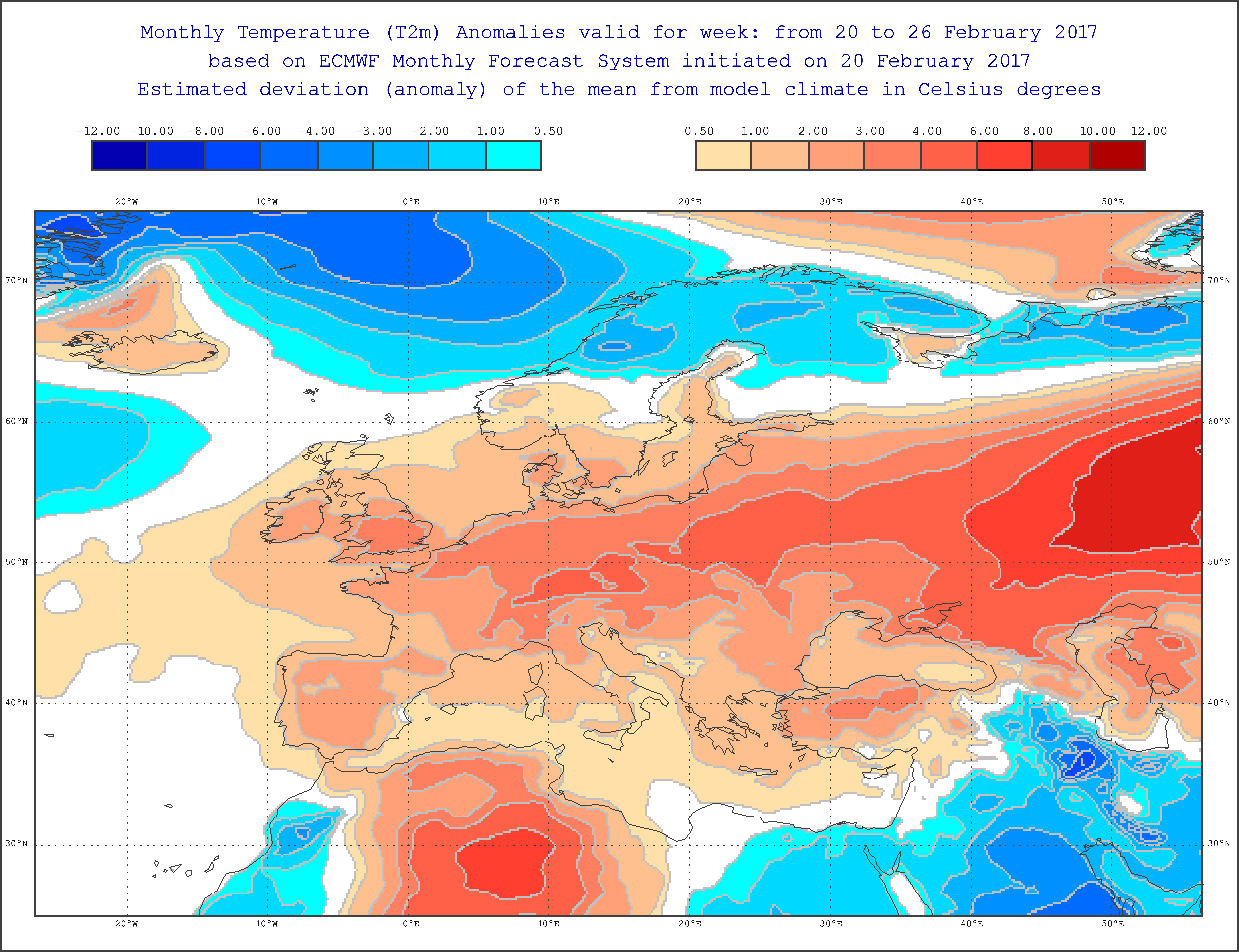
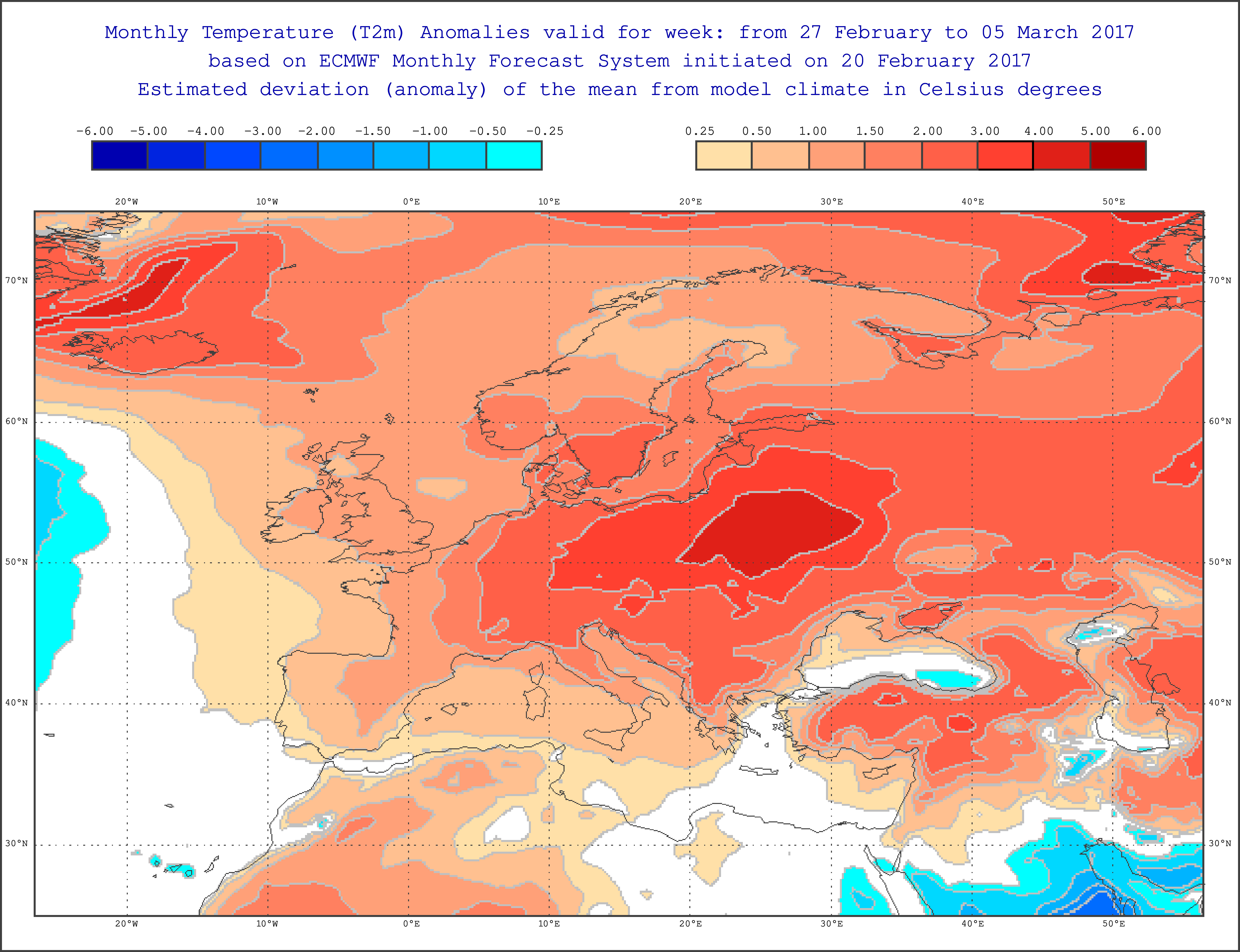
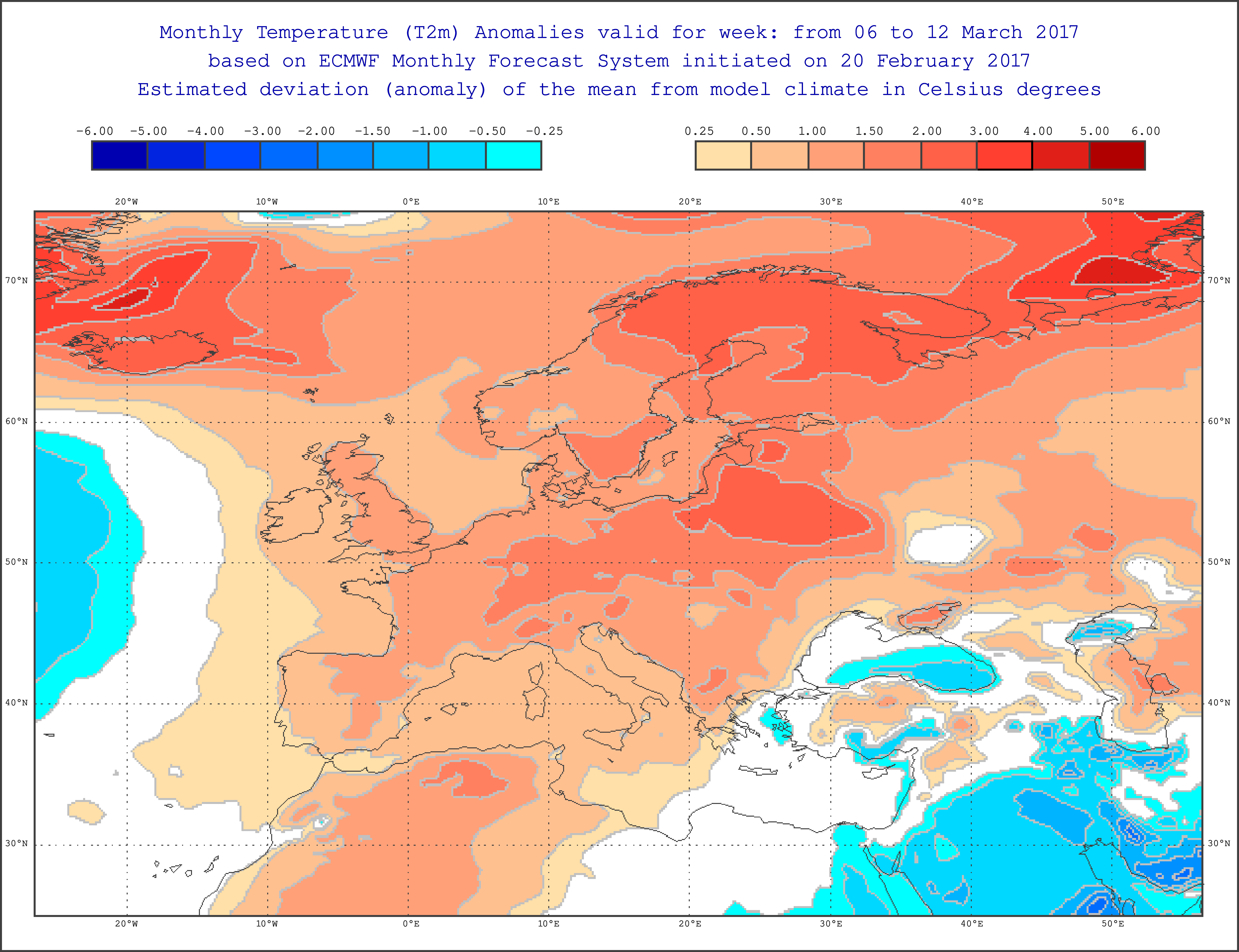
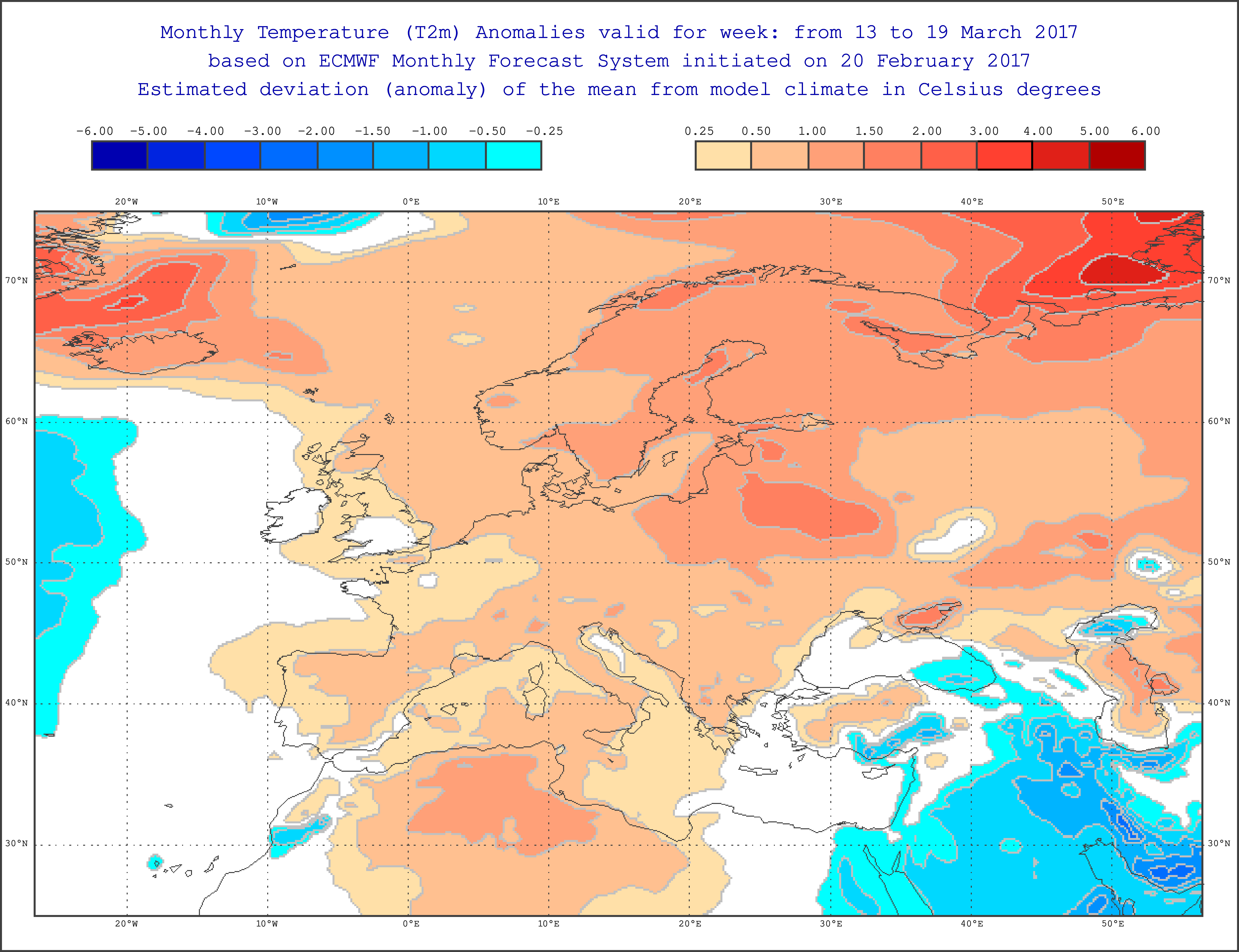
The ECM weeklies issued yesterday going out to March 19th show temps always at or a bit above average (the signal by week 4 is weaker for parts of the south)
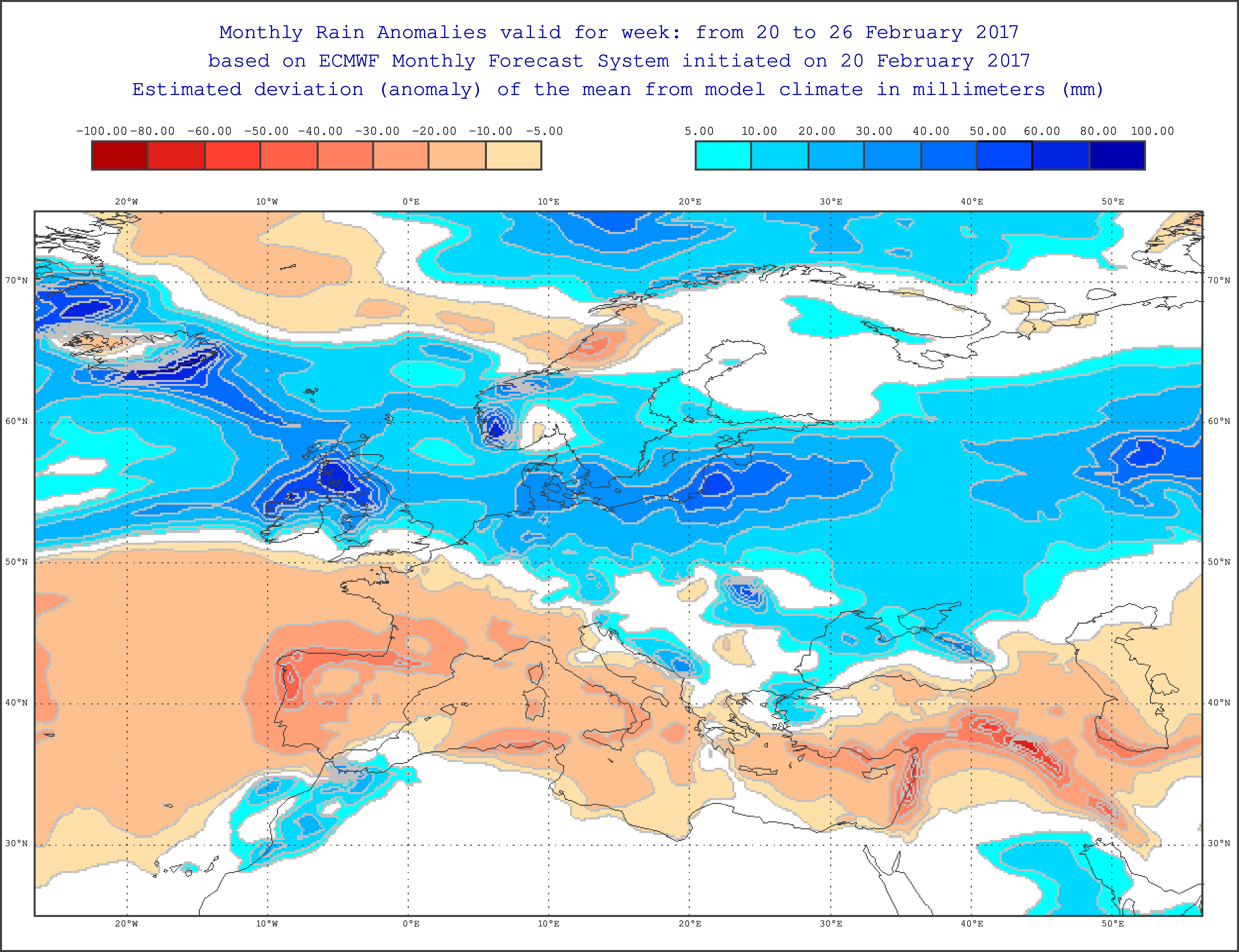
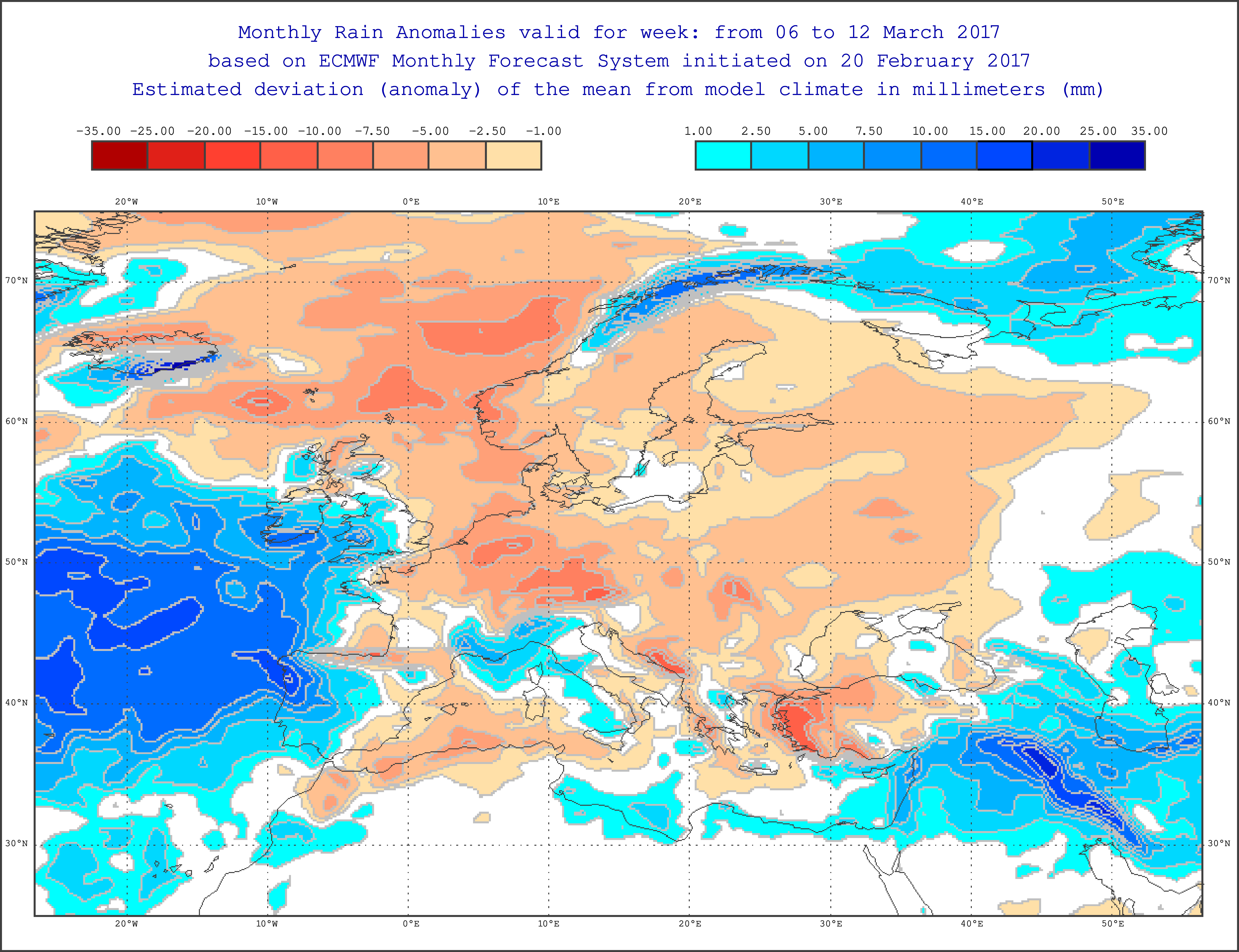
As for rain weeks, 1 and 3 look to be the wettest
The ECM weeklies issued yesterday going out to March 19th show temps always at or a bit above average (the signal by week 4 is weaker for parts of the south)As for rain weeks, 1 and 3 look to be the wettest
These seem to be having none of the HLB into March as proposed by some and seen recently at times by a minority of the NWP on the strength of favourable background signals (final warming SSW, QBO going COD, etc, etc).
The signal with the greatest correlation is probably persistence. It isn't fashionable and rarely gets a mention in here.
http://modeles7.meteociel.fr/modeles/gens/runs/2017022106/gens-17-1-276.png
plenty of interest in the GEFS again, a typical example
06z Op on the warm side for the 1st week of March
http://www.theweatheroutlook.com/twodata/chart.aspx?chart=/charts/ecm/192_mslp850.png?cb=816
ECM has the low dropping SE across us, but it then loses identity at 192 and fails to maintain the northerly.
Some Wintry possibilities end of next week!? 00z ensembles: - Look north and East!!
http://modeles.meteociel.fr/modeles/gfs/runs/2017022206/gfs-0-222.png?6
06z op
Winter arrives at last!
http://modeles.meteociel.fr/modeles/gfs/runs/2017022206/gfs-0-222.png?606z opWinter arrives at last!
Yes - a proper easterly from eastern Scandinavia and western Russia with low pressure over the med- not that slack 2 day event earlier in Jan and Feb when we had the HP over the Baltics and Denmark then sinking giving us milder S easterly airflow. - WIll have to wait a few more days to see if this materialises. - Also with Low pressure over the med - means it shouldn't be a sinker or collapser.
Quite a battle here but 1040mb is quite a bblock - cold air very near - hopefully this will not sink due to the LP over med:
Not many members going below -5 now for next week mean peaks at a low of around -3 after which a steady rise till the 7th
The 12z GFS is a crock of poo in showing a very lively Atlantic. One run, etc, of course.