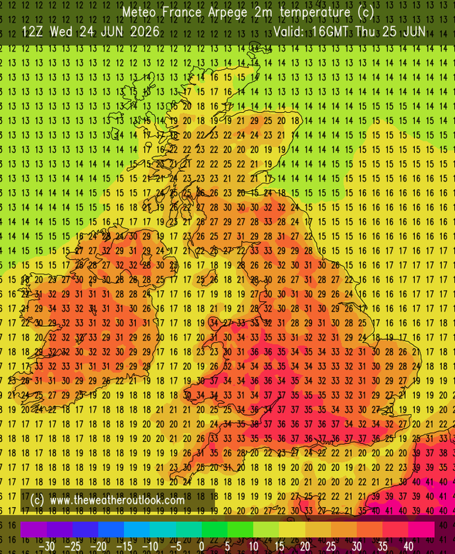
FAX - LP drifting up the west coast with most of the frontal and trough activity in N England/Scotland. By Sun 28th this has combined with Atlantic LP to form a centre S of Iceland 987mb which brings fresher westerly weather for all behind a couple of fronts. But HP is never far from the south and takes possession of Britain again 1028 mb N Ireland Tue 30th (but, hopefully, despite Matty's masochistic wishes, the really hot air is off to the SE of a long trailing front from E France to W Russia).
GFS Op 0z - picks up where FAX leaves off, and from there through to Sun 12th Britain's weather is mainly influenced by the position of the Azores high, so a 'traditional' British summer, basically fine and comfortably warm in the south, cooler and sometimes unsettled in the north (the Azores high at its closest Tue 2nd and Sun 12th, retreating with some cool NW-lies Sun 5th)
ECM - similar to GFS though the Azores High approaches closer to SW Ireland for much of the time, suggesting that weather over nearly all of Britain will be settled, fine and dry, though as the source of air is from the Atlantic around the 'top' of the HP, warm but not boiling hot,
AIFS - London, maxima dropping to 24C Sun 28th and staying there to Fri 10th, give or take a degree or two, small amounts of rain Sat 27th and Thu 4th. Edinburgh, maxima also dropping off but to around 18C, noticeably rising again after Wed 8th; rain at intervals until then.
GEFS - mean well supported by ens members down to norm Mon 29th and staying there for the following week (a little above in the S, a little below in the N) after which mean continues near norm but ens spread increases. A little rain at first in the south else mostly dry there, likelihood of rain progressively increases further north and actually quite wet for much of the time in the Highlands.
It's not the voting that's democracy, it's the counting - Tom Stoppard
Chichester 12m asl