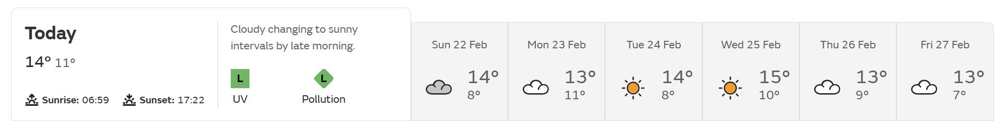
As is the MetO raw for here - I think we must have Aberdeen's climate right now, only several degrees warmer.
9 or 10 degrees over the next week, 6 or 7 by night (so well above average there) and rain or drizzle most days too. I've never seen the "headline" summary for the day show drizzle before, either!
https://ukwct.org.uk/weather/meto.jpg
Originally Posted by: Retron