An impressively 'warm' low from the northwest next Thu-Fri according to the majority vote of the 12z runs - but this feature's been coming and going a lot, and in such a generally vague setup across the N. Atlantic and into Europe, I'd not want to place any bets!
Models don't seem to have a flying clue how far east ridging will extend from the Azores, and how much this will be able to dictate the movement of various areas of shallow low pressure.
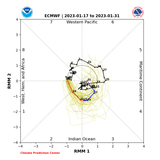
This transient uptick in western Indian Ocean convection may just about to enough to retract the ridge more west of the UK for a time until around mid-month, after which renewed extension east is most probable provided the Nino base state persists (which it looks likely to do, once you allow for typical model bias).
A possible wildcard remains the Arctic blocking - it seems it will be weakening overall, but this change is showing signs of being less smooth than initially put forward by the models. Often the way with such processes. Also happens with the initiation of blocking, as we've seen all too often in the winter season.
If you have any problems or queries relating to TWO you can Email
[email protected] 🙂
https://twitter.com/peacockreports 2021's Homeland Extremes:
T-Max: 30.4°C 21st Jul | T-Min: -6.8°C New Years Day! | Wettest Day: 34.1mm 2nd Oct | Ice Days: 2 (27th Jan & 8th Feb)
Keep Calm and Forecast On