Arcus
  • Arcus
  • Advanced Member Topic Starter
04 July 2017 15:10:25

Warnings out from MetO for potential convective developments on Thursday and overnight into Friday:


http://www.metoffice.gov.uk/public/weather/warnings


After the relative Bust of the last plume storms, expectations are no doubt in more restrained, but although the potential available energy is not as severe as last time...


... there is IMO a more realistic chance of realising that potential this time around especially for southern and central areas with a warm front and trough pushing NE:


Open to change as usual, but nevertheless worth keeping an eye on.


Ben,
Nr. Easingwold, North Yorkshire
30m asl
Charmhills
04 July 2017 16:01:21

Give the last let down, my expectations are very low this time.


We shall see of course.


Loughborough, EM.

Knowledge is power, ignorance is weakness.

Duane.
Arcus
  • Arcus
  • Advanced Member Topic Starter
05 July 2017 10:41:26

Updated warnings from the MetO.


http://www.metoffice.gov.uk/public/weather/warnings#?date=2017-07-06


CFA:


"Two waves of thunderstorms are expected to affect the UK on Thursday. The first wave is expected to develop over southern England early on Thursday and push northwards across parts of the Midlands and East Anglia, clearing later in the morning or during the afternoon. The second wave is expected to develop further north, most likely over parts of northern England and the Midlands during the afternoon before moving eastwards and clearing during the evening or early hours of Friday. 20 to 30 mm of rain may fall within an hour and perhaps 50 to 80 mm in 2 or 3 hours, these totals most likely associated with the second wave of storms. However, such totals are likely to be very localised with many places staying dry."


Faxes for Thurs help explain the double threat scenario:
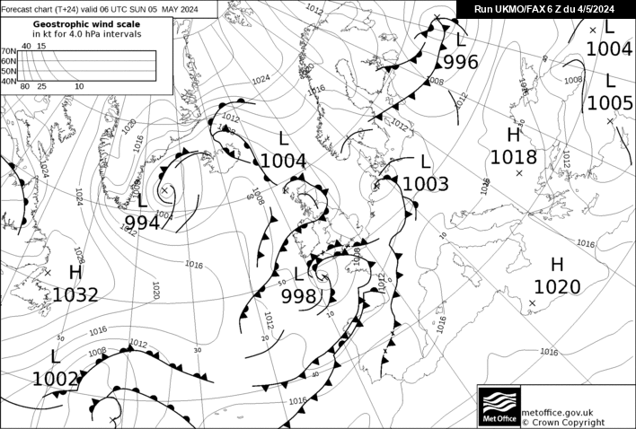


The risk in the south in the early morning onwards comes courtesy of the trough that tracks in from the south and moves NE to ENE during the day in that warm and humid air. The risk further north is associated with that slow moving cold front.


Ben,
Nr. Easingwold, North Yorkshire
30m asl
Bolty
05 July 2017 11:17:11
My expectations for this event are low and are already draining actually. This morning has brought a few eastward shifts on the models, so really by 18:00 tomorrow, it looks like the unstable air will have mostly moved away from here.

I'd be very surprised if anything did affect the Manchester area.
Scott
Blackrod, Lancashire (4 miles south of Chorley) at 156m asl.
My weather station 
Arcus
  • Arcus
  • Advanced Member Topic Starter
05 July 2017 11:37:12
If in doubt, the default highest risk area is always Lincolnshire... It may well be proved correct again tomorrow...
Ben,
Nr. Easingwold, North Yorkshire
30m asl
Bolty
06 July 2017 05:38:33

Already an interesting sky even at this time:


https://twitter.com/M35weather/status/882832342712188928


Scott
Blackrod, Lancashire (4 miles south of Chorley) at 156m asl.
My weather station 
DEW
  • DEW
  • Advanced Member
06 July 2017 05:57:09

Big disappointment here after yesterday's rainfall forecast. Woke up to 100% blue sky (though a little bit of cloud now in SW - will it come to anything?) MetO's interactive map now showing (for the SE) all the serious action happening offshore in the Channel, and then something in Kent for the afternoon.


War does not determine who is right, only who is left - Bertrand Russell

Chichester 12m asl
DeeDee
06 July 2017 06:48:43

Estofex rather bullish about todays storm forecast


still hope out there 


http://www.estofex.org


Harpenden, Herts.
speckledjim
06 July 2017 07:29:27
some nasty looking showers north of Middlesborough currently
Thorner, West Yorkshire


Journalism is organised gossip
idj20
06 July 2017 08:06:40

 Just seeing how the French coast cells have suddenly sparked into life, but still looking like they are bypassing by me to the south. Probably would be able to see flashing over the distant southern horizon if it is night time right now.


Folkestone Harbour. 
DeeDee
06 July 2017 08:08:49

Some dark skies here giving a few rumbles


Harpenden, Herts.
DEW
  • DEW
  • Advanced Member
06 July 2017 08:59:00

Originally Posted by: DEW 


Big disappointment here after yesterday's rainfall forecast. Woke up to 100% blue sky (though a little bit of cloud now in SW - will it come to anything?) MetO's interactive map now showing (for the SE) all the serious action happening offshore in the Channel, and then something in Kent for the afternoon.


Nice-looking anvil developed to the south about 0915, probably just offshore from Selsey


War does not determine who is right, only who is left - Bertrand Russell

Chichester 12m asl
Rob K
06 July 2017 09:03:14
I was expecting to wake up to rain but it was mostly blue skies. Still fine in London but there's quite a bit of Ac cas giving it a slightly ominous look.
Yateley, NE Hampshire, 73m asl
"But who wants to be foretold the weather? It is bad enough when it comes, without our having the misery of knowing about it beforehand." — Jerome K. Jerome
P+ve Giant
06 July 2017 11:40:36

Starting to get some cumulus bubbling up to the west of here now .. will that weak cold front be enough to kick things off? Certainly loads of surface heating going on here with plenty of humidity and winds remain with an easterly component so we'll see ...


John.
The Beast from the East
06 July 2017 12:10:42

Disappointing. Was looking forward to not having to water the garden for a while!


"We have some alternative facts for you"
Kelly-Ann Conway - special adviser to the President
Rob K
06 July 2017 13:44:50
It's certainly hot out there Over 30C in London now. I was sat on the roof terrace at work at lunchtime and it was sweltering. I saw a lone anvil out to the east but no sign of any thundery stuff anywhere nearby.
Yateley, NE Hampshire, 73m asl
"But who wants to be foretold the weather? It is bad enough when it comes, without our having the misery of knowing about it beforehand." — Jerome K. Jerome
picturesareme
06 July 2017 13:54:07
It will kick of later around Home Counties as there is a ton load of AC about down here in the south coast and it's drifting inland and growing in size!!
Arcus
  • Arcus
  • Advanced Member Topic Starter
06 July 2017 14:06:55

Well Norwich has certainly had a bit of action over the past hour or so, with more to come downstream as the warm front slips eastward. Elsewhere signs of showers building but not sustaining over Pennines. Bets bet might be the cell SE of Leeds, also showers invof Newcastle.


Ben,
Nr. Easingwold, North Yorkshire
30m asl
chelseagirl
06 July 2017 14:08:50

Have been hearing thunder for a couple of hours now on the coast. Surprising as all the storms have followed the A11 and turned right at Norwich onto the A47 and gone to Great Yarmouth. Sad really!


The Fenlands of Cambridgeshire
Bolty
06 July 2017 14:23:32
I'm very slowly losing hope for western areas now. I would have expected to have seen a bit more activity over North Wales and Cheshire by now. Looks increasingly like it's going to be the usual scenario where the west is the breeding ground for storms that affect the usual areas.
Scott
Blackrod, Lancashire (4 miles south of Chorley) at 156m asl.
My weather station 
Users browsing this topic

Ads