I posted yesterday that i was worried about the potential cold easterly spell being shortened by a squeeze at both ends.
Todays meto forecast has a statement that colder air may get into the SE on Tuesday.
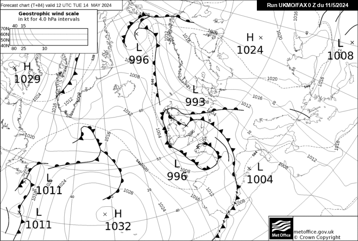
Presumably that is based on the 84h fax shown below which shows a cold front beginning to track west in the south but a warm front continuing to move east in the north.Looking at GFS ,ECM and GEFS it looks like the 17th/18th by the time an easterly flow is establishes.At the other end the easterly seems to collapse by Saturday/ Sunday so we are looking at a 3/4 day easterly.
Of course there maybe wintry possibilities in the breakdown Iceland/GH and even more snow opportunities However by 240h there are also zonal ENS starting to appear.