What's caught pretty much all major long-range forecasting efforts out big-time this month is a combination of the failure of true El Nino forcing to establish itself despite traditional measures suggesting it should have, and the reversal from the SSW proving unable to propagate down to the troposphere despite having been so strong and prolonged.
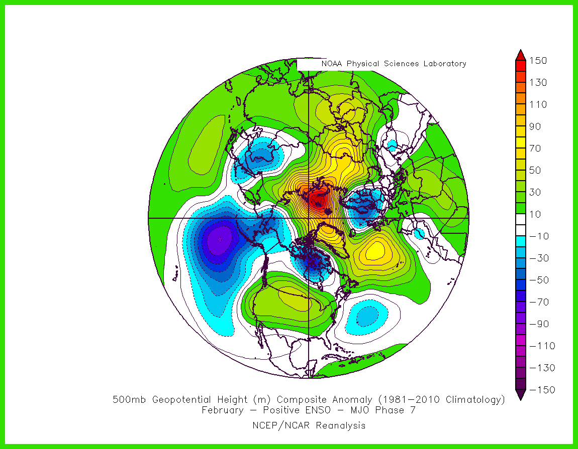
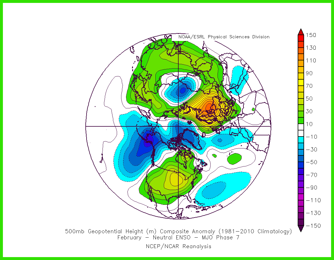
The MJO has just crossed phase 7 at high amplitude with lagged response dominating the weather patterns of the next week of so.
Comparing the El Nino variant of MJO P7 composite with the neutral variant demonstrates with startling clarify just how big an impact this is having on the temperature regime across the UK; it's the difference between frigid northerlies or north-easterlies and balmy southerlies.
The MJO's now moving on through P8 at high amplitude, and still the El Nino v. Neutral differences have huge implications for the UK weather;
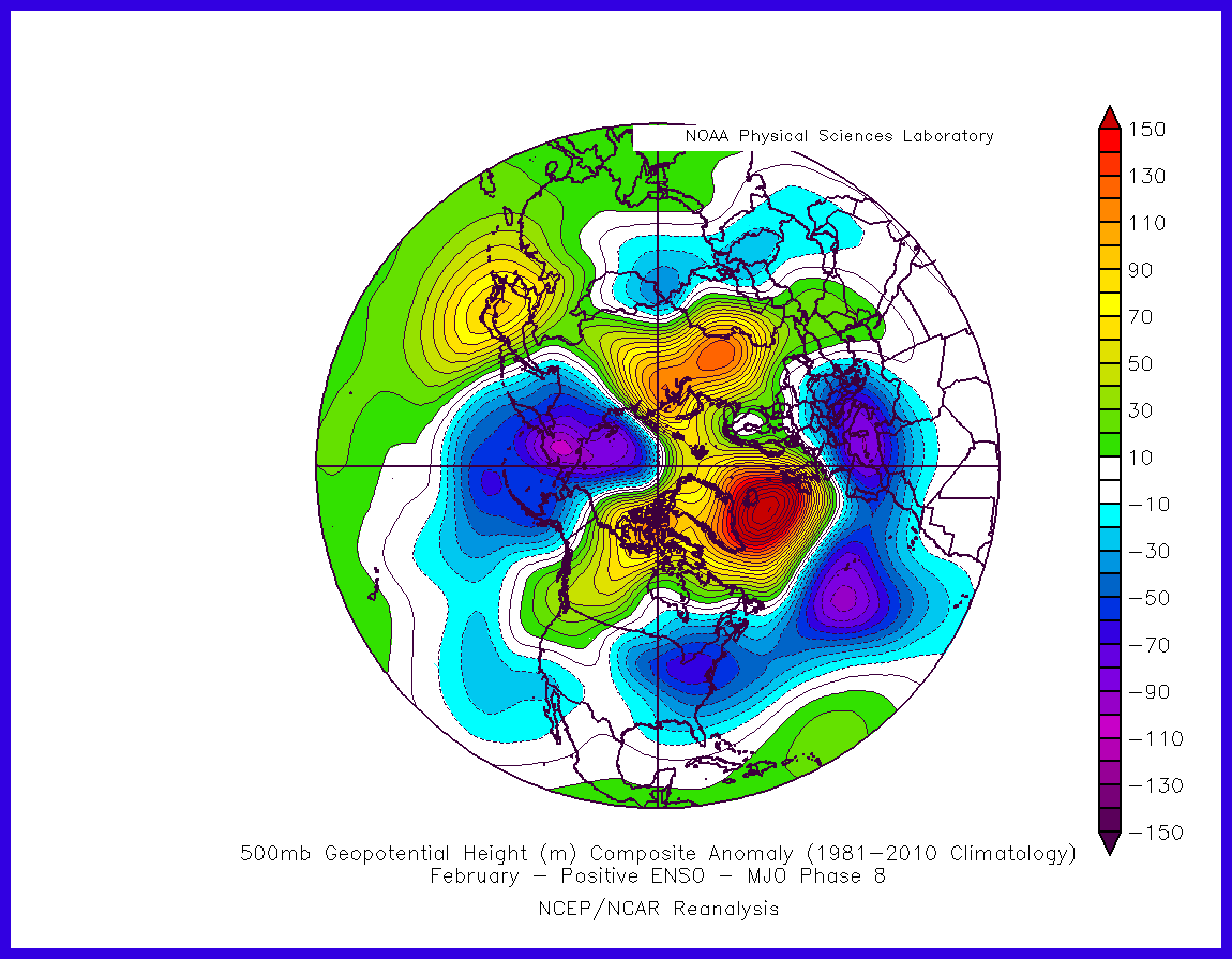
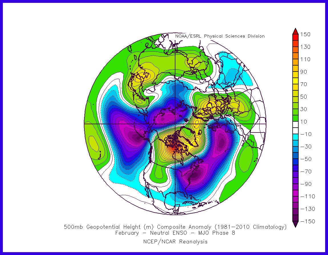
That on the left is pretty much the coldest blocking pattern possible for the UK, which requires El Nino conditions, while on the right we see what tends to occur with neutral conditions - deep troughs slow-moving west of the UK with us being subjected a very mild but unsettled regime.
Even under neutral conditions, if the SSW had propagated right down, we'd likely have managed a useful -NAO pattern for a few weeks thanks to a move negative AO allowing the focus of HLB to be more toward due north of the UK. There was a lot as of late Jan indicating that the SSW would pull through but it seems there was an underestimation of the power of a westerly QBO at 30 mb to derail that process.
With the SSW cast aside, we're left looking to tropical forcing as the dominant driver of our weather patterns.
Currently, the atmosphere is making its biggest effort so far this winter to take on the El Nino conditions as a very strong westerly wind burst takes place across the dateline - the best position for weakening the subtropical ridges (such as the Azores High) and opening the door to HLB development NW of the UK. This shift looks to occur in time to potentially bring about the Nino variant of MJO P8 response.

...yet the models aren't showing much appetite for the HLB aspect to this response. They hammer the Azores High down, yet heights remain stubbornly on the low side across Greenland, and the high across Europe has nowhere to go. You can really see it attempting to shift NW on the ECM 00z for example, but to little avail.
This is puzzling, as although the SSW hasn't come through for us, the lower-stratosphere is only weakly positive for zonal wind anomalies, so there's not much there to resist blocking development NW of the UK.
It seems something else is being predicted by the modelling that counteracts the effects of even such a strong and well-positioned WWB. Be that rightly or wrongly so, remains to be seen! I have a nasty feeling early March isn't going to build on the springlike foundations set by mid-Feb.
Speaking of which, the concerning signals for March are partly discussed in this latest blog post of mine that examines the most likely ground conditions ('going') at the Cheltenham Festival, if anyone fancies a read  .
.
Edited by user
14 February 2019 13:58:23
|
Reason: Only Human After All
If you have any problems or queries relating to TWO you can Email
[email protected] https://twitter.com/peacockreports
2025's Homeland Extremes:
T-Max: 32.0°C 12th Aug | T-Min: -5.4°C 4th Jan | Wettest Day: 31.8 mm 18th Dec | Ice Days: None
Keep Calm and Forecast On