The Weather Outlook

Remove ads from site

Crepuscular Ray
16 June 2020 21:45:29
Was down in south Notts for the day and experienced an hour or two of storm activity to the south over north Leics.

Driving back to Yorkshire around teatime I drove through Caz's storm on the A1....slow going!

Got back to Ilkley 2050 and a great storm going on just to the north over the moors and Bolton Abbey. Great c-g lightning


Jerry

Edinburgh, in the frost hollow below Blackford Hill

snow 2004
16 June 2020 21:53:34
More lightning visible to our South. Reports of a tornado around the corner from my house. A few houses have had some of thei roof tiles ripped off and thrown down the street!

You wouldn’t have been able to see it as the torrents of rain were incredible. I’m wondering if it passed very near to my house as the winds all off a sudden increased to an insane speed. Sent various things flying.


Glossop Derbyshire, 200m asl
Russwirral
16 June 2020 21:56:22
Looks like North cheshire and south manchester might get some activity soon...


snow 2004
16 June 2020 22:03:10

Looks like North cheshire and south manchester might get some activity soon...

Originally Posted by: Russwirral 


Yeah can see flashes to my South. Sky is getting ever darker. We shall see.


Glossop Derbyshire, 200m asl
Sharp Green Fox
17 June 2020 08:37:42

We had a proper storm for a couple of hours around 6.00 pm to 8.00pm.

I have really enjoyed the last couple of days. In the sun it has been warm to muggy. There has always been a sense that a storm may break out. But the best thing of all has been the cloud formations. Plenty of detailed cumulus some white some much darker, but for the most part blue sky was also part of the palette. Just wish it was more often like this throughout the summer. Perhaps I should move to the tropics!

WMB
  • WMB
  • Advanced Member
17 June 2020 10:05:41
Storm here, almost continuous thunder, but I haven't seen any lightning. Core appears to a couple of miles to the north.
ballamar
17 June 2020 10:07:15
Convection starting again midlands and NW look to be prime again
TimS
  • TimS
  • Advanced Member
17 June 2020 11:51:18
Fair bit of thunder here in SE London, and some moderate rain. Just had a big flash and bang. I think we have about an hour of this to come as there's an elongated set of cells moving across from the ESE currently.
Brockley, South East London 30m asl
DeeDee
17 June 2020 11:52:10
A lot of thunder here now, surrounded by navy blue clouds
Harpenden, Herts.
The Beast from the East
17 June 2020 12:04:36

Developing storm overhead, but moving towards London


Purley, Surrey, 70m ASL

"We have some alternative facts for you"

Kelly-Ann Conway - former special adviser to the President

Bolty
17 June 2020 12:12:46
Yesterday's time-lapse: several thunderstorms overhead in Manchester, the first such day since July 2013.

Should be able to post some footage from the storms later on, once I've edited it.


Scott

Blackrod, Lancashire (4 miles south of Chorley) at 156m asl.

My weather station 

Darren S
17 June 2020 12:25:04

Must have missed an absolute soaker. I went on a short bike ride up towards Finchampstead and could see that there had been huge amounts of surface water pouring through the woodland - big channels left in the leaf litter and plenty of standing water still around. Meanwhile here just two or three miles away we only had 1mm taking the June total to 9mm.

Originally Posted by: Rob K 

Sorry late to reply. I went for a bike ride yesterday evening as well, up towards Shinfield and Whitley. Big puddles on the road there but had almost dried up here by 8pm. As I said several nearby PWSs recorded 30mm in yesterday's storm. I got 1.5mm and my month total is now 21.9mm.


Darren

Crowthorne, Berks (87m asl)

South Berks Winter Snow Depth Totals:

2023/24 0 cm; 2022/23 7 cm; 2021/22 1 cm; 2020/21 13 cm; 2019/20 0 cm; 2018/19 14 cm; 2017/18 23 cm; 2016/17 0 cm; 2015/16 0.5 cm; 2014/15 3.5 cm; 2013/14 0 cm; 2012/13 22 cm; 2011/12 7 cm; 2010/11 6 cm; 2009/10 51 cm

Jim-55
17 June 2020 12:26:48

We've been pretty unlucky here in Frome these last few days, not a single storm has passed overhead, they've been close enough to hear a bit of thunder but not close enough, we've had very little rain here as well so could do with a few storms just to wet the ground some, fingers crossed for this afternoon.


Previously JimC. joined back then in 2009. Frome, N/E Somerset, 125mtrs asl.
TimS
  • TimS
  • Advanced Member
17 June 2020 12:29:38
Steady, heavy but not torrential rain here and only minor rumblings now. Mediocre thunderstorm with one loud bang.

Temperature has dropped a lot mind. Feeling chilly.


Brockley, South East London 30m asl
redmoons
17 June 2020 12:36:36
Heavy rain here with thunder and lightning, the first storm to hit Watford all week.

17c with 5.7mm of rain so far and rain rate of 39.6mm


Brian Gaze
17 June 2020 13:14:59

10.2mm of rain here from the downpour. 


Brian Gaze

Berkhamsted

TWO Buzz - get the latest news and views 

"I'm not socialist, I know that. I don't believe in sharing my money." - Gary Numan

warrenb
17 June 2020 13:25:17
Storm passed just to the north of here hitting Sevenoaks, now have one developing just to the south about to hit Tunbridge Wells. Classic thundery afternoon of distant rumbles from passing storms.
Rob K
17 June 2020 13:34:13
It’s amazing how the southern edge of the storms has followed the same track to within a mile or two on the last three occasions, with Sandhurst getting soaked while Yateley misses all but the edge.
Yateley, NE Hampshire, 73m asl

"But who wants to be foretold the weather? It is bad enough when it comes, without our having the misery of knowing about it beforehand." — Jerome K. Jerome

RobN
  • RobN
  • Advanced Member
17 June 2020 13:47:52

A lot of mostly distant rumbling here from thundery activity just to the west of Cambridge - looks mostly C-C and seen only one C-G.

In my location - just north of Cambridge - moderate blobby rain but nothing to write home about.


Rob

In the flatlands of South Cambridgeshire 15m ASL.

Saint Snow
17 June 2020 14:10:35

Convection starting again midlands and NW look to be prime again

Originally Posted by: ballamar 


It's really p*ssing me off now.

For three days running, around lunchtime, hefty showers have bubbled up over Manchester/Peak District, then drifted west.

On the westerly, we get the rain; now on an easterly we get the bloody rain.


(MBY seems to just catch the edge of the slow-moving showers, so not quite as bad here, but it wets everywhere nonetheless)


Martin

Home: St Helens (26m asl) Work: Manchester (75m asl)

A TWO addict since 14/12/01

"How can wealth persuade poverty to use its political freedom to keep wealth in power? Here lies the whole art of Conservative politics."

Aneurin Bevan

Rob K
17 June 2020 14:21:21
Quite impressive footage from Guildford yesterday with a set of steps turned into a waterfall following a heavy downpour!

https://www.eagleradio.co.uk/news/local-news/3124955/stairs-turn-into-waterfall-following-heavy-rain-in-guildford/ 


Yateley, NE Hampshire, 73m asl

"But who wants to be foretold the weather? It is bad enough when it comes, without our having the misery of knowing about it beforehand." — Jerome K. Jerome

Stormchaser
17 June 2020 15:21:49

For the third day running, the sea breeze effect has pushed the developing showers inland before they could even put down any rain here, let alone deliver a thunderstorm.

In this way, the marine layer does tend to bring a run of very fine days here whenever there's a gentle flow around a low that's positioned close to the south, southwest or west. Sometimes northwest.

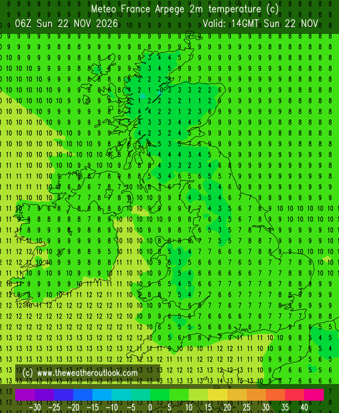
Interestingly, I've noticed that high-resolution models tend to develop showers a little too close to the south coast. I think this is largely down to underestimated surface heating - for example, ARPEGE predicted a high of 19-20°C for Central-Southern England today, but in reality quite a few places have reached 21-22°C.


This in turn is probably down to cloud cover being increased too rapidly during the morning. It's hard to verify that, though, as I can only see total cloud cover views, which include thin high cloud and so just shows 90-100% cloud coverage all day for most of England.

I don't know why it's not routine for model data to omit high cloud from that parameter. It's not useful information for most people! 


If you have any problems or queries relating to TWO you can Email [email protected]

https://twitter.com/peacockreports 

2025's Homeland Extremes:

T-Max: 32.0°C 12th Aug | T-Min: -5.4°C 4th Jan | Wettest Day: 31.8 mm 18th Dec | Ice Days: None

Keep Calm and Forecast On

NMA
  • NMA
  • Advanced Member
17 June 2020 15:23:12

A friend in Yeovil has texted and say's there is the mother of all rainstorms with thunder and lightning right now. 

Here nearer the coast it's another warm sunny afternoon. Still waiting for the first thunder storm of the year. Just hope it wont be December like last year for the first one. Tonight's rain is off the cards though the forecast this time yesterday was confident about it coming. 

A thundery plume. Now that would be something here.


Vale of the Great Dairies

South Dorset

Elevation 60m 197ft

GezM
  • GezM
  • Advanced Member
17 June 2020 15:30:13
Torrential rain and thunder here for the second time today.
Living in St Albans, Herts (116m asl)

Working at Luton Airport, Beds (160m asl)

17 June 2020 15:55:04

Lots of thunder here this afternoon but all quite distant and running to the south of me. Dark clouds but not a drop of rain yet. Did manage one heavy shower yesterday.

Remove ads from site