Shropshire
19 January 2019 11:05:11

Originally Posted by: The Beast from the East 


Yes, this is slipping away and hopefully the agony wont be prolonged and we can move on.


The evening runs may finish off the easterly 


I think we will see that finished off by about 4.10pm today.


What's amazing is how when things do go spectacularly wrong how often zonality just takes back over as per the 06z and ECM, the same happened in Dec 2012. Ou best hope is another mid-latitide High holding pattern.


From December 27th 2020, zonality will be banned from mixing with the UK. We appreciate that this may come as a shock to younger people and old Uncle Barty. This ban will last for a minimum of ten days.
Shropshire
19 January 2019 11:06:23

Originally Posted by: doctormog 


You don’t need to look beyond 120hr for interesting conditions though


(That’s from the 06z GFSP)


For you Doc definitely, not for the rest of us ! 


From December 27th 2020, zonality will be banned from mixing with the UK. We appreciate that this may come as a shock to younger people and old Uncle Barty. This ban will last for a minimum of ten days.
Chunky Pea
19 January 2019 11:07:54

Originally Posted by: Maunder Minimum 


Basically, nothing beyond t+120 is to be trusted at the moment  whatever it shows. For the British Isles the marginality is such that in any case a 100 mile difference in the output at t+96 can make all the difference down the line between wintery Nirvana and typical grey misery with cold rain. 


So true MM, but I find it as interesting as I do curious that while the mid-term outputs are changing constantly, the longer-terms are pretty resolute, which suggests that while there is some sort of signal being picked up,  the route that takes us to that point is not yet drawn out. 


Current Conditions
https://t.ly/MEYqg 


"You don't have to know anything to have an opinion"
--Roger P, 12/Oct/2022
stophe
19 January 2019 11:08:36

London ecm ensembles.


Latest 15 days ensemble forecast temperature for London

warrenb
19 January 2019 11:08:59

Originally Posted by: Shropshire 


I think we will see that finished off by about 4.10pm today.


What's amazing is how when things do go spectacularly wrong how often zonality just takes back over as per the 06z and ECM, the same happened in Dec 2012. Ou best hope is another mid-latitide High holding pattern.


Yes the raging zonality at the end of the gfs is a sight to behold


doctormog
19 January 2019 11:10:55

Originally Posted by: Shropshire 


For you Doc definitely, not for the rest of us ! 


Actually I think that would probably be better for most other parts than for here (just like the possible/impossible easterly). 


idj20
19 January 2019 11:12:13

Originally Posted by: Gandalf The White 


But it doesn't work like that, does it?  Ian makes the same comment periodically - it depends on the jetstream. Cyclogenesis off the Eastern Seaboard doesn't mean LP systems have to race across the Atlantic.


Maybe not, but it is something that happens more often than not. The Atlantic is not our friend.


Folkestone Harbour. 
Shropshire
19 January 2019 11:15:05

Originally Posted by: warrenb 


Yes the raging zonality at the end of the gfs is a sight to behold


You know full well what I mean, after the failure in the mid-term the jet fires up as per the ECM. What T300 shows is as irrelevant as T192 was this morning and yesterday if the earlier period is called wrongly.


From December 27th 2020, zonality will be banned from mixing with the UK. We appreciate that this may come as a shock to younger people and old Uncle Barty. This ban will last for a minimum of ten days.
Ally Pally Snowman
19 January 2019 11:15:20

Para poor again I think its wait to round 2 prob in about 10 days .


Bishop's Stortford 85m ASL.
doctormog
19 January 2019 11:16:23
If anyone is interested the 06z GFSP is similiar to the 00z ECM at 144hr. It will be interesting to see what it shows down the line.
nsrobins
19 January 2019 11:24:36
For balance there are still 7 members going for early Easterly (120) and another 5 or so in a ‘col’ holding pattern - the rest are ECM like.
With ICON & UKM Evidence if needed that it’s too soon to call this off.
Neil
Fareham, Hampshire 28m ASL (near estuary)
Stormchaser, Member TORRO
moomin75
19 January 2019 11:30:19

Originally Posted by: Ally Pally Snowman 


Para poor again I think its wait to round 2 prob in about 10 days .


Unbelievable isn't it, the number of times this goes mammatus verticus in this part of the world. 


With the daffodils and blossom starting to come out down here, I am definitely looking forward to the end of this God forsaken "winter".


Witney, Oxfordshire
100m ASL
backtobasics
19 January 2019 11:30:46
Goodness , can you hide posts from selected posters in here, is that an option anyone ?
Gandalf The White
19 January 2019 11:31:32

Originally Posted by: stophe 


London ecm ensembles.


Latest 15 days ensemble forecast temperature for London


So, firstly, the op has followed the minority cluster that becomes less cold for 2-3 days. Secondly the 00z pattern is much the same as the 12z yesterday in showing much greater consistency in a cold theme beyond day 9.


This isn't settled yet by any means, whatever one or two posters seem to want to imply.


Location: South Cambridgeshire
130 metres ASL
52.0N 0.1E


Bertwhistle
19 January 2019 11:32:53

Originally Posted by: Whether Idle 


Personally, Ive always been a fan of the CMA.  There have been occasions when it has been correct at a distance when other models have faltered.  Here is the CMA take on day 8, deep FI:


As I have maintained consistently for the past week or so, there is great uncertainty and the situation is in the balance. 50/50 west or east flow IMHO.  More runs are needed.


No knee jerking when I look at that chart. 


Bertie, Itchen Valley.
'We'll never see 40 celsius in this country'.
nsrobins
19 January 2019 11:34:40

Originally Posted by: backtobasics 

Goodness , can you hide posts from selected posters in here, is that an option anyone ?


Click on the user name for the profile. ‘Hide User posts’ is an option.


Unless you’ve already hidden me in which case you won’t see this 😎


Neil
Fareham, Hampshire 28m ASL (near estuary)
Stormchaser, Member TORRO
Gavin D
19 January 2019 11:34:55

Originally Posted by: backtobasics 

Goodness , can you hide posts from selected posters in here, is that an option anyone ?


Gavin D
19 January 2019 11:36:00

GFS P backing ECM at t144


ECM1-144.thumb.GIF.de194e1ba7515aadd5d57ec7c51ea0ab.GIFgfs-0-144.thumb.png.73af22232972870d66fcea31321e536f.png


ECM0-144.thumb.GIF.3e21ac41a4e98d15560578720dda4df3.GIFgfs-1-144.thumb.png.41c2a0d057be6afa097351c61f0a454c.png


Still hope yet it won't be as cold as I feared

doctormog
19 January 2019 11:36:44

Originally Posted by: Gandalf The White 


So, firstly, the op has followed the minority cluster that becomes less cold for 2-3 days. Secondly the 00z pattern is much the same as the 12z yesterday in showing much greater consistency in a cold theme beyond day 9.


This isn't settled yet by any means, whatever one or two posters seem to want to imply.


I think those ECM data actually tie in quite nicely with the GEFS data. Cold, less cold interlude and then potentially colder. It’s also been signposted for weeks, unlike the TBC easterly which, while a threat, had not been a consistent theme.


tallyho_83
19 January 2019 11:40:20

Originally Posted by: tallyho_83 


Low pressure over central southern and SE Europe will prevent the Scandi block from sinking and hopefully the LP in Atlantic will under cut the Scandi high and allow this to retrogress to Greenland and build more of a bigger block: 


A shade less cold in the south in this 00z run so far but still heading in right direction and await the ECM 00z run for clarity!
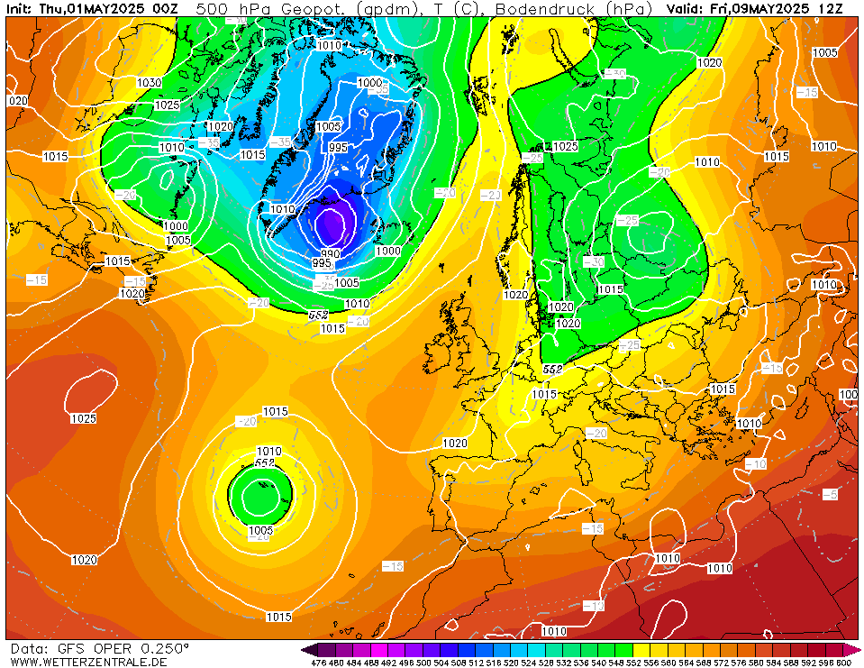


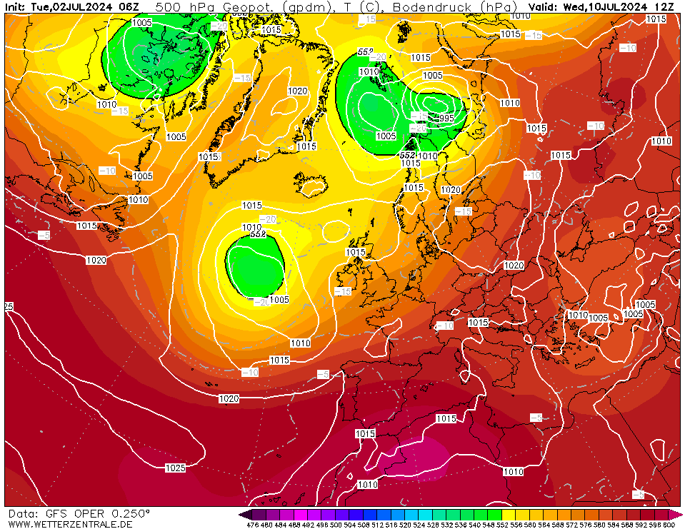
Well that was certainly worth staying up to observe and analyse the 00z run! NOT only for this to now happen and cold air goes into the east and SE Europe where it was due to turn milder!?


Very frustrating but was expected but never knew it would be such a downgrade, not just the GFS but ECM. At least next Tuesday still gives us some snow potential for now. Anything after that is for fun but i really thought we were heading into a prolonged spell of cold or very cold weather which the met office also suggested a very cold end to Jan - in line with many other longer range models BCC, CFSv2, JMA and EC 30 day etc.


Home Location - Kellands Lane, Okehampton, Devon (200m ASL)
---------------------------------------
Sean Moon
Magical Moon
www.magical-moon.com


Users browsing this topic

Ads