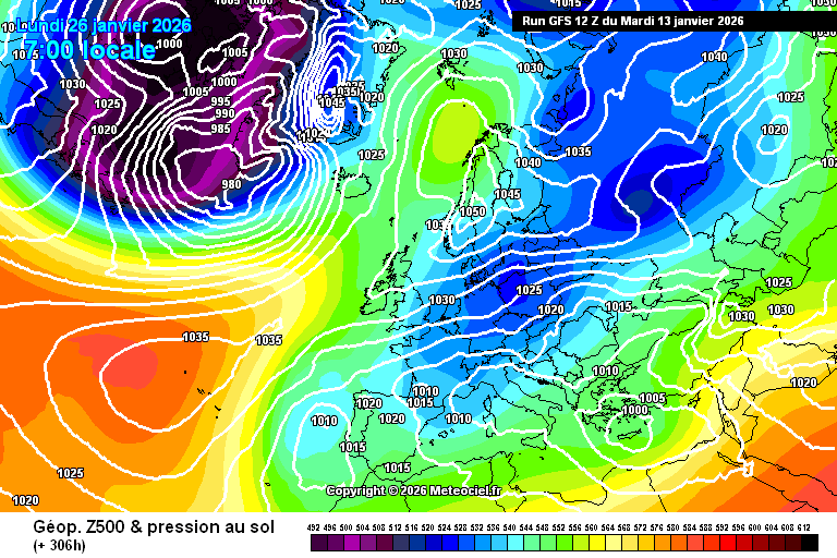
What an absolute stunner the 12z GFS op turns out to be - another classic 80s style easterly, again with an upper high near Svalbard and a chunk of the Siberian High moving westwards as a result, settling over Scandinavia and delivering a truly bitter spell. Another 6-incher run for here!
Must... resist... (It's hard not to get a little excited, I have to say, as these midwinter easterlies are all but extinct.)
Here's the MC "LCC" view, which gives a better overview than the normal view.
https://images.meteociel.fr/im/89/7306/gfseu_0_306mob2.png
Originally Posted by: Retron