This morning's ECM isn't quite out yet, but in the meantime here's the GFS rundown:
The Azores High is displaced northwards on this morning's GFS, lying to the west of the UK. A trough has recently moved southwards over the UK, introducing relatively cold cyclonic northerlies. There's widespread sleet and snow over higher ground in the north and west, with rain over eastern coastal areas.
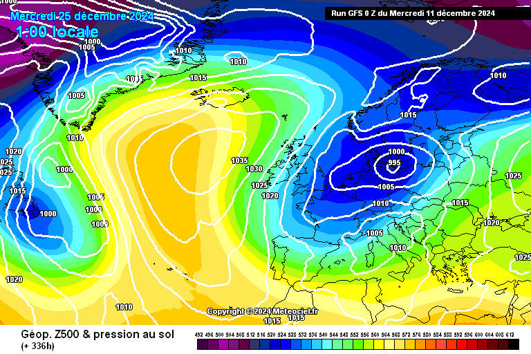
https://images.meteociel.fr/im/89/6664/gfs_0_336mrn9.png
The GEFS control has the Azores High ridging over Iberia and a trough crossing the UK. Winds are southerlies in advance and WSW'ly following behind. There's a weak high to the NE of Iceland and trough disruption is ongoing to the NW of the UK.
The ensemble members show the following scenarios:
Anticyclonic SW'lies: 6
Ridge to west with westerlies or NW'lies (not cold): 4
High over British Isles: 4
Trough crossing UK, SW'lies in advance: 3
Ridge from high to east over UK: 3
Cyclonic SW'lies: 2
Complex low over Scandinavia, cold WNW'lies or NW'lies: 2
High over or to immediate west of Biscay, westerlies: 2
The other scenarios include a high to the NE with easterlies over the UK and an Icelandic High with cold NE'lies.
The pattern has changed subtly from yesterday, with a shift away from a straightforward SW'ly pattern - ridging nearby has moved up the charts instead. Cold weather remains unlikely.
The standout today is perturbation 13, which shows that Icelandic High - there is relatively widespread sleet and snow, and milder air only makes slow progress eastwards over the following couple of days.
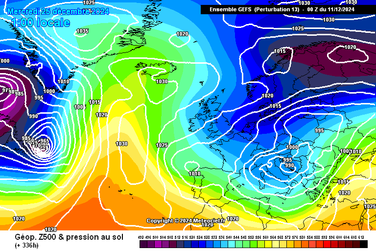
https://images.meteociel.fr/im/65/9762/gens_13_1_336wpy2.png