It's now 8 days until Christmas Day, and it's no surprise to see that the models are continuing to coalesce around a WSW'ly flow for next Wednesday.
https://images.meteociel.fr/im/27/14988/gfs_0_192fnw1.png
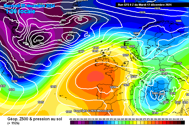
The operational GFS kicks things off with a large high centred to the immediate SW of the UK, with WSW'lies for most. There's rain for the far NW of Scotland, with more rain clipping Kent. Temperatures are mild everywhere.
Today's GEFS control run is broadly similar, again with a high to the SW and WSW'lies over the UK.
The remainder of the pack show the following outcomes:
High to south or SW, WSW'lies: 21
Trough crossing UK, westerlies: 6
There are few minor one-off variations, and one member with a completely different outlook - number 11, which shows a Scandinavian High ridging SE'wards over the UK. This is also today's standout run, showing a band of rain turning sleety as it moves slowly across the Midlands on Christmas Day.
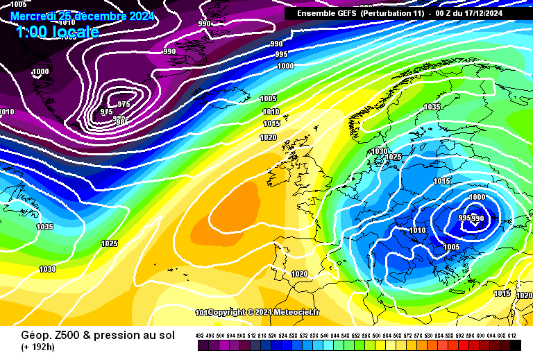
https://images.meteociel.fr/im/32/6240/gens_11_1_192ipn6.png
The picture today is an overwhelmingly WSW'ly one, with the only real variance being the strength of the wind, or whether there's a trough crossing the UK or not.
I'm loathe to call it at 8 days out (as that's faintly ridiculous), so I'll keep going for another day or two - I'm not expecting much change though!