As the last of this mornings snow now melts its time to start looking to the next event.

Here in Folkestone I've witnessed 3 separate altitude brief snow events locally this winter (4th December, 8th January and 16th January).
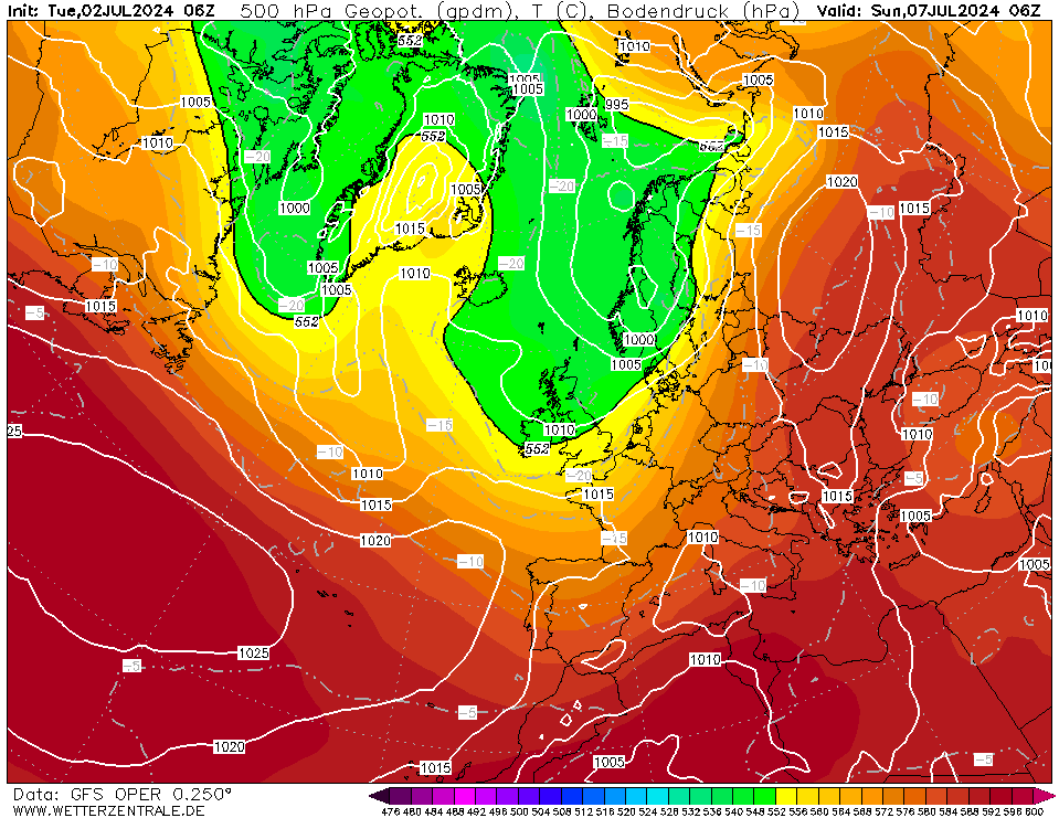
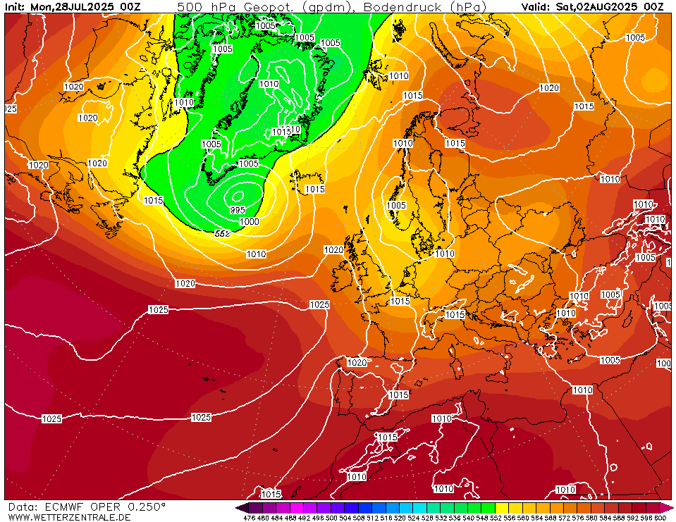
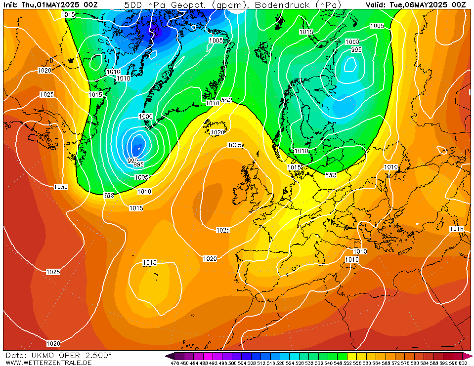
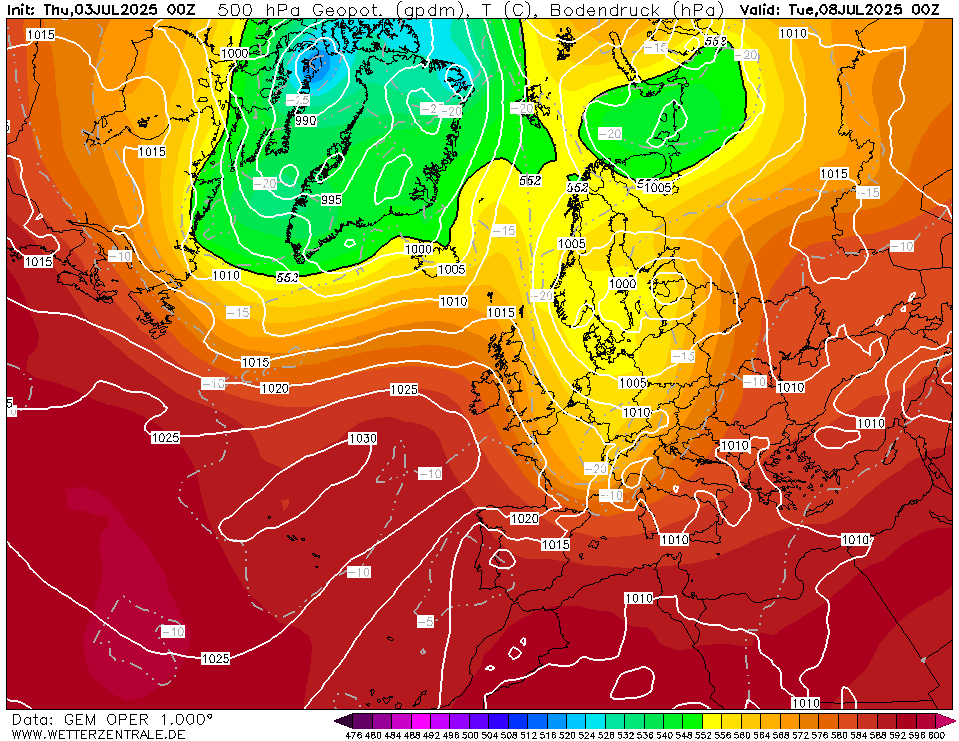
At FI 120 hours these charts look tantalising.
Greenland High far enough east to prevent prolonged Tm incursions, deep low pressure advecting cold air south across the UK and an arctic high nosing into Svalbard acting as a conveyor to start ushering very cold very deep arctic air SW'wards. Check out historic cold events of the past and you'll notice many charts looking like this a week or two before.
This progressing pattern with secondary lows spiralling on ever southward tracks will bring cold air a good deal further south with time.
GFS 120
ECM 120
UKMO 120
GEM 120
Originally Posted by: Gusty