I'm finding it quite difficult to share your pessimism, Brian. For the south, at least, the predicted very mild temperatures aren't materialising: each run seems to scale it back to just rather mild, with some cooler interludes.
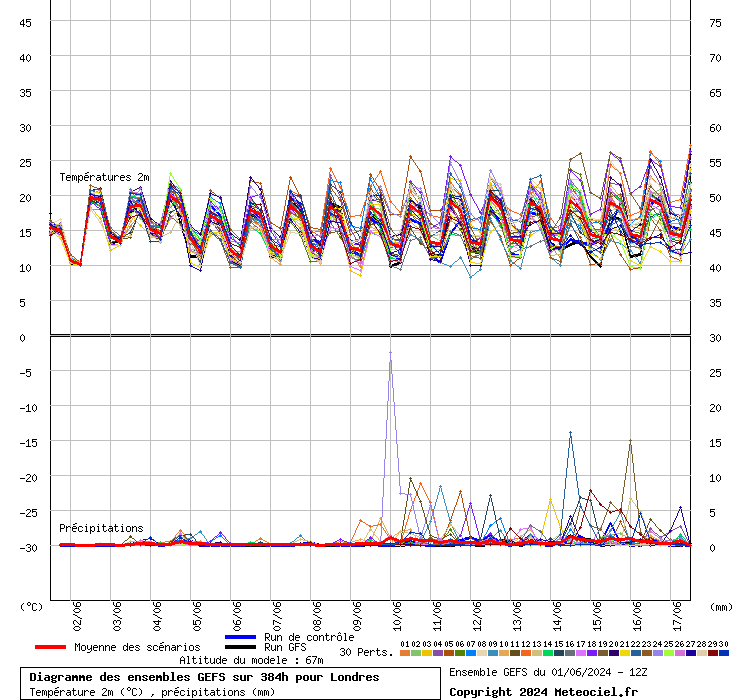
Height of the zero degree isotherm from today's 12z ensemble for London

2m temperature:
mild, not so mild, very mild, extremely mild, mildly warm......
it doesn’t matter because it’s winter and it’s not cold, and shows no signs of being cold, or even about average for any period of time. It’s truly pants, monotonous and predictable in the extreme (not a dig at you, just so bloody frustrating that the heart of winter is being ripped away again).