I am pretty cynical about trying to formulate these global models this far out.
I think these are generated by taking the day to day data and running in out for months ahead instead of just 4-6 days. IMO the noise rapidly swamps any meaningful data and produces in effect random numbers
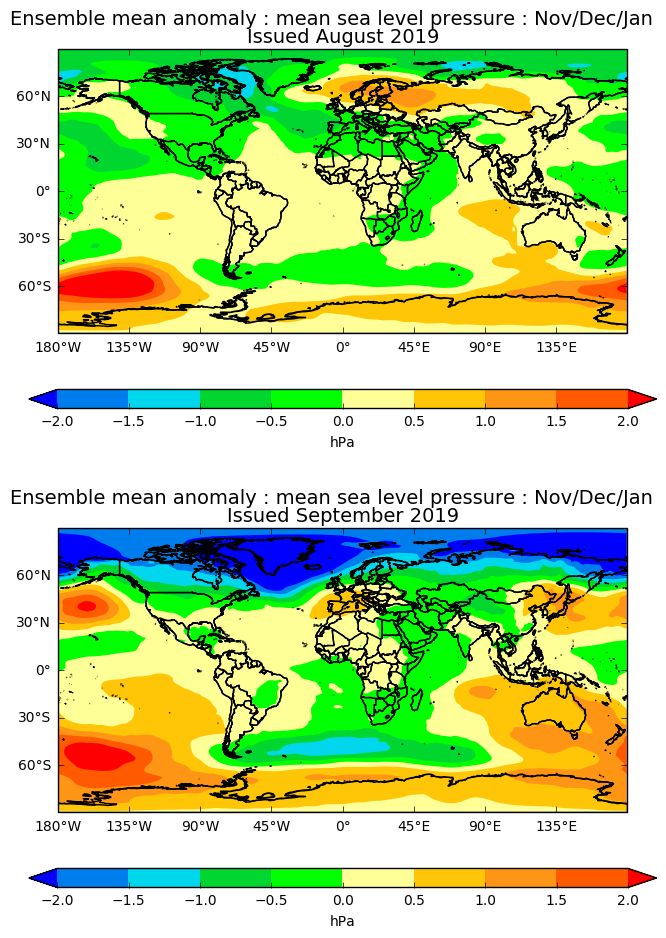
As an example take a look at the August and September predictions for Nov/Dec/Jan MSLP below. These could hardley be more different to each other from a UK point of view with one showing Scandi Heights, a Southerly Jet and lower heights over NW Europe in the August run switching to a Eurotrash high and a strong northerly jet in the September effort (being the "default" MetO winter set-up)
The only bit I found interesting was the establishment of increased heights over the N Pacific in the later run (a big switch round in the later run) which recently has been the death-knell for cold winters in the UK as it re-inforcesas NW-SE jet over N America with the SW-NE wave hitting the UK with uncanny precision
Edited by user
13 September 2019 10:49:33
|
Reason: Not specified