The Weather Outlook

Remove ads from site

Gandalf The White
10 January 2019 09:33:12

I confess I’m just starting to become a little ‘underwhelmed’ by the surface response (modelled) to the SSW and the lack of a decent HLB signal going into the period (20th on) that is supposed to see the start of the trop response. If it wasn’t for the consistency of the UKM long range I’d even start to doubt my own ascertain on the theory, and of course the phrase ‘by no means certain’ does’t help.
We do however seem to have agreement on heights riding over the pole which is a good start, the 20th on is only just appearing in GFS long range and despite the dearth of ‘stella’ charts such synoptics can and historically do appear quickly so I’ll leave the fence climbing until the weekend when something much more definitive should start making itself seen.
This won’t make sense to those of you further North and higher up but cold NW flows don’t really cut it for lowland south.

Originally Posted by: nsrobins 

The Met Office video, posted in the media thread, was interesting in that SSWs occur quite regularly: on average every other winter but sometimes twice in a winter.  The point was also made that a wind reversal in the stratosphere is just one part of a complex jigsaw when it comes to the troposphere.  The emphasis was put on a shift in the probability of blocking, not in any way a certainty.


Location: South Cambridgeshire

130 metres ASL

52.0N 0.1E


Downpour
10 January 2019 09:35:14


Yes, recently it's seemed that every time the latest operational run has disappointed the parallel has come up trumps, and vice versa. I'm salivating over that 0Z parallel run. If it by any chance came off, in the SE we'd have snow up over the tops of our wellies. :)

Originally Posted by: jhall 


The GFSP is due to take over the op permanently in short order, is it not?


I'm sure I recall someone saying it would flip to become the op around this time. 


Chingford

London E4

147ft

Gandalf The White
10 January 2019 09:40:19


The GFSP is due to take over the op permanently in short order, is it not?


I'm sure I recall someone saying it would flip to become the op around this time. 

Originally Posted by: Downpour 

It’s due to go live this month.  I guess the clue will be when the parallel option disappears from the options.


Location: South Cambridgeshire

130 metres ASL

52.0N 0.1E


David M Porter
10 January 2019 09:42:50


The Met Office video, posted in the media thread, was interesting in that SSWs occur quite regularly: on average every other winter but sometimes twice in a winter.  The point was also made that a wind reversal in the stratosphere is just one part of a complex jigsaw when it comes to the troposphere.  The emphasis was put on a shift in the probability of blocking, not in any way a certainty.

Originally Posted by: Gandalf The White 

I think a lot of the reason for the expectations of some on here recently for a quick shift to stella-looking charts which RobK alluded to in his post on the last page is because of the pretty quick response there was in the troposhere last February to the SSW that took place that month. The main differences this time are that this SSW that has just happened has taken place rather earlier in the winter and thus at a time when the polar vortex is normally in a stronger state than it is im February. By the time last Feburary's SSW took place, the sun was already two months into its' journey northwards and thus the vortex would have been weakening.


Lenzie, Glasgow

"A body of men holding themselves accountable to nobody ought not to be trusted by anybody." – Thomas Paine

Gavin D
10 January 2019 09:44:51


The GFSP is due to take over the op permanently in short order, is it not?


I'm sure I recall someone saying it would flip to become the op around this time. 

Originally Posted by: Downpour 


GFS P is due to take over on Jan 19th

Ally Pally Snowman
10 January 2019 09:48:12


GFS P is due to take over on Jan 19th

Originally Posted by: Gavin D 


They must of realised its nailed it this morning. 


Bishop's Stortford 85m ASL.
Gavin D
10 January 2019 10:00:46

doctormog
10 January 2019 10:00:56

I confess I’m just starting to become a little ‘underwhelmed’ by the surface response (modelled) to the SSW and the lack of a decent HLB signal going into the period (20th on) that is supposed to see the start of the trop response. If it wasn’t for the consistency of the UKM long range I’d even start to doubt my own ascertain on the theory, and of course the phrase ‘by no means certain’ does’t help.
We do however seem to have agreement on heights riding over the pole which is a good start, the 20th on is only just appearing in GFS long range and despite the dearth of ‘stella’ charts such synoptics can and historically do appear quickly so I’ll leave the fence climbing until the weekend when something much more definitive should start making itself seen.
This won’t make sense to those of you further North and higher up but cold NW flows don’t really cut it for lowland south.

Originally Posted by: nsrobins 


It makes good sense Neil (not that that may be helpful).

Hopefully things will become a bit more widespread in terms of wintriness in the coming few days. There is a lot of cold around but perhaps not a massive amount of high level blocking .That could manifest in a few different ways, some significantly more wintry than others.


Arbroath 1320
10 January 2019 10:08:17

GEFS 00z in its later stages has more of a twelve bore look to it than yesterday's 12z update. It could be just be background noise or we could be seeing a trend towards more mixed conditions during the last third of the month. The latter would fit in with the recent updates from Exeter and the idea of a fairly mobile but at times cold pattern. My view hasn't change significantly in the last 24 hours - colder with the best chance of significant snow in the north. Roll the dice in the south and you need a 5 or 6 from this.   

https://www.theweatheroutlook.com/twoforecasts/ensemble-forecast.aspx?location=London


Originally Posted by: Brian Gaze 

Agreed Brian. A mixed outlook sums things up. 

Things could change but no evidence at present of sustained Northerly blocking. Pretty bog standard Winter fare but the models are not without interest.


Kenmore, Highland Perthshire, GGTTH
Whiteout
10 January 2019 10:12:50


They must of realised its nailed it this morning. 

Originally Posted by: Ally Pally Snowman 

LOL  Seriously though, the output today is hardly uunderwhelming, steady as you go, stunning GFS para, excellent UKMO and ECM, steady GFS ens, not sure where any negativity is coming from - apart from the usual doom mongers of course.


Home/Work - Dartmoor

240m/785 ft asl

ballamar
10 January 2019 10:14:56
http://www.wetterzentrale.de/maps/GFSOPEU06_150_1.png 

Could be a better op run, still got my eyes looking NE

Whiteout
10 January 2019 10:15:47

Blimey - the parallel GFS this morning is the snowiest run this winter [for England, at least], dumping 4 to 6 inches over most of the country. An astonishing run.

http://www.meteociel.fr/modeles/gfse_cartes.php?&ech=264&mode=0&runpara=1


Originally Posted by: Retron 

Should hopefully start to see more of these types of runs as we head into Feb. 


Home/Work - Dartmoor

240m/785 ft asl

Solar Cycles
10 January 2019 10:21:51

Originally Posted by: Gavin D 

Hugo & Dutton. πŸ˜‚πŸ˜‚πŸ˜‚

Ally Pally Snowman
10 January 2019 10:28:34

http://www.wetterzentrale.de/maps/GFSOPEU06_150_1.png

Could be a better op run, still got my eyes looking NE

Originally Posted by: ballamar 


Indeed looking good at 192 for  a nor easter


Bishop's Stortford 85m ASL.
tallyho_83
10 January 2019 10:34:54

No sign of any blocking in the FI OP run this morning either:

If anything it's a strengthened PV - purples and blues over the Pole and Greenland and a strengthened Azores HP.?

Not what you would associated with a split PV, REVERSAL of Zonal winds following a major SSW.


Home Location - Vixen Tor Close, Okehampton, Devon (221m ASL)

---------------------------------------

Sean Moon

Magical Moon

www.magical-moon.com

tallyho_83
10 January 2019 10:48:15

06z run - yet again with a positive NAO - just as you think things are quietning down the jet fires up and a deep area of low pressure develops to south of Greenland heading into Iceland post +252:


Home Location - Vixen Tor Close, Okehampton, Devon (221m ASL)

---------------------------------------

Sean Moon

Magical Moon

www.magical-moon.com

Rob K
10 January 2019 10:51:10

06z run - yet again with a positive NAO - just as you think things are quietning down the jet fires up and a deep area of low pressure develops to south of Greenland heading into Iceland post +252:

Originally Posted by: tallyho_83 

Look at the NH view, though. It's totally different to the previous run, with a totally split vortex and high pressure over the pole. Run to run variation is so vast it is pointless to get hung up on the detail. The trend is for it to turn increasingly unsettled and cold from the NW. Good for the northern half of the country, and potentially good for the south later depending how deep the jet can dive.


Yateley, NE Hampshire, 73m asl

"But who wants to be foretold the weather? It is bad enough when it comes, without our having the misery of knowing about it beforehand." β€” Jerome K. Jerome

Rob K
10 January 2019 10:56:13

No sign of any blocking in the FI OP run this morning either:

If anything it's a strengthened PV - purples and blues over the Pole and Greenland and a strengthened Azores HP.?

Not what you would associated with a split PV, REVERSAL of Zonal winds following a major SSW.

Originally Posted by: tallyho_83 

That is an 00Z chart. The equivalent 06Z has a split vortex with high pressure over the pole. It's pointless posting individual op run charts when they change completely every six hours. Look at the medium term trends instead.


Yateley, NE Hampshire, 73m asl

"But who wants to be foretold the weather? It is bad enough when it comes, without our having the misery of knowing about it beforehand." β€” Jerome K. Jerome

ballamar
10 January 2019 10:56:16
Really is chaotic with the effects of the warming - differences run to run are astonishing even the ENS post 144 will be pretty rubbish esp on detail. Can see multiple snow chances later in Jan and many popping up short notice - still think NE is where the real fun will come from
Rob K
10 January 2019 10:59:57

Really is chaotic with the effects of the warming - differences run to run are astonishing even the ENS post 144 will be pretty rubbish esp on detail. Can see multiple snow chances later in Jan and many popping up short notice - still think NE is where the real fun will come from

Originally Posted by: ballamar 

Yes I agree with this, I think those of us in the south might have to put up with a pretty miserable week or two of cold rain with maybe the odd surprise snowfall, but if the high pressure over the pole can nudge down this way a little bit (hints at the end of the GFSP 0z and op 6z) then fun and games could ensue from the northeast. Just need a fast forward button now, I'm getting impatient!


Yateley, NE Hampshire, 73m asl

"But who wants to be foretold the weather? It is bad enough when it comes, without our having the misery of knowing about it beforehand." β€” Jerome K. Jerome

tallyho_83
10 January 2019 11:09:07


That is an 00Z chart. The equivalent 06Z has a split vortex with high pressure over the pole. It's pointless posting individual op run charts when they change completely every six hours. Look at the medium term trends instead.

Originally Posted by: Rob K 

I know it's the 00Z run and it's hardly consistent is it? Bare in mind each run we're getting ever closer to the end of January...!?


Home Location - Vixen Tor Close, Okehampton, Devon (221m ASL)

---------------------------------------

Sean Moon

Magical Moon

www.magical-moon.com

Russwirral
10 January 2019 11:13:56
The 06z run yet again delivers a "Meh" run. glancing blows of cold, quickly evaporating into the continent. Deep cold features out west arriving into the UK with a wimper and a cool chill.

Think I might give the charts a break for a day or two....


Ally Pally Snowman
10 January 2019 11:20:05

6 Para already looks more amplified at day 6. -10 850s into Scotland


Bishop's Stortford 85m ASL.
JACKO4EVER
10 January 2019 11:33:06

No sign of any blocking in the FI OP run this morning either:

If anything it's a strengthened PV - purples and blues over the Pole and Greenland and a strengthened Azores HP.?

Not what you would associated with a split PV, REVERSAL of Zonal winds following a major SSW.

Originally Posted by: tallyho_83 

careful there Tally- we may have to go live in a Scottish ski resortπŸ˜‰


tallyho_83
10 January 2019 11:34:18

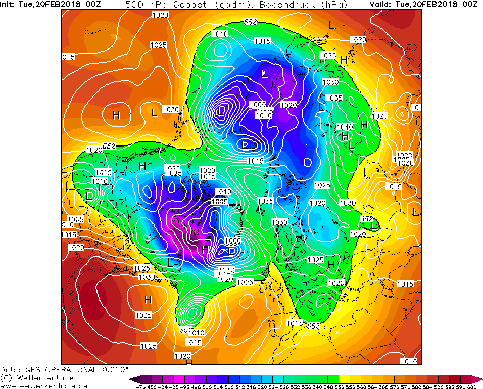
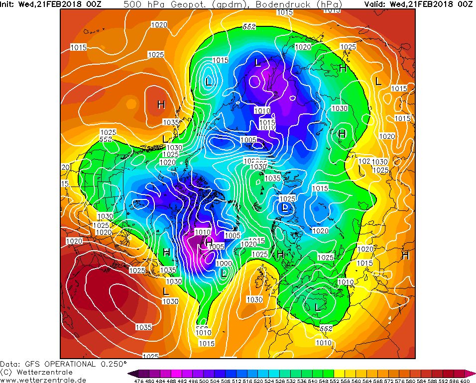
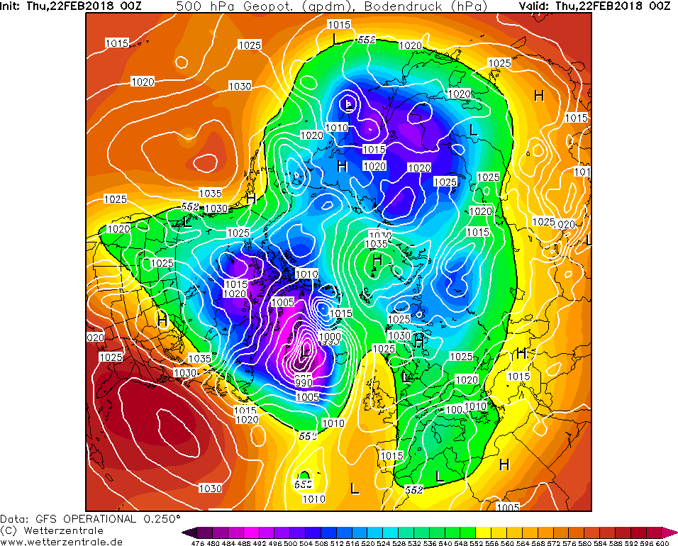
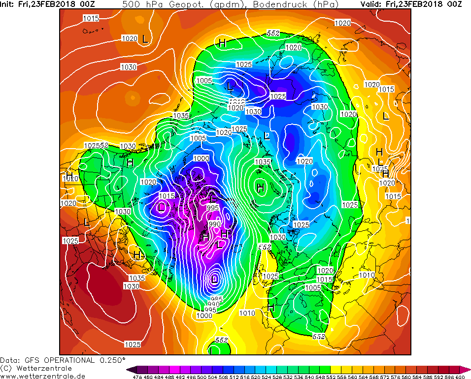
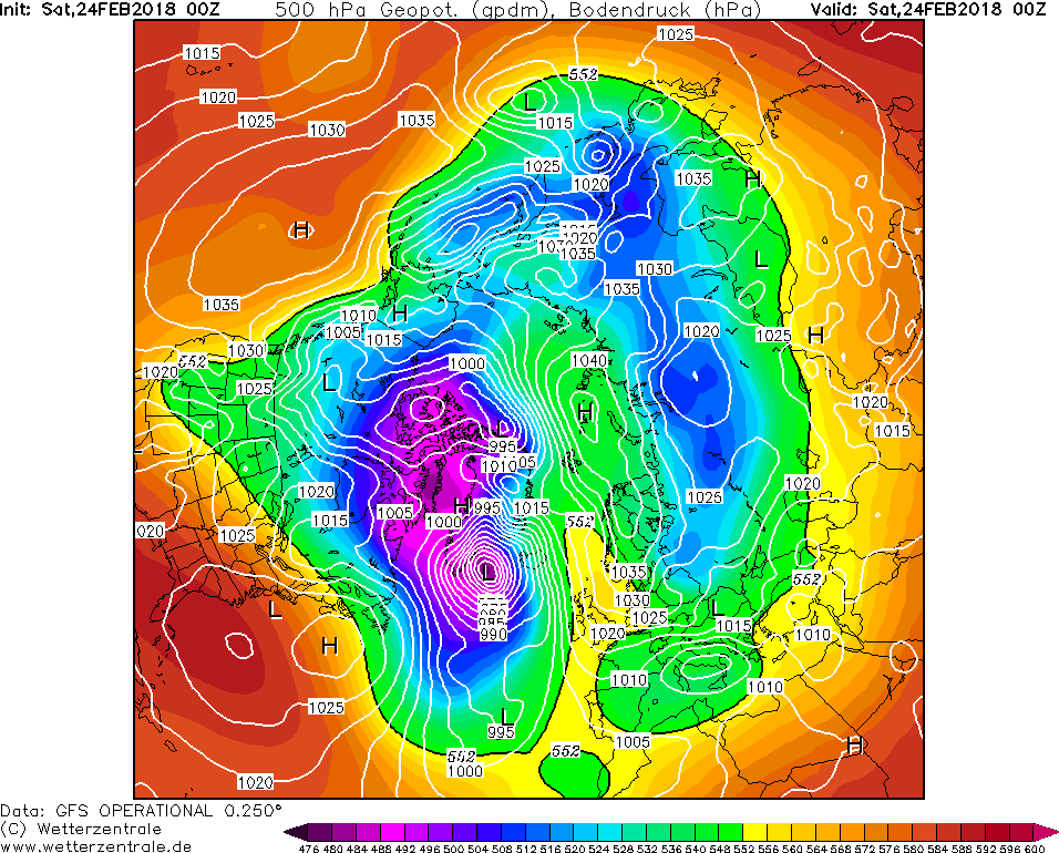
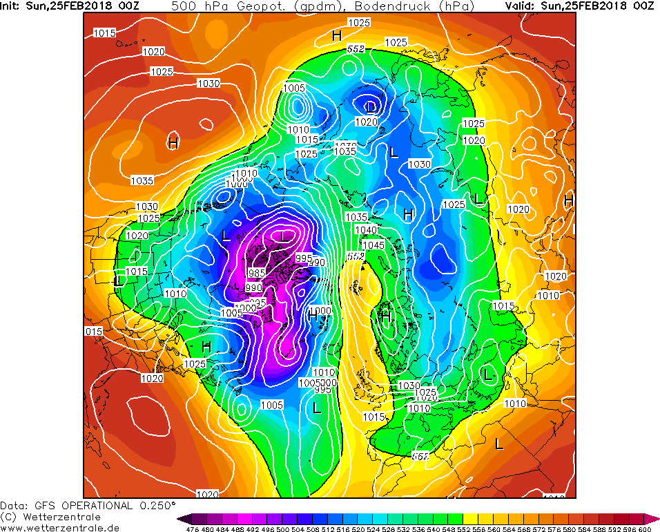
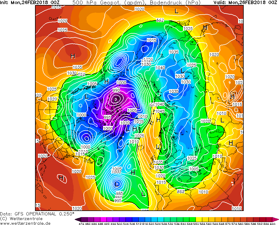
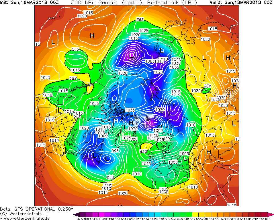
Thought I would look at history and share how the blocking started which gave us the Feast from East in Feb 2018 commencing on 20th Feb 18:


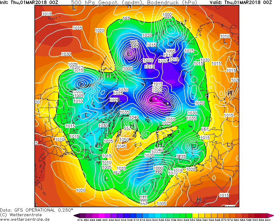
THEN A BLIZZARD WHICH DUMPED 6 - 7 inches of snow in 5 hours in Exeter, along with a daytime max of -3c and many parts of the south and south west on 1st followed by more ice pellets of sleet freezing rain and then an additional amount of snow on afternoon of 2nd. - About 1cm. (wetter snow).

--------------------------------------------------------------------------------------------------------------------------------------------

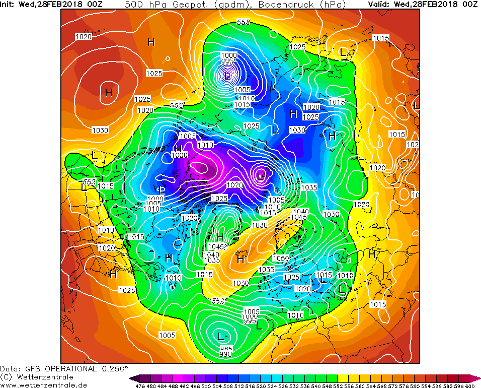
NOW BEAST from the East part 2:

15th March was mild temps of 12 or 13c.


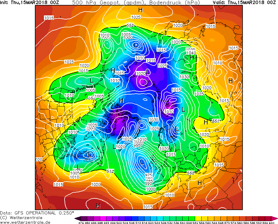
Wet snow fell all day and started settling 2-5cms by night!

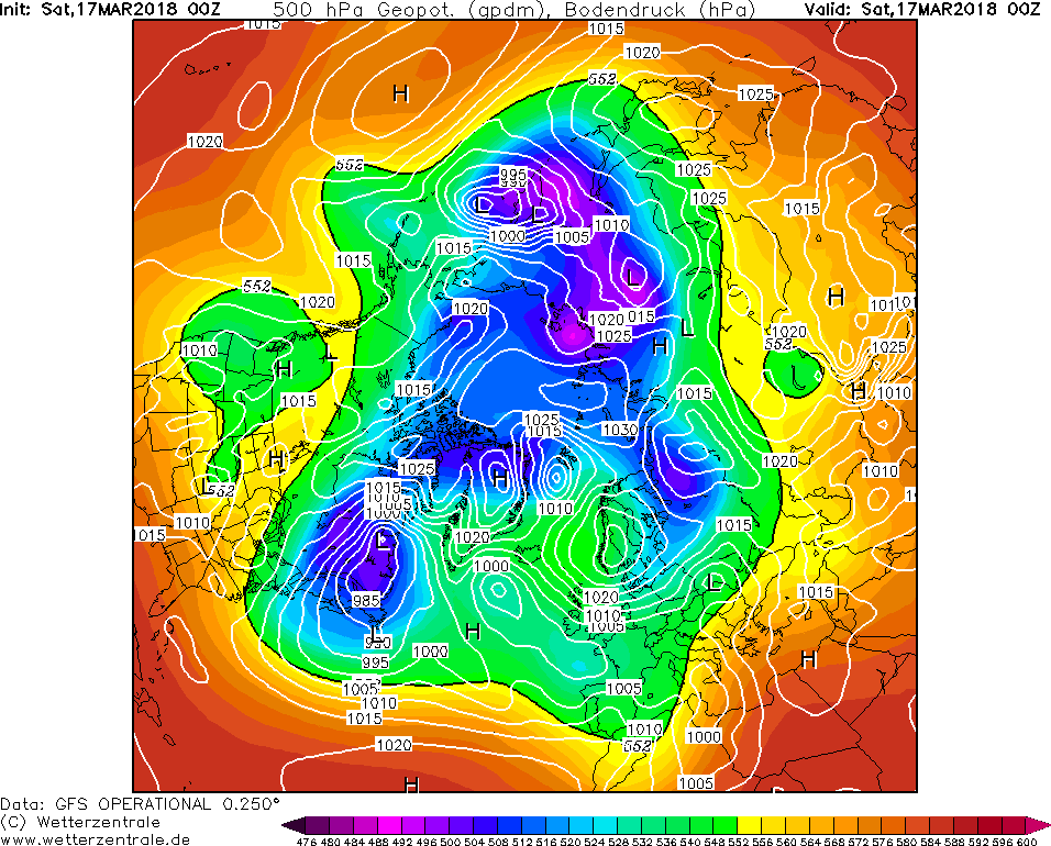
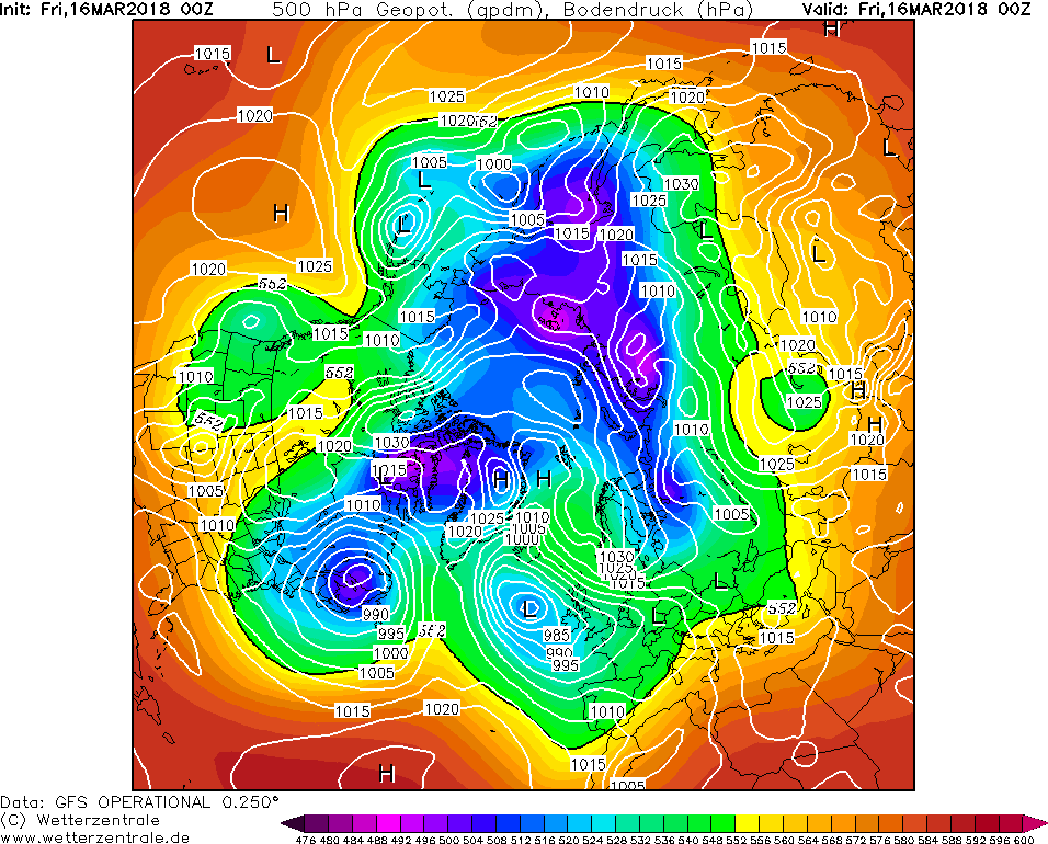
Another spell of heavy wet snow fell - which only initially settled on rooftops and pavements and grass but then accumulated onto roads and all surfaces by mid afternoon and evening and continued throughout the whole night of 17th into 18th and another bout of snow much heavier this time fell on 18th and it snowed for 15 hours - gave us an additional 5- 6" of snow:

The snow that fell on Saturday was wet and didn't settle until very end of day when temp dropped to -1c then snowed all Sat night melted a little Sunday morning before another bout of snow came mid morning and this time settled everywhere and lasting throughout the whole day and night of 18th to 19th March and temp dropped to -2.5c so snow became more powdery. 

 I really don't think anything can beat that, esp after the first beast from east i thought we won't get snow like this for another decade or so and less than x2 weeks later we had the same - just not so much of a blizzard and now powdery drifting snow! 


Was truly a memorable month of weather!

We had more snow in the Spring month of March 2018 than we did throughout the whole of December 2010 and winter 2012/13 put together! If I was to totally up all the accumulated snow for March 2018, including storm Emma and 2nd beast from eass! I would have it 15" - 20" of snow! Although with storm Emma it was difficult to measure the snow depth as the powdery snow was like dunes and drifting but it averaged around 6 to 7 inches!

Maybe, we were lucky with that SSW? Perhaps, it was the La Nina or EASTERLY QBO but either way that SSW earlier in FEB 2018 delivered well and twice if not 3 times as we have more sleety snow on 29th March - Good Friday/Easter Saturday, less than weeks on from this! Nothing settled it was more sleety rain with snow mixed in followed by light rain and snowflakes in heavier bursts!

---------------------------------------------------------------------------------

I will be hard to find anything that beat's cold and snow that we had during March 2018. 


Home Location - Vixen Tor Close, Okehampton, Devon (221m ASL)

---------------------------------------

Sean Moon

Magical Moon

www.magical-moon.com

Remove ads from site