This morning's MetO raw output tells the tale well. Despite all the potential, the wonderful charts that have popped up, and - at times - the likelihood of cold, if not deep cold conditions, the week ahead forecast for here now has, as its highs:
10 / 9 / 9 / 9 / 8 / 9 / 8
A smidge above average, in other words, and not even a sniff of a ground frost, let alone an air frost. It doesn't normally flip quite as badly as this, for example yesterday evening it had, for the same days:
10 / 9 / 9 / 7 / 5 / 8
There are still some cold runs around if you're prepared to cherry-pick ensemble members, but last night's GEFS only had 3 members bringing in -10C 850s to London, well down from the 15 or more of just three days ago.
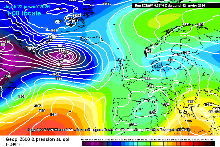
Just for fun, here's what the ECM was predicting 10 days ago for today:
https://images.meteociel.fr/im/90/115/ecmwf_0_240zow3.png
...and here's what we ended up with:
https://images.meteociel.fr/im/98/29639/ecmwf_0_3mgd6.png
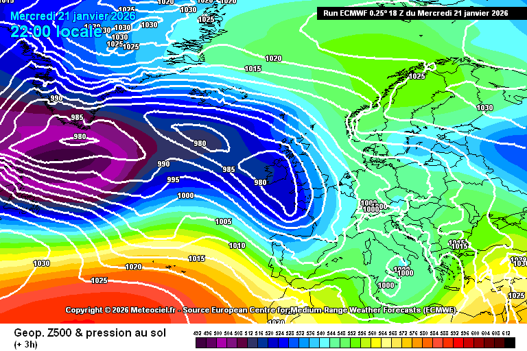
On a very broad-brush basis it's not actually too bad - but on a more local level it's the little changes that make all the difference. It's the same old story, really, the strength of the Atlantic flow was underestimated, the strength of the blocking to the NE overestimated. Small changes on a global scale, but boy - what a difference they make to our little islands!
Originally Posted by: Retron