Starting to see a few genuine heatwave scenarios from the deterministic modelling now.
The GFS 06z was the most impressive yet, with 10 days hitting the mid-high 20s widely, locally low 30s on a few of the days.
Something like that would lift the CET into the upper 10% on record by 26th.
https://twitter.com/peacockreports/status/1414592479144329222
...but as I stated there, caution is (of course) advised. The models have a habit of getting a bit carried away with a newly emerged signal once they've got hold of it.
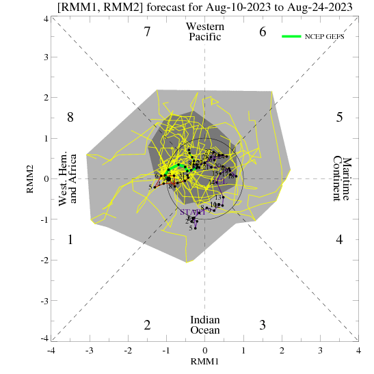
Having said that - the propagating MJO is still there in the GEFS predictions. Even EPS are starting to show some appreciable interest now.
This could be enough to drive exactly the kind of tropical cycle that tends to bring the UK a lengthy settled spell with am increasing tendency for high temperatures, as high pressure gradually drifts eastward across the UK and then across the North Sea.
It's not always a one-high process, mind. Sometimes there are exchanges, marked by thundery interludes. ECM 00z showed one of those taking shape at the end of its 00z run.
If you have any problems or queries relating to TWO you can Email
[email protected] 🙂
https://twitter.com/peacockreports 2021's Homeland Extremes:
T-Max: 30.4°C 21st Jul | T-Min: -6.8°C New Years Day! | Wettest Day: 34.1mm 2nd Oct | Ice Days: 2 (27th Jan & 8th Feb)
Keep Calm and Forecast On