Retron
17 January 2021 12:28:47

Originally Posted by: Phil24 


The SSW took place 12 days ago, the effect was MMW that has caused mayhem with the PV being displaced, split and nocked for six. What with a minor SSW due soon,


We're in the middle of an SSW right now (the second one in quick succession).


https://users.met.fu-berlin.de/~Aktuell/strat-www/wdiag/ec.php?alert=1&level=10&forecast=f24&lng=eng&hem=nh


The end of the GFS 6z hold promise (doesn't it always) - but we won't see the effects of this current SSW for a while (hell, it doesn't even finish until Thursday).


Leysdown, north Kent
Jiries
17 January 2021 12:35:01

Originally Posted by: Snow Hoper 


I knew someone had, that's why I went and looked. All very similar imo.


Seeing FB awash with nostalgic pictures of snowy pasts leads to a lot of questions. Why? Apart from GW what's so different now? It seems increasingly more difficult to get it here than back then. Other places like the USA get hammered and we dont. People say it fires up the Jet Stream and destroys our chances. Did the Americans not get cold winters in the past then? Then we move onto the La Nina, El Nino, MJO, Smurf farts, and such. Did they not occur in the past also? With everything in the mix it has to come down to GW being the primary cause, whether you want to believe in it or not. I was never taken by the whole debate and dont want to turn it into one in here but IMO there is no alternative now.


Toronto is having a mild winter this year and not that cold as they normally do for Jan at -10C min to -3C average for Jan but now having many days above 0C and almost same as here tad cool temps lately.    Nothing to do with GW as when here normally get big freeze, Toronto goes mild but this time stupid LP over Norway refusing to move off so we been very unlucky to get deep cold chances.


https://www.wetterzentrale.de/en/show_diagrams.php?model=gfs&var=2&geoid=48656&lid=ENS&bw=1


Nuneaton ensembles : boring.  Today sun see 1 to 2 meter more sunlight entering the garden so I feel more Spring mode now and hope that come early this year.

idj20
17 January 2021 12:51:28

While thankfully (as things stand) the "big" rain this week is unlikely to be an issue at my neck of the woods, but I do have three straight days of SW & S gales to look forward to. Note how the wind seems to pick up during the night.


It's going to be a long and tiresome week. And it's like I said last week, the GFS model seem to be the best at picking out this kind of thing afar and now it's pretty much nailed on.


Folkestone Harbour. 
Gandalf The White
17 January 2021 12:55:29

Originally Posted by: Sevendust 


It's all nonsense to be honest. Why would winter be from the the shortest day to the midpoint of the suns power in the year?


Yes there is thermal lag but all assertions of seasons applying to a three month corridor are basically bollocks


Yes, I've never understood the logic of taking Winter as three months from from the shortest day to the Spring Equinox. If nothing else that would mean Summer started on 21 June and ran until 20 September.


Wintry weather in late November or early March can still be notable and disruptive although I accept that psychologically it may be less appealing for some when thoughts have turned to Spring.


In terms of the lag due to the surrounding sea/ocean, it's effect offsets the growing solar input such that January and the first half of February have very similar temperatures.


Location: South Cambridgeshire
130 metres ASL
52.0N 0.1E


Gusty
17 January 2021 13:14:00

Exciting weather this week with plenty of wind, more rain (not so fun), a sharp cold front on Thursday and then a cold weekend with a return of frosts and wintry showers for many northern areas.


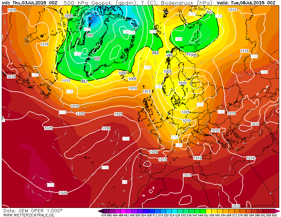
I'm really encouraged by this mornings GFS 6z at 144 hours in (Deep FI) which shows a Greenland High in place a cold trough over Scandinavia, evidence of an arctic high feeding in frigid air to the north of Scandinavia and evidence of lowering heights across Northern Italy.


Add in an ESE'ly tilt of a southerly tracking jet and the second wave of an SSW and we have the ingredients for something really quite special before the end of the month.


From a coldy perspective in the shorter term we need to see this push of cold air at the end of the week push as far south as it can. If we can clear the -5c (850 line) into the the Northern France there is every chance that the next ESE'ly runner low from the Atlantic low will enter the UK with cold air in situ. Where that low enters next weekend is up for debate but there is every chance by next Sunday some parts of the UK will be looking at another snowfall event. From a selfish point of view I would like to see this feature run along the Channel.


Hopefully we will understand more when this appears in the 120-144 range tomorrow.


Steve - Folkestone, Kent
Current conditions from my Davis Vantage Vue
https://www.wunderground.com/dashboard/pws/IFOLKE11 
Join Kent Weather on Facebook.
https://www.facebook.com/stevewall69/ 


Rob K
17 January 2021 13:23:33

Uncertainty starting to creep into the London GEFS again with one trendsetter keeping it cold almost throughout once the next few days are over.

Op is at the cold end of the spread at the end of the run with a very frigid setup just to our east. Still the models are far more interesting than the weather in real life, but at least I was able to get out for a sunny bike ride this morning. (First proper sunshine of 2021!)


Yateley, NE Hampshire, 73m asl
"But who wants to be foretold the weather? It is bad enough when it comes, without our having the misery of knowing about it beforehand." — Jerome K. Jerome
Schnow in Peace
17 January 2021 13:35:05

The very far reaches of the 06GFS would certainly be in line with the METO video on the second warming more directly affecting us(sorry cant post chart just linked me to whole 06 GFS suite)


Of course bringing that through to real time is another matter Looking at the low pressure tracks digging further S and SE on following runs might be a guide.


Current events then seem to favour yet another disturbance to the vortex. There is a deal of interest and some very interesting links in the stratosphere thread on the other side. They are also in the Judah Cohen Twitter feed. The similarities to Winter 1928-29 are discussed there too- changes since notwithstanding. I remember reading about that one in the Robin Stirling (IIRC) Weather of Britain book.


Would be interesting to compare the ENSO profiles and the like to see what if anything they have in common. 


More interesting than last year anyway! 

MRayner
17 January 2021 13:41:28

As for model accuracy , been watching the ECM for a good while in isolation, and it nailed the low going to be sitting off Scotland on Thursday / Friday  at the 240 mark . It has been interesting to see its exact centre wander a few 100 miles , but that’s pretty good accuracy . The Fax seems to relate exactly to the ECM. 


Location Whisky 🥃 country, Cragganmore ,Moray, 440 AMSL
Roger Parsons
17 January 2021 13:41:47

Originally Posted by: Roger Parsons 


River level results from our local station tell the same story. Gandalf!


We plan to take a walk down to see the what's happening today.


https://flood-warning-information.service.gov.uk/station/6073


Roger


We walked down to the River Witham and up to Bardney Lock - 1.5 hours return. Photos taken showed the water level to be close to the flooding of November 2019 - not far from the highest ever level recorded. That year a dyke was breached and it flooded farm land at Short Ferry, Fiskerton. This year that has not happened [yet] but the washland/flood reservoir at Branston Island is now a convincing lake.


We have Yellow alerts for rain next week, Thurs, Weds and Thurs, so it could get interesting.


https://www.metoffice.gov.uk/weather/warnings-and-advice/uk-warnings#?date=2021-01-17&region=em&regionType=area


Water level update:


https://flood-warning-information.service.gov.uk/station/6073


Roger


RogerP
West Lindsey district of Lincolnshire
Everything taken together, here in Lincolnshire are more good things than man could have had the conscience to ask.
William Cobbett, in his Rural Rides - c.1830
SnowyHythe(Kent)
17 January 2021 13:52:20

Originally Posted by: Retron 


We're in the middle of an SSW right now (the second one in quick succession).


https://users.met.fu-berlin.de/~Aktuell/strat-www/wdiag/ec.php?alert=1&level=10&forecast=f24&lng=eng&hem=nh


The end of the GFS 6z hold promise (doesn't it always) - but we won't see the effects of this current SSW for a while (hell, it doesn't even finish until Thursday).


I thought the latest SSW had finished? It was only a smallish uptick too..

Rob K
17 January 2021 13:53:10

Originally Posted by: Snow Hoper 


I knew someone had, that's why I went and looked. All very similar imo.


Seeing FB awash with nostalgic pictures of snowy pasts leads to a lot of questions. Why? Apart from GW what's so different now? It seems increasingly more difficult to get it here than back then. Other places like the USA get hammered and we dont. People say it fires up the Jet Stream and destroys our chances. Did the Americans not get cold winters in the past then? Then we move onto the La Nina, El Nino, MJO, Smurf farts, and such. Did they not occur in the past also? With everything in the mix it has to come down to GW being the primary cause, whether you want to believe in it or not. I was never taken by the whole debate and dont want to turn it into one in here but IMO there is no alternative now.


In very simple terms: the past lasted a long time :)


What I mean is, every snowy spell from the past gets lumped together into some wintry golden age, while the mild guff gets forgotten, but the reality is that snow always has been a rarity in much of lowland England. It has got rarer, for obvious reasons, although actually the past 10-12 years have been snowier in my part of the world than the previous 30. Aside from 1991, the 90s were disastrous for snow lovers round here, as were the early 2000s and indeed much of the 80s. I’m not old enough to remember the 70s but they had largely uninspiring winters too, 78/79 aside. 


Yateley, NE Hampshire, 73m asl
"But who wants to be foretold the weather? It is bad enough when it comes, without our having the misery of knowing about it beforehand." — Jerome K. Jerome
UncleAlbert
17 January 2021 13:53:20

Originally Posted by: Sevendust 


I suspect only Gavin remembers that one.


As Doc says, the folly of selecting one run a long way out is futile given the volatility al though I am concerned at the lack of high level blocking at the moment.


For us southerners the focus as we move to late January is on developments to the north-east


Two points from the discussions today.


With regards to the post about the lack of Northern blocking going forward, I notice that a large cluster of GFS members give the hint that the MJO may head through COD into the more favourable territory of Phase 7 towards the end of the run. There has been no help from this direction thus far.


https://www.cpc.ncep.noaa.gov/products/precip/CWlink/MJO/mjo.


Secondly and separately it has been mentioned that the MO in their podcast stated that SSW1 will have little effect. Have not listened to it but shtmlone post said 'no effect on us' and a previous post said no effect period. With respect to the bigger picture there is not a great deal about the 10 day models that looks like normal January synoptics with a southerly and slackish jet and a disrupted vortex. Looking at the UK this may bring copious amounts of precipitation. Can't be certain that this is an effect but is it not probably a factor? I say this because we can easily perceive that just because it does not bring the appropriate blocking and cold to our neck of the woods, it has not been a major player.


nsrobins
17 January 2021 14:15:35

Originally Posted by: Gandalf The White 


Yes, I've never understood the logic of taking Winter as three months from from the shortest day to the Spring Equinox. If nothing else that would mean Summer started on 21 June and ran until 20 September.


Wintry weather in late November or early March can still be notable and disruptive although I accept that psychologically it may be less appealing for some when thoughts have turned to Spring.


In terms of the lag due to the surrounding sea/ocean, it's effect offsets the growing solar input such that January and the first half of February have very similar temperatures.


I’ve never understood the controversy. Astronomical seasons are defined by the solstices and equinoxes. These vary in length by a few days. For data and records you need equal periods hence the fixed three month quarters.


The ‘season’ however is subjective to a certain extent. For instance IMO ‘Autumn’ these days runs from August to July 😉


Neil
Fareham, Hampshire 28m ASL (near estuary)
Stormchaser, Member TORRO
ballamar
17 January 2021 14:19:25
Still all to play for depends on the warm air interaction with the Scandi low. Less warm air into the low changes the intensity and stops it spinning further north. Interesting how it plays out,could look very different to what is modelled in 96 hours
Schnow in Peace
17 January 2021 14:33:08

Originally Posted by: ballamar 

Still all to play for depends on the warm air interaction with the Scandi low. Less warm air into the low changes the intensity and stops it spinning further north. Interesting how it plays out,could look very different to what is modelled in 96 hours


Very good point


Talk on met.ie of the Wednesday rain here turning to sleet/snow and maxes only 2 to 4 degrees over most of the country. 

tallyho_83
17 January 2021 14:47:00

Originally Posted by: Phil24 


The SSW took place 12 days ago, the effect was MMW that has caused mayhem with the PV being displaced, split and nocked for six


Sorry I am confused MMW and nocked for six?


Please explain?


Home Location - Kellands Lane, Okehampton, Devon (200m ASL)
---------------------------------------
Sean Moon
Magical Moon
www.magical-moon.com


Surrey John
17 January 2021 14:57:10

Originally Posted by: tallyho_83 


Sorry I am confused MMW and nocked for six?


Please explain?


Nocked is process of fitting an arrow to a bowstring, you are not alone in trying to understand the connection to a weather model, maybe it means goes fast in six directions 


Bradford on Avon, Wiltshire
35m ASL
Snow Hoper
17 January 2021 14:59:21

Originally Posted by: Gusty 


Exciting weather this week with plenty of wind, more rain (not so fun), a sharp cold front on Thursday and then a cold weekend with a return of frosts and wintry showers for many northern areas.


I'm really encouraged by this mornings GFS 6z at 144 hours in (Deep FI) which shows a Greenland High in place a cold trough over Scandinavia, evidence of an arctic high feeding in frigid air to the north of Scandinavia and evidence of lowering heights across Northern Italy.


Add in an ESE'ly tilt of a southerly tracking jet and the second wave of an SSW and we have the ingredients for something really quite special before the end of the month.


From a coldy perspective in the shorter term we need to see this push of cold air at the end of the week push as far south as it can. If we can clear the -5c (850 line) into the the Northern France there is every chance that the next ESE'ly runner low from the Atlantic low will enter the UK with cold air in situ. Where that low enters next weekend is up for debate but there is every chance by next Sunday some parts of the UK will be looking at another snowfall event. From a selfish point of view I would like to see this feature run along the Channel.


Hopefully we will understand more when this appears in the 120-144 range tomorrow.


I think adopting this approach during these chaotic times is probably best. Although keeping one eye open on the beyond section, its pointless giving it any credence because, as Doc pointed out, a forecast, just 6 hrs later, had changed completely. 


Although I could be wrong, the 2 recent snowfalls were originally ensemble bumps in the road that got ironed out nearer the time. The next one looks like happening but the 2nd, more pronounced one, looks like it might be flattering already. (Just the one eye as I said watching that one).


Going to war over religion is like killing each other to see who has the better imaginary friend.


Home : Thorndon, Suffolk.
Retron
17 January 2021 15:01:32

Originally Posted by: SnowyHythe(Kent) 


I thought the latest SSW had finished? It was only a smallish uptick too..


Nope, I even included the link in my post!


Here it is again...


Originally Posted by: Retron 


We're in the middle of an SSW right now (the second one in quick succession).


https://users.met.fu-berlin.de/~Aktuell/strat-www/wdiag/ec.php?alert=1&level=10&forecast=f24&lng=eng&hem=nh


The end of the GFS 6z hold promise (doesn't it always) - but we won't see the effects of this current SSW for a while (hell, it doesn't even finish until Thursday).


The rest of the charts (showing that yes, we're in a major SSW at the moment) are here:


https://users.met.fu-berlin.de/~Aktuell/strat-www/wdiag/diag.php?alert=1&lng=eng&hem=nh


Leysdown, north Kent
JRobinson
17 January 2021 15:01:37

Originally Posted by: tallyho_83 


Sorry I am confused MMW and nocked for six?


Please explain?


“Knocked for six” is a phrase used to mean something has happened to cause total confusion.


as far as MMW goes.... I’ll let the experts explain

Users browsing this topic

Ads