You should/they be fine - if it makes you feel better my family and cousins were staying at the Moon Palace - Playa del Carmen in Cancun in August 2012 when Ernesto hit as a cat 2/3. We had our flight delayed and had to cancel the trip to Cozumel Island. The hurricane struck 1 day after my cousins wedding on the beach so we were really lucky! The majority of the storm went to the south and battered Belize and Guatemala! The yellow is where Cancun is and we had tropical storm conditions!!
It was quite worrying but worse of the storm went 100 miles south and we just had really heavy rain, tropical storm force winds and coastal flooding - even branches and trees were swept into the hotel resorts and swimming pools too!
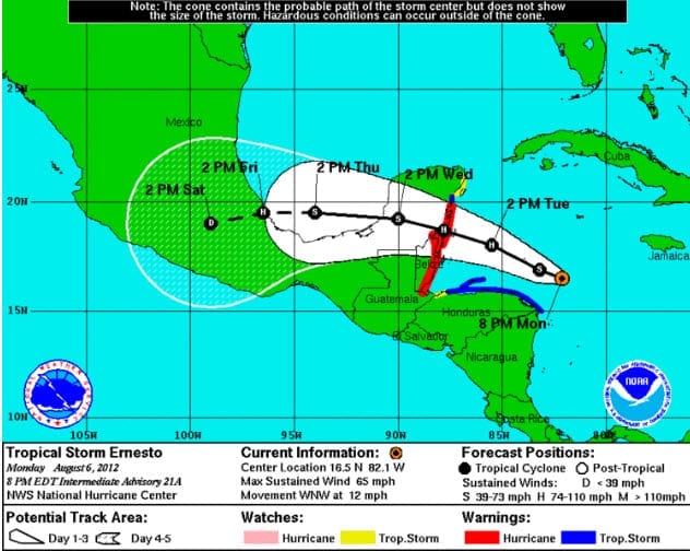
This was the track Ernesto took early August 2012 - which looks like a similar route Isaac may take! - Will see! If if does take the below route Cancun would escape the worse of Isaac.

Originally Posted by: tallyho_83