This morning has not raced out of the starting blocks like yesterday did, due to a bit of high cloud and even a few cumulus about between 7:30 and 8:30, plus a slight breeze - but this breeze has a northerly component to it which is significant given that the sea breeze will soon be attempting to move the air in the opposite direction.
That should either lead to a 'dead heat' if the dry air and strong capping inversion keep it clear despite the surface convergence, or the sudden development of what could rapidly grow into towering cumulonimbus given the CAPE that will be present.
Models favour the former outcome (for example ARPEGE produced a single afternoon shower near to this location on the 00z run yesterday but has lost interest since then) and as a result ARPEGE produces maximums of 31 or 32*C (below-left) despite the slower start to the day (then again it's only about a degree behind yesterday at this stage);
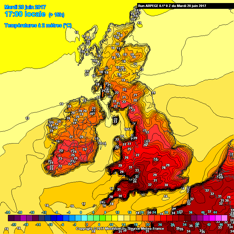
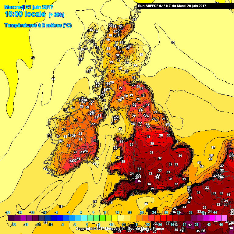
It will be very important whether such values actually manifest today, and even more so those values around Bristol, given what ARPEGE continues to predict for tomorrow, although in that case there does look to be some kind of 'wave of heat' moving across from the southwest, clearest to see on the Theta-E charts:


That arm of black shading represents a band of air with the potential to achieve values rarely seen in the UK. Question is whether cloud amounts and sea breeze interactions will really allow that to occur. The timing has shifted from the 12z to be a few hours earlier so now it's during the peak heating hours which is alarming to say the least!
ARPEGE doesn't stop there either; the peak of the plume takes a little longer to clear east than it did on the 12z and as a result East Anglia has a run at the mid-30s on Thursday  .
So yeah - how close ARPEGE ends up being today will determine whether we should be truly concerned or in a position to mock the model's antics.
p.s. Why is this called 'hot spell late June' when it's mid-June? 
If you have any problems or queries relating to TWO you can Email
[email protected] https://twitter.com/peacockreports
2025's Homeland Extremes:
T-Max: 32.0°C 12th Aug | T-Min: -5.4°C 4th Jan | Wettest Day: 31.8 mm 18th Dec | Ice Days: None
Keep Calm and Forecast On