We are due a cold February, at some point we will have one 30 years since the last one
There's no blow torch being shown and we haven't had that at all this winter
Since mid December, it's been average or chilly
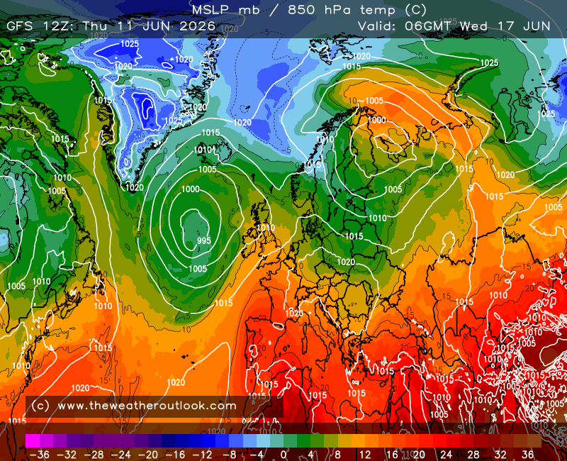
The 12z has a strong block in place, Atlantic is held with us sat in the middle
No sign of cold though
Very average
Originally Posted by: western100
Are we looking at the same GFS run?
Cold in Scotland (okay probably more grim stuff for some but cold uppers anyway!):-
Chilly to cold over most of the UK. That would be cold at the surface away from far SW I think.
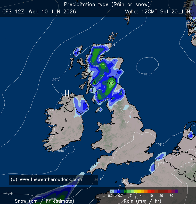
Cold air in situ over a chunk of the UK, rain turning to snow as LP pushes precip North and convective snow for some eastern coasts:-
Weakish (i.e no yellows on the 500hPa charts, so surface stuff I believe?) but extensive northern blocking starts to push colder air south:-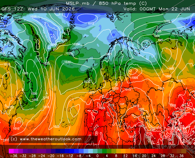
Cold air pushing south meets LP moving in, heavy snow for some:-
Now how likely that is, is entirely reasonable to ponder. It does though continue the theme of HP reasserting itself to our east in the near to mid term and then northern blocking becoming more influential thereafter. I imagine it'll be part of a colder cluster in the ens, with plenty of milder options. I wonder if the extended ECM will continue with the northern blocking too, as it's consistently shown for the past couple of runs - there's milder ens members in that suite too so very much not a guarantee but I'll go with it will have a similar pattern, whether it's enough for colder stuff, very much TBC.
It's entirely possible the whole of the UK could end up in a no mans land for cold in the currently modelled setup but objectively it's not what the 12z GFS op showed, which was at various times a wintry run (not for MBY really, although the rain would be colder at times 🤡). Unless the GEFS and ECM/ECM Ens backtrack there is a decent signal for colder weather around 7th Feb or so that IMO is worth keeping an eye on but noting the usual caveats:-
* It's deep FI.
* It's by no means the only option.
* It's not a clean cold solution and much as the current setup all it takes is the jet to be stronger and/or a bit further north and things end up close but no cigar or collapsing entirely.
As with the last possible cold spell until we are at the edge of the reliable (T120 ish) and the ens suites are solidly backing a cold solution I'll view any colder weather as possible but not guaranteed and try not to get carried away by charts like the GFS 12z op (or preferably better!), which showed a fair bit of cold weather around at times.
Home: Tunbridge Wells
Work: Tonbridge