I was just going to post that the difference in the ens sets for London and Aberdeen rather strongly suggests the north east quadrant of the UK is looking at greatest risk of a more prolonged spell of colder 850s, with MBY closer to LP sitting to the west and moving south or south eastwards in to Europe. That said it's not a particularly warm signal down here and the T2M temps suggest continental air at least as you head through FI.
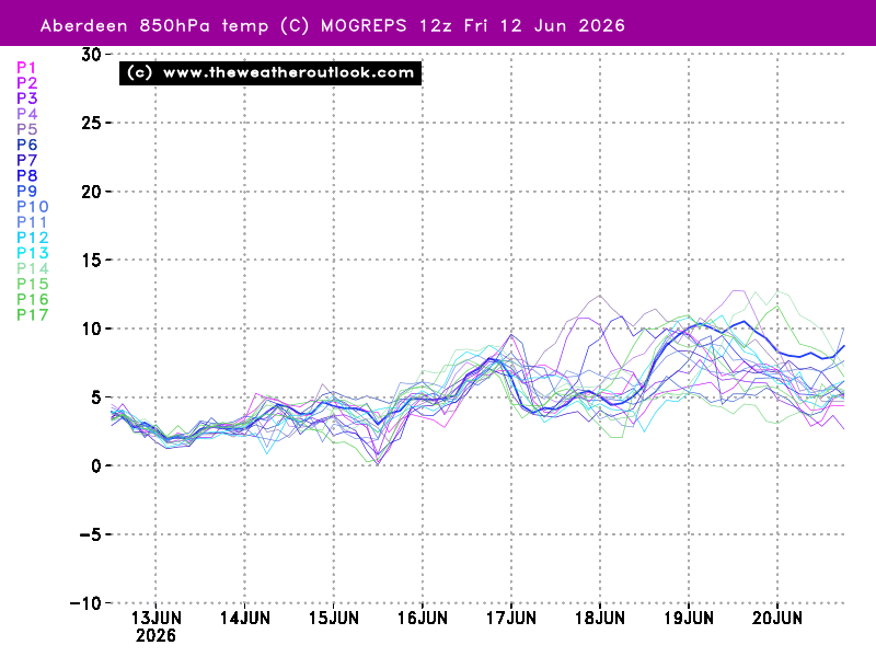
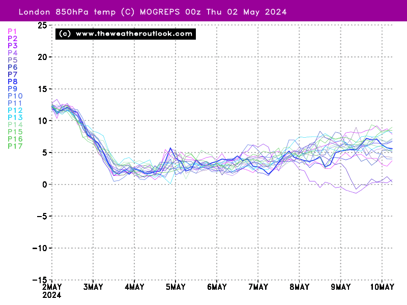
I think MOGREPs can be a bit of a mess at times due to the lower number of ens members but they do very nicely show the contrast between the 2 locations this morning:-
Aberdeen:-
London:-
It's a signal that's present on the GEFS and ECM suite too.
So big picture HP to the east ridging north/westwards, LPs bumping in to the block and generally stalling/filling and/or wandering somewhere south or south east allowing colder air to be channelled into northern England and Scotland, maybe for the south too if the block is robust enough and the LPs weak enough or take a favourable track. Deeper in FI and it remains a case of what the Atlantic does versus whether the block can reposition or intensify, which the ECM just about manages in deep FI bringing in a short fetch but fairly cold easterly.
Messy, chilly for most and cold at times biased the further North you head.
Overall I think this morning's GEFS/ECM ens are better than the 12zs from yesterday, particularly the ECM which had more mild members and less colder ones. That's nice to see but we still seem to be wobbling between a more robust HP/weaker Atlantic and vice versa so no consistency yet.
Originally Posted by: Hippydave