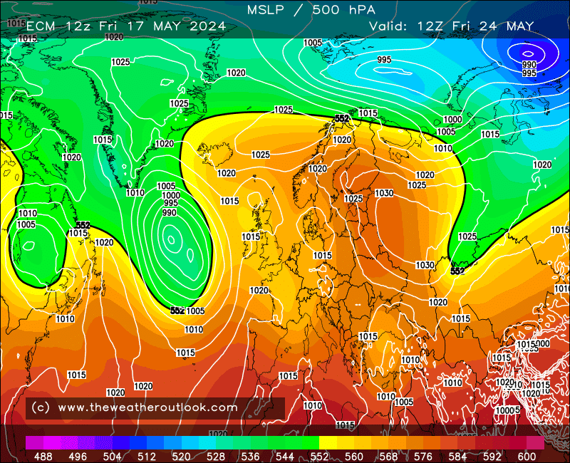
Looking at ECMs op easterly and how the other models go, seems to me the ECM triggers the initial push by dropping LP due south at T168, whilst the deep LP over Iceland decays:-

That all seems to give time to allow HP to develop properly over Scandi and gradually push westwards.
Not an avenue the rest of the Ops take and synoptically there's a fair bit of difference at T168 as a result. UKMO is poised at T168 but needs the LP to head south or at least south east I would guess.
Looking at the GEFS there is very little support for the ECM op although member 4 evolves in much the same way and has a lengthy cold spell setting in.
Possible Scandi based rainbow aside, Friday's LP positioning is maybe solidifying somewhat with more agreement on the Ops at least for a track that brings the core of the LP somewhere around the south coast rather than further north, with potential for coastal gales as a result. Main snow risk is a little early to pin down IMO until there's firm agreement on track - a quick look through MOGREPS suggests decent support for the LP to be a touch further south, GEFS are mixed with a real mess of further north, little LP development and LP further south. On that basis whilst you'd expect the ops to be best at this range, some further small shifts wouldn't be a surprise and could potentially make the difference between snow or rain.
Originally Posted by: Hippydave