Not much change this morning I guess, GFS more positive with the breakdown, ECM a touch less less so. I don't find the GEFS convincingly behind 05/01 being when the upper air warms, with a decent cluster until 07/01 - the T2M temps are rather more firmly behind 07/01 for air changeover date. (IMBY)
Outside of the usual areas exposed to northerly convection that little wintry feature moving down the country may be the best chances some people have to see some snow, although ECM says mostly rain.
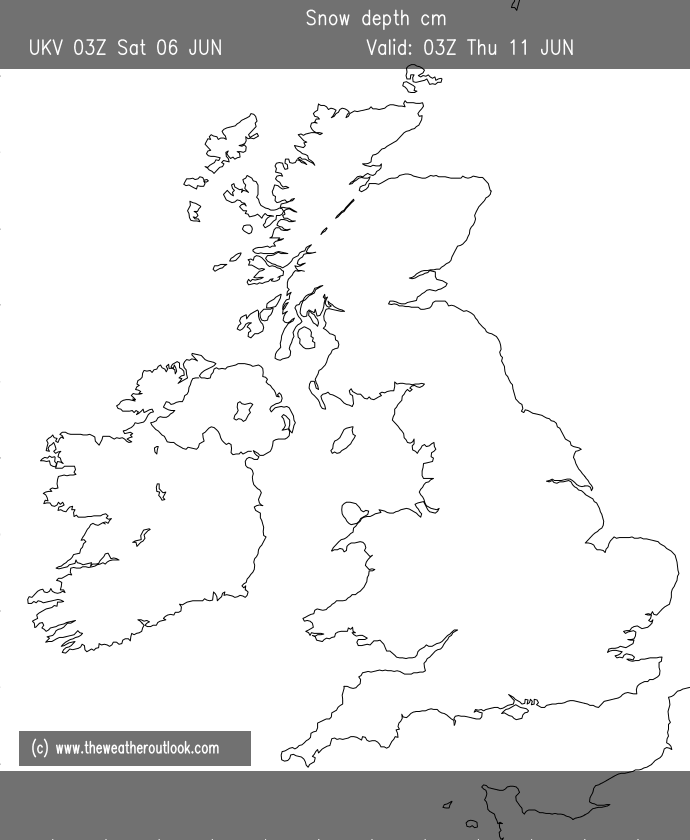
Here's UKV's take on where lying snow will be by T120, was expecting to see a little down the east coast but winds maybe have too much of a westerly element? Unlikely to be 100% accurate of course and I'd not be surprised to see more for higher ground in the SW if wind direction steers showers inland, interesting though to see the piling up on higher parts of NW Scotland.
As an aside and very much an opinion/perception based one but generally I find when the models go resolutely Atlantic breakdown they invariably don't back off but do sometimes overplay the initial signal somewhat, with a delay of a day or so before it properly replaces any cold air in situ. Doesn't always happen and either way it still warms up but will be interesting to see how this pattern pans out (assuming, he says optimistically some of the ECM ens solutions which keep it chilly don't pan out!).
Originally Posted by: Hippydave