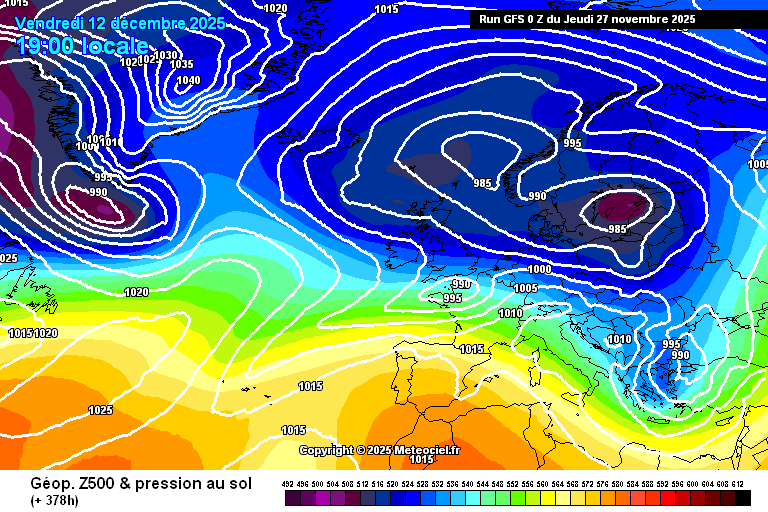
This morning's 0z GFS op isn't without interest. A right old battering in the later stages, with lows diving ESE'wards over or around the UK, culminating in a deep low to the south with widespread heavy snow (settling) across the south. Just for fun, of course, and the stormy bits before wouldn't be much fun!
https://images.meteociel.fr/im/46/16562/gfs_0_378lug8.png
ECM-45 wise it's an improvement for cold fans. The SSW is a bit firmer now, still a very brief affair but still below zero, and the outlook for most of December has flipped back to normal rather than a fair bit above as we've seen just recently.
The potential SSW is only a couple of days away, and hopefully it'll actually come off - if nothing else, it'll be interesting to see whether we do get a more normal spell (temperature wise) as a result of it.
EDIT: And last night's 12z op only went down to +0.1 m/s, so no SSW there.
Originally Posted by: Retron