Hmm - while I'd jump at the chance of an SSW, as they do increase the odds of a cold outbreak here in winter, I can't help but note the conclusion:
"With strong signs emerging for a weak Polar Vortex in 2025/2026, the likelihood increases for more colder winter days and snowfall over the United States, Canada, and parts of Europe."
We've seen the way things have changed in the past 20 years or so, and every winter the media seems to whip up hype in the States about a record-breaking cold spell, snow storms, "polar vortex" and so forth. (We see similar hype here, of course, with those clickbaity "the EXACT DAY a 400 MILE WALL OF SNOW will hit the UK" articles based on a single model run, but unlike the US/Canada a cold outbreak is by no means guaranteed every winter).
And odds are that the "parts of Europe" will be a) Greece and b) parts that people don't think of as getting snow, e.g Spain... it's so woolly in fact that any snow anywhere in Europe would allow them to claim a successful forecast.
Predict that at some point in the afternoon it'll be 3PM and you won't be wrong. It's the same principle.
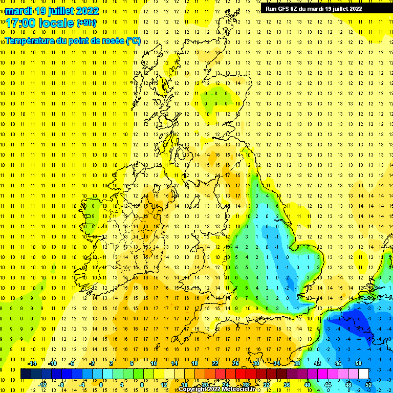
WRT one of the other things being discussed, the low dewpoints modelled on some of the output, I was thinking earlier - it reminds me of the stories about desertification of the Iberian peninsula, and indeed if you look at the likes of the Sahara and the Mojave Desert - where Las Vegas lies - you'll often see days in the 30s and dewpoints around freezing, or even a fair bit below. You can see the theory in action: such dry air desiccates vegetation, and if it starts happening more often than not the vegetation just dies. That then removes moisture from the system (as trees of course draw up water and it evaporates from their leaves), and it becomes a self-reinforcing cycle.
At least where we are, surrounded by sea and ocean, we have a source of moisture most of the time, but I do wonder about France and areas further south: we saw the "canicule" back in 2003, but temperatures were broadly higher in 2022 and, as we've seen this year, there are plenty of runs which show 40s again there (and occasionally here). 2022 was remarkable as what started as an outrageous outlier gradually gained support - the memory of that lingers, and like most I'm wary of seeing 40s modelled again.
Oh, and FWIW - here's the 6z GFS run on the day of that heat in 2022. Note the pool of subzero dewpoints, something I pointed out at the time as being dangerous:
https://images.meteociel.fr/im/64/14014/9_101UKiiv3.GIF
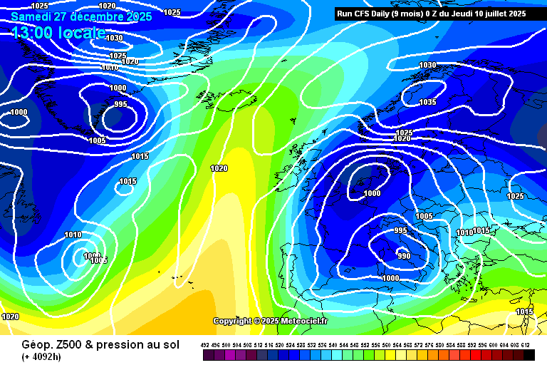
EDIT: And one model at least does in fact show a nice snowy flow over the UK just after Christmas. It's the CFS, of course... wouldn't it be nice if just once it got it right!
https://images.meteociel.fr/im/5/17304/cfs_0_4092hsm1.png
Originally Posted by: Retron