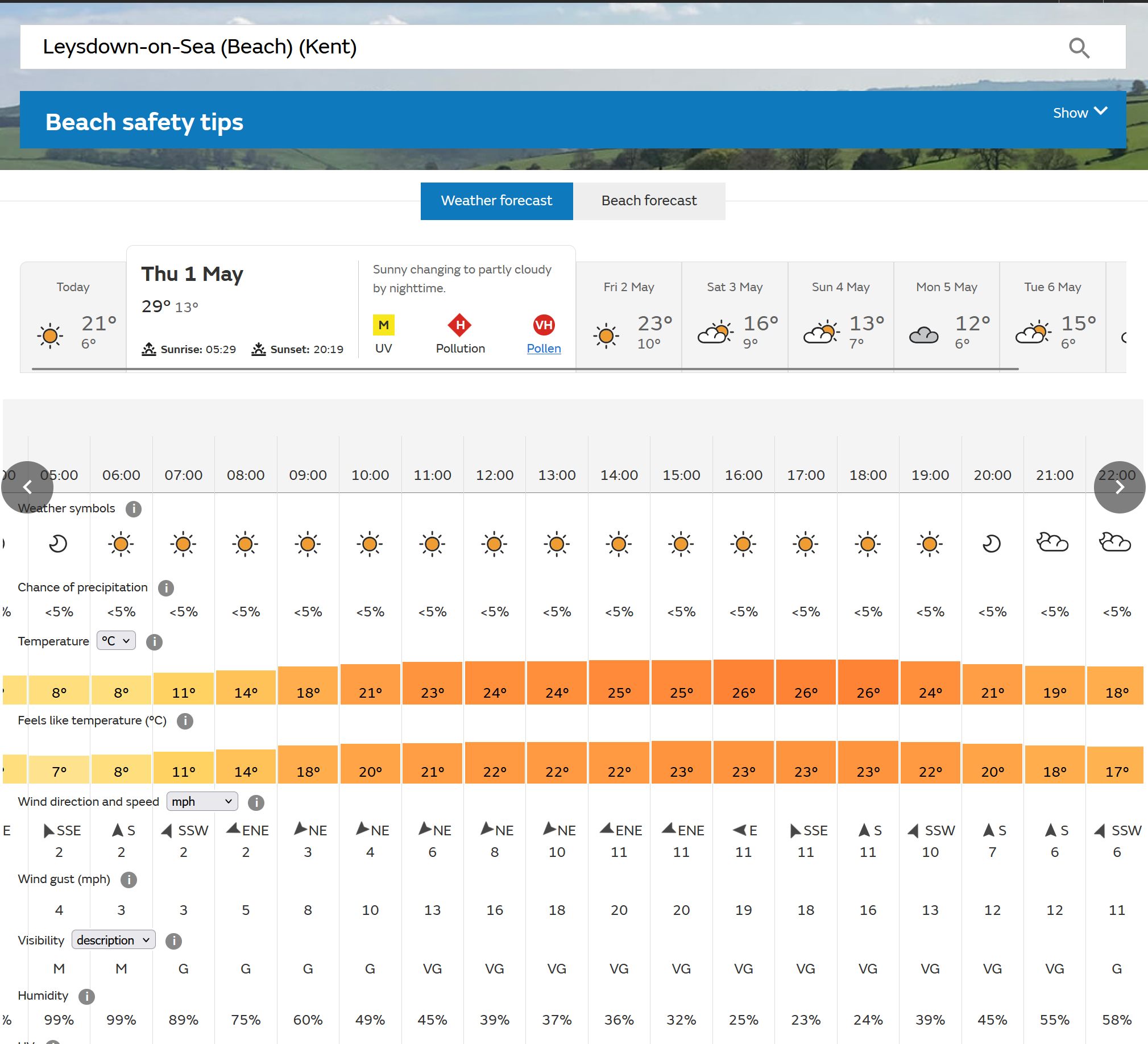
The way things are going it'll be reached here! Astonishing model output from the MetO.
The temperature's been creeping up over the past couple of days: started off at 25 three days ago, was 26 two days ago, 27 yesterday morning and 28 yesterday evening. The text mentions a regional high of 29 and given we have an onshore breeze for much of the day I'd be amazed if we reached 29. There are three things responsible: one, a switch away from an onshore wind later in the day; two, clear skies all day for maximum insolation and three, very low humidity - humid air takes longer to warm up and cool down, so the very low humidity (23%) means faster warming. (In effect the ground acts like a radiator, if the air is humid that radiator effect is less efficient - at least that's my understanding).
These conditions, if they happen, will probably lead to a 30 at Brogdale - it always does well in these situations due to its position to the lee of the Downs.
https://ukwct.org.uk/weather/may1.jpg
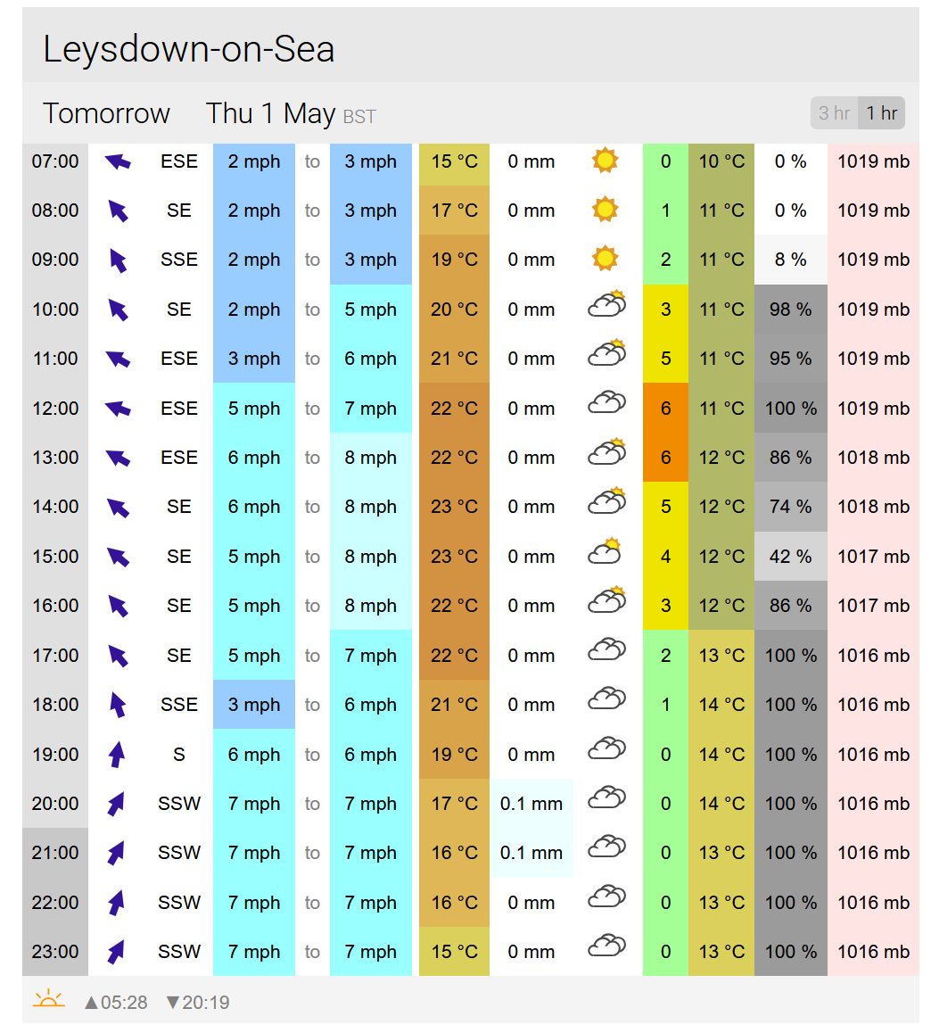
The GFS, meanwhile, paints a completely different picture. No onshore breeze, cloud building from late morning onwards and a much higher dewpoint - 12 or 13, rather than the 3 that MetO shows. This would be a very warm, stuffy-feeling sort of day, compared to the hot but very dry feeling day from the MetO.
https://ukwct.org.uk/weather/may1xc.jpg
It's very unusual to get such massive differences between the models only a day out - it'll be interesting to see which, in any, ends up being correct!