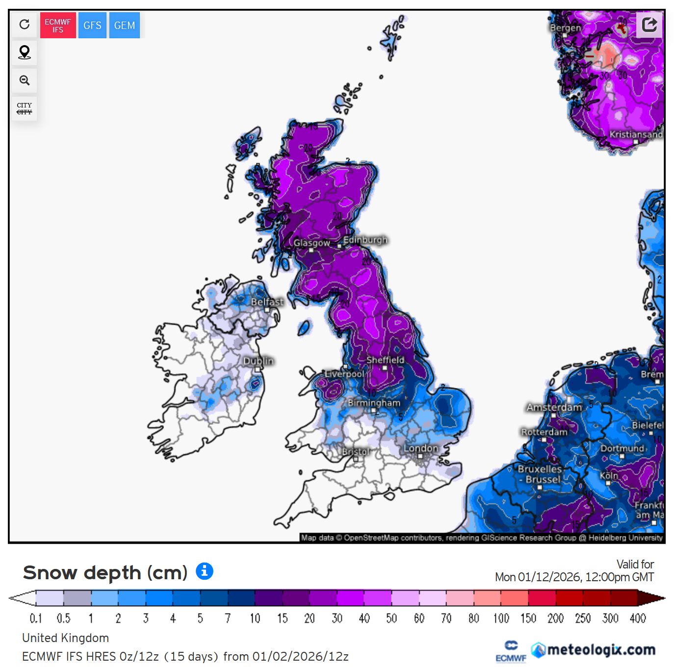
The 0z ECM snow depth charts aren't available yet though? Only the 12z ones from last night...
(It's around an hour after the traditional "essential use" 240 chart appears before you get the detailed charts IME...)
EDIT: Found it, looks like wxcharts processes the high-res ECM charts earlier than anyone else. Forgive me for being underwhelmed by it, nice for you guys further north though! 😉(And of course it's JFF at this time of year. I'll be more interested if it's still showing tomorrow.)
I've stuck a copy on my server as the one posted on NW breaks if you try and put it on here - as you found out!
https://ukwct.org.uk/weather/ecm.jpg
Originally Posted by: Retron