Might be due to another day of drab nothingness IMBY but it's hard to get too interested in the models at the moment, particularly as the idea of colder zonality has gradually morphed in to strong HP to the south pulling up milder air in the mid to long term!
That aside and looking at the charts there's some interesting weather shown, even if it's mostly some distance away from me. A flick through the UKV run suggests, in the more reliable timeframe, alternating airmasses bringing cold enough air for snowfall to Scotland, along with strong winds for many Western parts at times. I've stuck up a couple of charts with a few more I could have added on different days showing this. (There does appear to be a small window where the air may be cold enough for wintriness on high ground in Northern England and Wales on Thursday but it's a bit blink and you'll miss it).
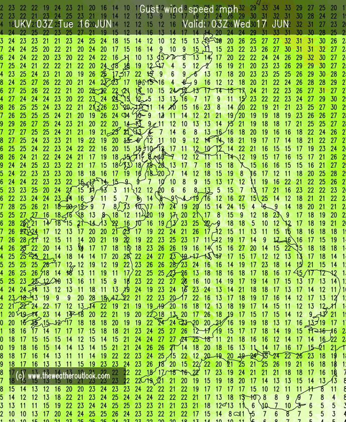
There's also some coastal gales shown for the extreme SE tomorrow, although not looking at strong winds inland. I guess I should also say there's several hours of potentially heavy rain shown for a wider area of the south and SE tomorrow too, which is more interesting than gray and drab at least. The ground around here is pretty saturated at the moment so I'd expect some local flooding and a lot of surface water runoff.
Longer term and some glimmers of hope on the last couple of GFS runs that HP will move a touch further North, allowing either surface cold to develop or bringing in properly cold air. There's a corresponding dip in the ens albeit deep in FI, so may well fade away over subsequent runs.
Home: Tunbridge Wells
Work: Tonbridge