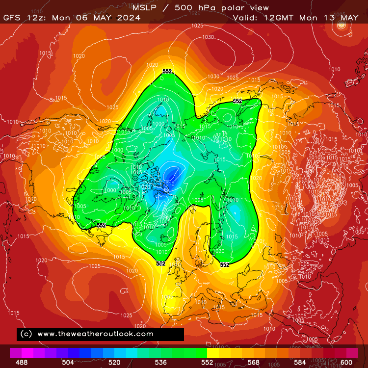
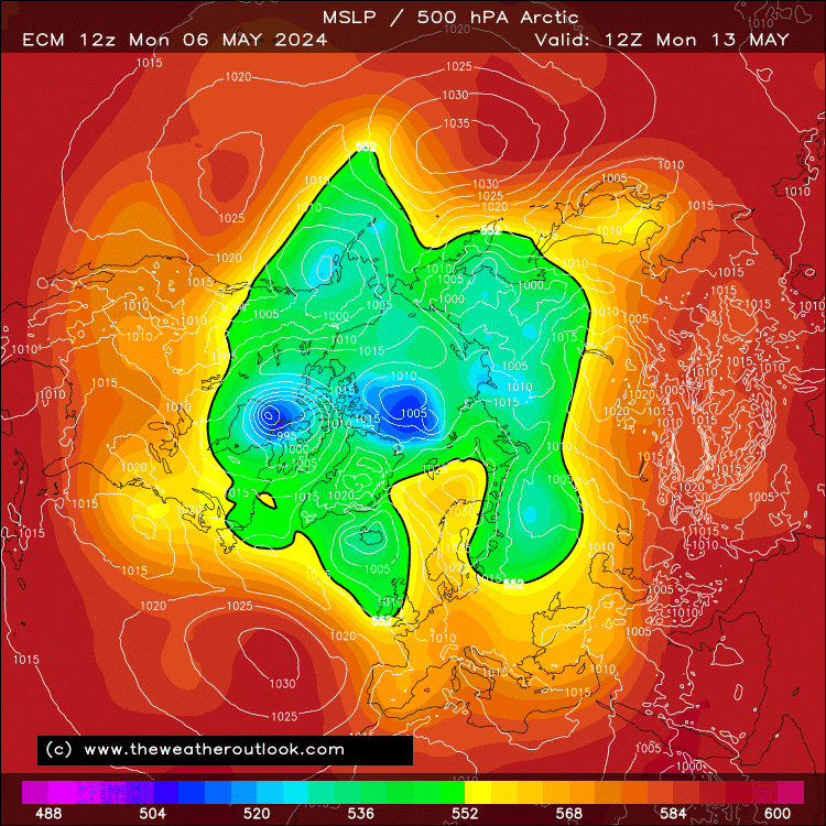
Sticking with wacky notions...  - except not really, on this occasion! There's some very impressive high-latitude blocking being indicated by the modelling for next weekend and at least some way into the following week.
Usually I'd not pay much note to such extreme patterns being modelled, but the polar vortex is finally collapsing for its summer break and the current behaviour of the tropical cycle offers some support too.
It remains to be seen whether the HLB consolidates into one massive feature as per recent ECM runs, or gets split in two via the trough over Canada, which GFS is insistent upon. This evening's runs show some movement toward the GFS idea from ECM but toward the ECM idea from GFS. We can't really have a typical middle-ground compromise this time, though... the HLB is either split or not split.
Regardless, the potential is there for some exceptionally chilly temperatures for at least one day and notably cool ones for at least a few.
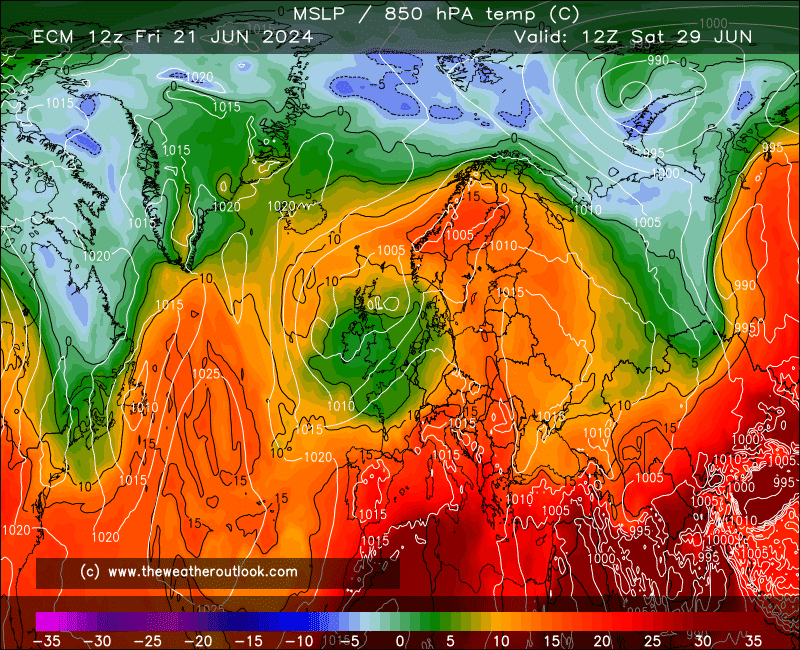
This, I factored into my May CET estimate - but I didn't go any lower than average, due to anticipation of a warm final third to the month (but not necessarily fine & dry...), which is based on where the tropical cycle looks to go next - essentially, what promotes a -NAO later next week looks to promote a +NAO by about a week after that. Part of the natural balancing of the climate system.
If you have any problems or queries relating to TWO you can Email
[email protected] 🙂
https://twitter.com/peacockreports 2021's Homeland Extremes:
T-Max: 30.4°C 21st Jul | T-Min: -6.8°C New Years Day! | Wettest Day: 34.1mm 2nd Oct | Ice Days: 2 (27th Jan & 8th Feb)
Keep Calm and Forecast On