We already have one, and as the MetO noted in their deep dive before Christmas it's the strongest block of that type in that area at that time of year for 45 years. The models are a cavalcade of blocking as a result, and the "holy grail" of a diffluent changing to an omega and back again has been shown by a fair chunk of the output over the past few days.
("Rex" is the American term btw, they're diffluent blocks in UK English).
Back in the 80s the old wives' saying was whatever New York had, we'd get two weeks later. You could rely on snow most winters even down here, but the saying no longer applies (the Big Apple is still as snowy as ever, but we're certainly not!)
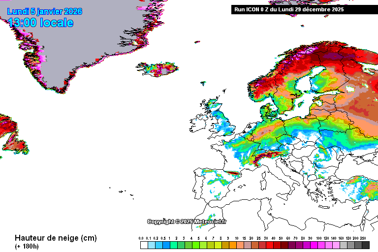
Back to the here and now, the 0z ICON is much like the 18z GFS was last night in so far as it goes - I've a feeling the next big question will be that low to the south at the weekend, which has the potential to be a snow-bringer for many, but just bringing rain down here to the far SE. Like GFS, ICON shows a fair bit of snow cover down in the SE, with the exception of parts of Kent, where we just get lots (and lots) of rain.
Here's the ICON's 180 "snow on the ground" chart. You can see the white bit of Kent jutting out in all its soggy splendour.
https://images.meteociel.fr/im/19/19043/icon_16_180kbw9.png
Originally Posted by: Retron