And back to the model output
Plenty of variety available in the model output this evening. In the interests of not tripping out mordant observations on the weather,
Here is the GEM at day 8 :
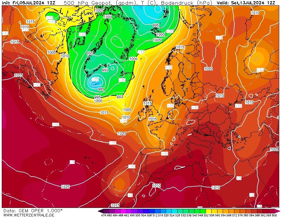
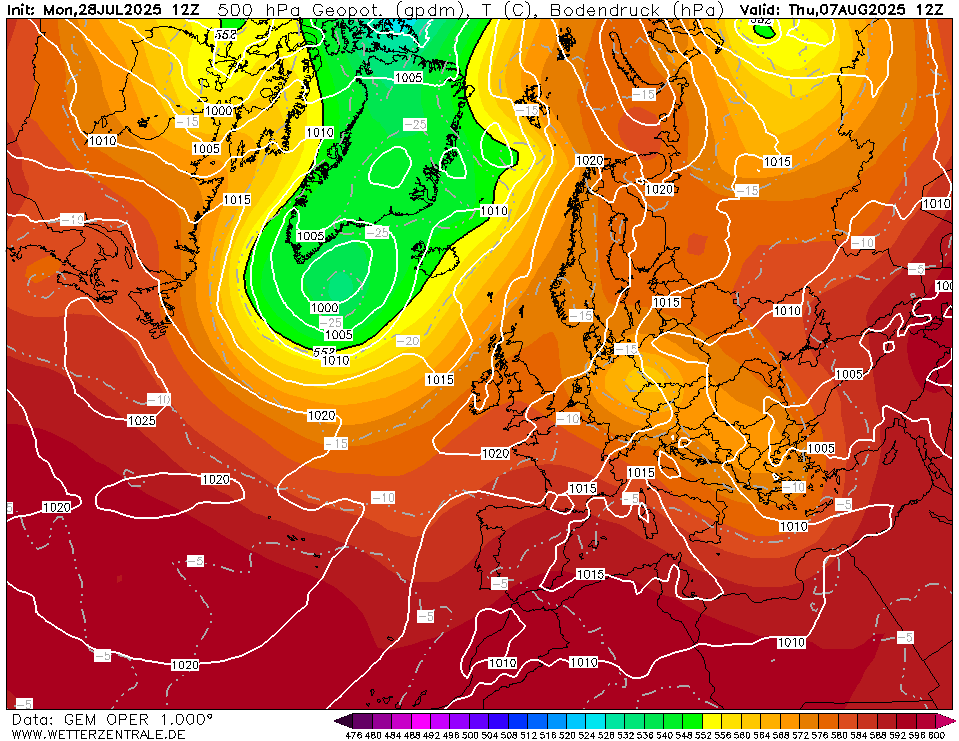
Which then develops into this day 10: Which would be increasingly warm and sunny.
WI
Originally Posted by: Whether Idle