Blimey, it goes on all the way to 360 - a proper midwinter easterly. The ECM op (but not the ensembles) has been pretty keen on a Scandinavian High of some sort for a couple of days' worth of runs now... the difference being the initial stages of it are sown as soon as Sunday now.
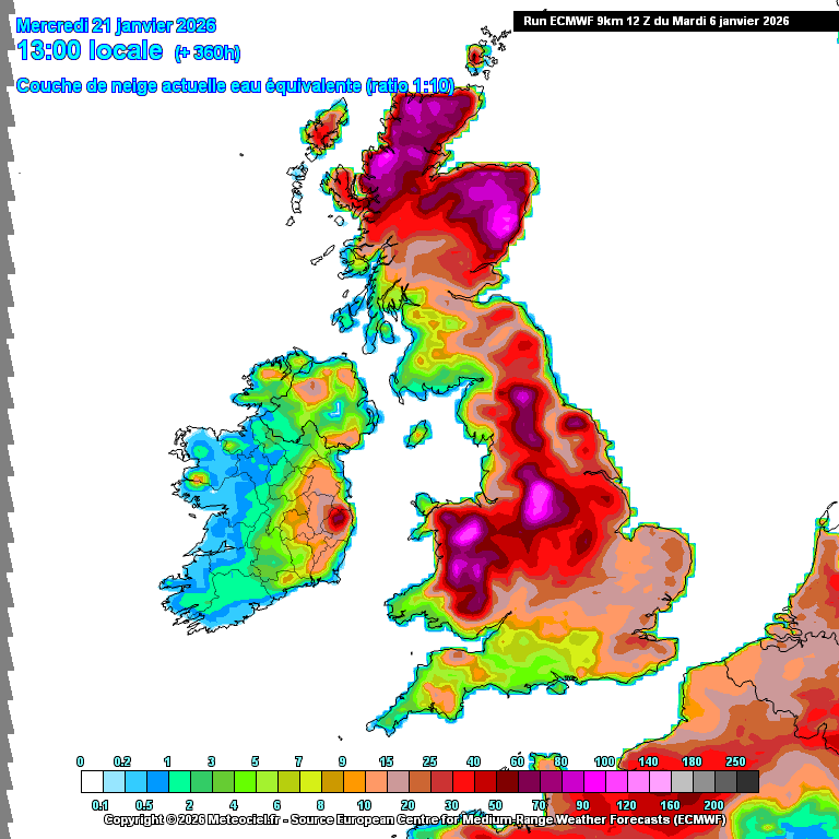
The "snow on the ground" chart is remarkable...
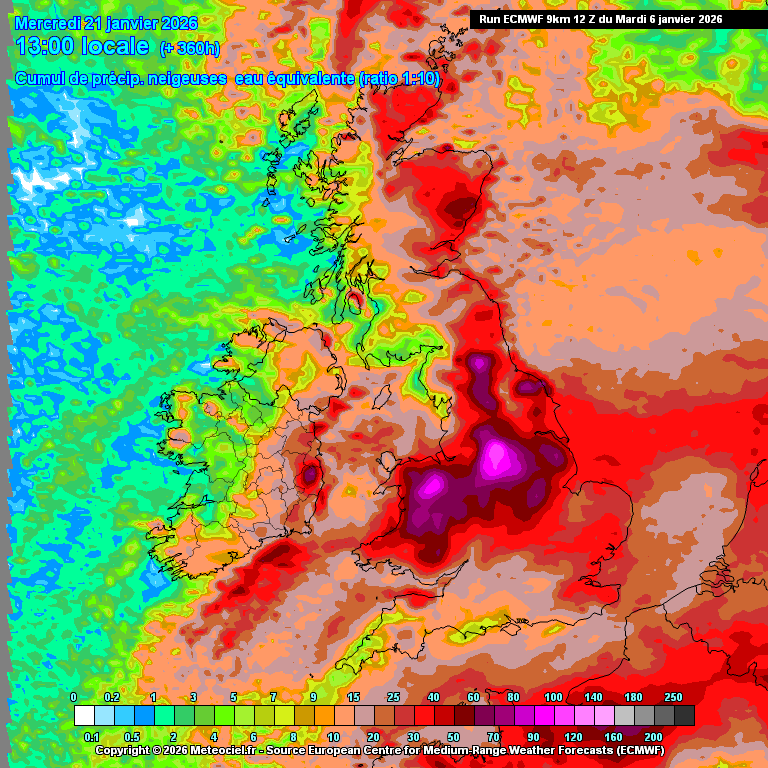
An effortless 15cm here, thanks to the easterly, and just look at those pinks! And unlike the previous modelling, that really is a "snow on the ground" chart. Compare to the "total snow fall" chart pasted afterwards...
https://images.meteociel.fr/im/74/8346/ecmwfuk_34_360qon9.png
https://images.meteociel.fr/im/45/16776/ecmwfuk_33_360zzg4.png
Originally Posted by: Retron