The Weather Outlook

Remove ads from site

Taylor1740
06 January 2022 16:16:55
Looks like the mild snap early next has almost vanished on the latest runs. Good to see mild weather failing for a change.
NW Leeds - 150m amsl
Joe Bloggs
06 January 2022 16:45:06


Originally Posted by: Saint Snow 

My thoughts entirely, Saint! 😂😂😂

Brian Gaze
06 January 2022 16:46:32

The mighty Icon looks less favourable for cold. Will ECM 12z follow? 


Brian Gaze

Berkhamsted

TWO Buzz - get the latest news and views 

"I'm not socialist, I know that. I don't believe in sharing my money." - Gary Numan

Brian Gaze
06 January 2022 16:47:24

UK Met global 168 also seems less favourable, although it's difficult to say where it would go because it has a lot of similarities with GFS. 


Brian Gaze

Berkhamsted

TWO Buzz - get the latest news and views 

"I'm not socialist, I know that. I don't believe in sharing my money." - Gary Numan

idj20
06 January 2022 16:53:29

Steady as we go. Not quuuuuuuite there in terms of proper deep cold and long fetched easterlies but better than staring down the barrel of relentless zonality producing flooding and incessant gale force winds.


Home location: Folkestone Harbour.
Russwirral
06 January 2022 16:59:22
Plenty of surface cold in the offing next week on the GFS..

a week of frosts - with the risk of something colder and snowier a run or two away


warrenb
06 January 2022 17:03:36
UKMO not having any of it.
ballamar
06 January 2022 17:06:52
At the end of the run could be good if the high doesn’t get pushed into Europe
western100
06 January 2022 17:36:01
12z GFS is a chilly run and although not showing the deep cold pooling as yesterday (still a cold end but that’s t384)

It would bring the prospect of January getting close to average or a tad below

Obviously were still at +4-5C above average CET so a lots got to happen to get it below but certainly chilly prospects


Worcestershire / Warwickshire Border

100m ASL

X…..@Weather4u2

DEW
  • DEW
  • Advanced Member
06 January 2022 17:49:44

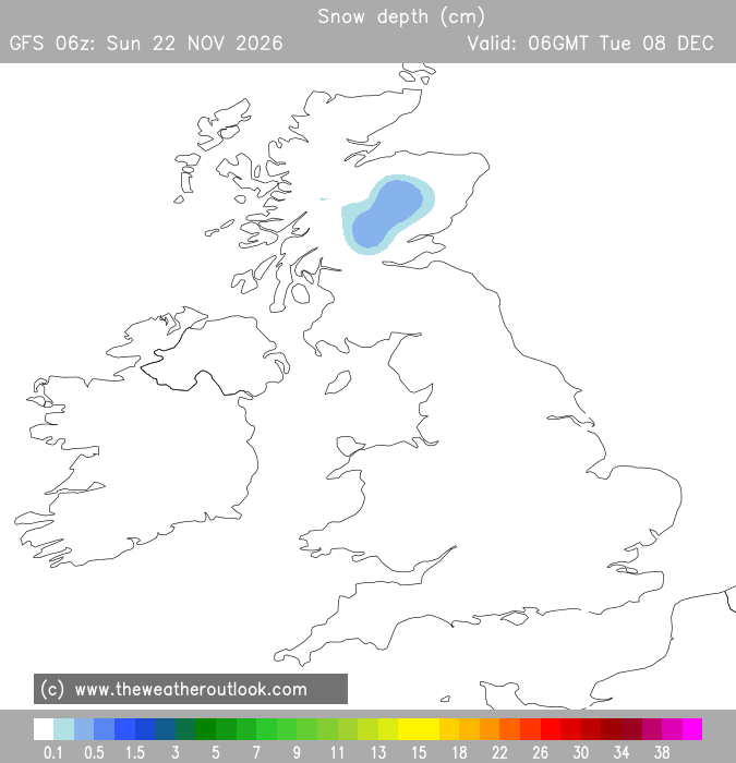
Looks like the GFS has nailed this


Originally Posted by: Rob K 

Guess who's committed to travel from Chichester to the New Forest on the 22nd! Any other day ...


I can calculate the movements of stars, but not the madness of men - Isaac Newton

Chichester 12m asl

Brian Gaze
06 January 2022 18:37:36


Brian Gaze

Berkhamsted

TWO Buzz - get the latest news and views 

"I'm not socialist, I know that. I don't believe in sharing my money." - Gary Numan

jhall
06 January 2022 18:40:43


Guess who's committed to travel from Chichester to the New Forest on the 22nd! Any other day ...

Originally Posted by: DEW 

In the unlikely event of that chart coming to fruition, you might do best to head NE on the A3 towards London, then west on the M4 until you'd gone far enough to approach the New Forest from NW to SE. It would probably make the journey ten times as long, but you'd have a better chance of eventually getting there. smile


Cranleigh, Surrey
fairweather
06 January 2022 18:46:45

I know snow rows aren't exactly that prophetic but 23 for London on Saturday does seem extremely optimistic.


S.Essex, 42m ASL
western100
06 January 2022 18:53:51

Originally Posted by: Brian Gaze 

How do you print screen those images on here?


Worcestershire / Warwickshire Border

100m ASL

X…..@Weather4u2

Brian Gaze
06 January 2022 18:56:18


How do you print screen those images on here?

Originally Posted by: western100 

That's a tweet not a print screen. Just select the Tweet embed option and then paste into the source here.


Brian Gaze

Berkhamsted

TWO Buzz - get the latest news and views 

"I'm not socialist, I know that. I don't believe in sharing my money." - Gary Numan

CField
06 January 2022 19:40:02

Interested which way ICON will go......looked more UK and realistic at present. 


Favourite snowstorm

Famous channel low

Dec 31st 1978

Hastings East Sussex

Foot of level snow severe drifting

Next day max temp -4 degrees Celsius

ballamar
06 January 2022 20:08:40

Originally Posted by: Brian Gaze 

wouldnt be interesting if we had CMA - we need models to keep changing until 24 hrs before any cold. This far out is futile but fun!

picturesareme
06 January 2022 20:11:36

Looks like the GFS has nailed this


More seriously though, it does look like quite a chilly month could be setting up, which is rather different from what we were looking at two or three days ago.

Interesting little burst of cold air sneaking in from the east across the south next week, then meandering around with the high pressure for a bit before a more solid cold incursion from the north perhaps?

Originally Posted by: Rob K 

Is that even possible? I mean half a meter of snow over the Solent & IOW 🤣

jhall
06 January 2022 21:04:17


Is that even possible? I mean half a meter of snow over the Solent & IOW 🤣

Originally Posted by: picturesareme 

It may have come close to it in February 1978, thought I don't think the heaviest snow reached further east than about Bournemouth. January 1982 is another possibility. The most likely is probably the great blizzard of January 1881, though.


Cranleigh, Surrey
picturesareme
06 January 2022 21:08:49


It may have come close to it in February 1978, thought I don't think the heaviest snow reached further east than about Bournemouth. January 1982 is another possibility. The most likely is probably the great blizzard of January 1881, though.

Originally Posted by: jhall 

So probably a once a century thing then. Still thinking my odds of winning the lottery jackpot are higher than seeing that amount of snow fall here.

western100
06 January 2022 21:10:17
GFS loves throwing up some glory charts at the end of the runs, look at N America today on their t384 chart lol
Worcestershire / Warwickshire Border

100m ASL

X…..@Weather4u2

squish
06 January 2022 21:31:39
https://expert-images.weatheronline.co.uk/daten/proficharts/web/en/euro4-high/2022/01/06/basis12/ukuk/prty/22010712_0612.gif 

This caught my eye. Interesting feature tomorrow afternoon.....


D.E.W on Dartmoor. 300m asl
Brian Gaze
06 January 2022 21:44:12

https://expert-images.weatheronline.co.uk/daten/proficharts/web/en/euro4-high/2022/01/06/basis12/ukuk/prty/22010712_0612.gif


This caught my eye. Interesting feature tomorrow afternoon.....

Originally Posted by: squish 


Remember that's essentially a lower resolution and 3 hours older version of this:

https://www.theweatheroutlook.com/twodata/ukv.aspx?run=15&charthour=22&chartname=rain_rate&chartregion=uk-region&charttag=Precip%20+%20cloud


(Not saying the Euro4 12z view will be wrong but you wouldn't back it)


Brian Gaze

Berkhamsted

TWO Buzz - get the latest news and views 

"I'm not socialist, I know that. I don't believe in sharing my money." - Gary Numan

IanT
  • IanT
  • Advanced Member
06 January 2022 21:57:03

 Is that even possible? I mean half a meter of snow over the Solent & IOW 🤣

Originally Posted by: picturesareme 


Don’t get carried away. Only the NE corner of IOW will get 52cm. Most of the island will only get 30-40cm. Sorry.


Woking, Surrey. 40m asl.
The Beast from the East
06 January 2022 22:02:15
Must be getting old as I find myself yearning for those long summer days and warm hazy sunshine. Even 10 years ago I would have been tearing my hair out in frustration at the lack of snow and cold, now I just want winter to end and in fact never even start. Hopefully the euro slug or Bartlett high can set up for the rest of the season and I am longing for some more light in the mornings and longer evenings
Purley, Surrey, 70m ASL

"We have some alternative facts for you"

Kelly-Ann Conway - former special adviser to the President

Remove ads from site