The Weather Outlook

Remove ads from site

sunny coast
06 February 2021 11:11:15


Just for you then!

https://www.ecmwf.int/en/forecasts/charts/web/classical_meteogram?facets=undefined&time=2021020600,0,2021020600&epsgram=classical_10d&lat=51.0833&lon=1.18333&station_name=Folkestone,%20United%20Kingdom&altitude=1

A stunning set of ECM ensembles (Folkestone above, other locations can be looked up via the "location" button on the link above).

A tad warmer than here, but still a sstring of ice days... and note the mean struggles up to 3C by Tuesday week, with even next Saturday having a mean of zero. Note most of the scatter is on the milder side of the mean too!

GEFS isn't interested, but that ECM set this morning sure has me interested.

(The ECM ensembles of course haven't shown that depth of cold, for so long, this millennium, at least down here. I know plenty think 2010 was universal, but Kent really missed out big time. Even the Beast didn't affect everywhere here and of course it was so short - the first low that came up from the SW knocked it away.)


Originally Posted by: Retron 

  parts of Kent may have missed out in 2010 but I was working in Tonbridge  then and there was more than afoot level there early in that spell . Jan 10 and Dec 09 also gave heavy falls . 2018 beast gave a good 6 inches around the High Weald area 

TimS
  • TimS
  • Advanced Member
06 February 2021 11:12:23

The GFS currently rolling out is worth a look if only for the insanely high pressure. 10 days out we actually have a 1055 isobar over most of Scotland. If that really did verify it would smash the UK all-time pressure record to pieces.

Originally Posted by: Col 

Dundee the lucky spot.


Brockley, South East London 30m asl
tallyho_83
06 February 2021 11:15:08

The Control has a snowy Thursday also 


Originally Posted by: Gooner 

Exeter could be back in the game if that verified!?


Home Location - Vixen Tor Close, Okehampton, Devon (221m ASL)

---------------------------------------

Sean Moon

Magical Moon

www.magical-moon.com

Rob K
06 February 2021 11:17:40

25mm accumulated rainfall is a foot of snow in my book.

Some of this starts as rain.

No reason to dispute this will be a general 20cm + even on most low ground from this event. Excluding drifting.

 Modele GFS - Carte prévisions

Originally Posted by: Gusty 

Much of that away from the east coast will be rain though. Turning to snow between midnight and 3am here I reckon. 


Yateley, NE Hampshire, 73m asl

"But who wants to be foretold the weather? It is bad enough when it comes, without our having the misery of knowing about it beforehand." — Jerome K. Jerome

tallyho_83
06 February 2021 11:22:15
Is the parallel run still frozen?
Home Location - Vixen Tor Close, Okehampton, Devon (221m ASL)

---------------------------------------

Sean Moon

Magical Moon

www.magical-moon.com

Rob K
06 February 2021 11:26:40

Is the parallel run still frozen?

Originally Posted by: tallyho_83 

Yep. 

looking at the op run it seems the GFS has cottoned on to the scope for the high to get reinflated by the Atlantic attack and set up either another easterly or just a cold high for us if it can’t quite get far enough north. 


Yateley, NE Hampshire, 73m asl

"But who wants to be foretold the weather? It is bad enough when it comes, without our having the misery of knowing about it beforehand." — Jerome K. Jerome

tallyho_83
06 February 2021 11:26:52

Some crazy temps on the OP by 14th. Widely -4c by day.

Originally Posted by: Gary L 

Quite an upgrade and I am really getting the feeling that the cold is here to stay as per met office long range suggests and the BBC MO. Yes -4c by midday on 14th could make it the coldest valentines day in decades?

Also anyone notice that each GFS run that the cold get's prolonged and the blocking is returning and cold air to our east is creeping ever so closer each run?


Home Location - Vixen Tor Close, Okehampton, Devon (221m ASL)

---------------------------------------

Sean Moon

Magical Moon

www.magical-moon.com

Chiltern Blizzard
06 February 2021 11:33:29

25mm accumulated rainfall is a foot of snow in my book.

Some of this starts as rain.

No reason to dispute this will be a general 20cm + even on most low ground from this event. Excluding drifting.

 Modele GFS - Carte prévisions

Originally Posted by: Gusty 

Still looking epic for my corner of east Suffolk... I told my 13 year old son earlier to make the most of the green grass outside as you may not see it again in a while as we’re due for another BFTE... He didn’t believe me and thinks we’ll have another 2cm of slush like we got the other week.  We “only” got 9 cm in the BFTE.... He’ll be dumbfounded if this comes off - as will we all... 


Rendlesham, Suffolk 20m asl
tallyho_83
06 February 2021 11:34:41


Yep. 

looking at the op run it seems the GFS has cottoned on to the scope for the high to get reinflated by the Atlantic attack and set up either another easterly or just a cold high for us if it can’t quite get far enough north. 

Originally Posted by: Rob K 

Bummer - para is good - same frozen on Wetter and Meteociel.

I wanted to check the latest snow event for the SW - if any and our best chance could be Tuesday night into Wednesday - one minute the Met office has a snow symbol for Exeter Tues night/wed and then it get's removed again.

Also the breakdown looks uncertain and with models re-establishing cold and a further blocking pattern and each run that high pressure is drifting that little bit further north isn't it? Right now it shows eastern Europe getting the cold but slight adjustment northwards would make the UK in the firing line - I wonder if we will see a 'breakdown? come end of the week?' Another question - I wonder how the met office are feeling about their long range seasonal winter forecast esp after the Glosea 5 seasonal which went for zonal flow and LP over Greenland!? 

Anyway- notice the change from 00z run @ 240z: - A cold high but snow to the Greeks.


06z run @ 240z:

High pressure tracking much further north and slightest adjustments could bring in another BFTE:
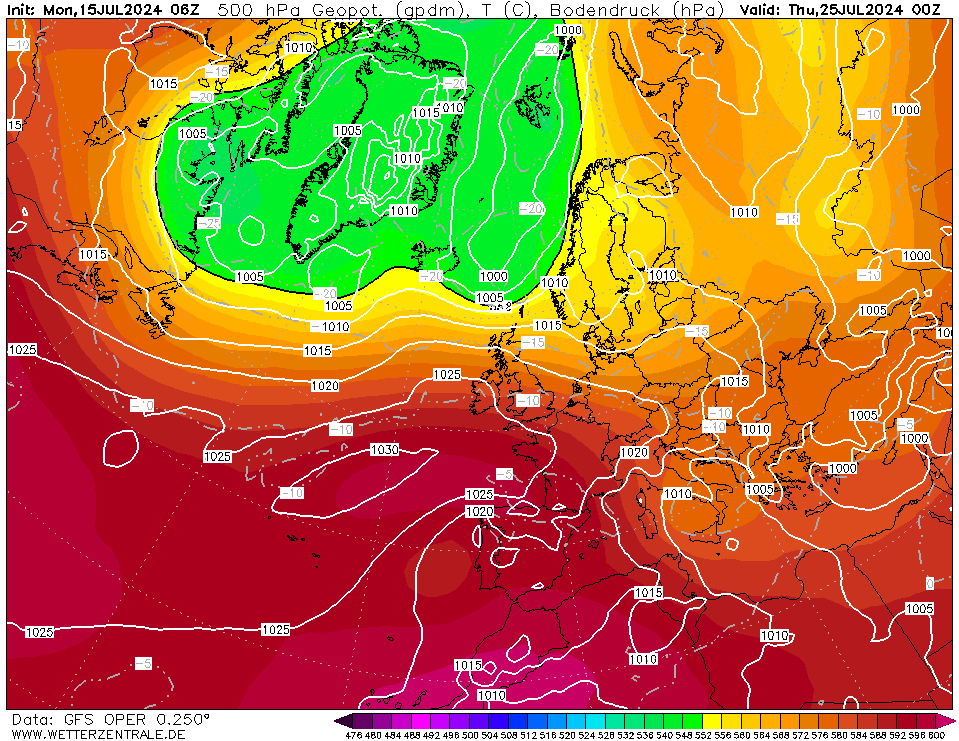
 

 Also LP developing to south of Azores just off coast of Portugal - all FI but one to watch and meanwhile we have this weekend and all of next week to look forward to.


Home Location - Vixen Tor Close, Okehampton, Devon (221m ASL)

---------------------------------------

Sean Moon

Magical Moon

www.magical-moon.com

TimS
  • TimS
  • Advanced Member
06 February 2021 11:40:46
I’m liking those big high pressure evolutions. Nice clean, slow sunny thaw. Just the ticket. Battleground snow into rain thaws just don’t do it for me.
Brockley, South East London 30m asl
NMA
  • NMA
  • Advanced Member
06 February 2021 11:50:25

Perhaps not really relevant to the models but my Dad a forecaster at a time way before satellites used to say that if and when the Gulf of Bothnia froze this could have a significant impact on the UK temps in an easterly merely because it increased the likelihood of Scandinavia becoming colder than otherwise and of course any air from that direction coming this way would be colder too. So if he was right it might be worth keeping an eye on this site and others like it. Top half is frozen so watch the bottom half and into the Baltic. Bearing in mind it's pretty much fresh water so it can freeze quite quickly.

http://baltice.org/weather/

http://baltice.org/map/

Nick


Vale of the Great Dairies

South Dorset

Elevation 60m 197ft

bowser
06 February 2021 12:01:08

Perhaps not really relevant to the models but my Dad a forecaster at a time way before satellites used to say that if and when the Gulf of Bothnia froze this could have a significant impact on the UK temps in an easterly merely because it increased the likelihood of Scandinavia becoming colder than otherwise and of course any air from that direction coming this way would be colder too. So if he was right it might be worth keeping an eye on this site and others like it. Top half is frozen so watch the bottom half and into the Baltic. Bearing in mind it's pretty much fresh water so it can freeze quite quickly.

http://baltice.org/weather/

http://baltice.org/map/

Nick


Originally Posted by: NMA 

interesting point that. Been keeping an eye on the Baltic for a few weeks now and the freeze has certainly gained traction.

Gandalf The White
06 February 2021 12:15:25

Yes the ensembles for the next week at least look very good. This is the t850hPa one for here.

Originally Posted by: doctormog 

The 00z ECM clusters for next Thursday-Saturday are interesting: Thursday/Friday shows a reasonable chance of a battleground and some support for high pressure holding somewhere to the east. Saturday is very finely balanced but still support for a battle between high pressure to the east and low to the west and a very keen SE/SSE flow.

https://apps.ecmwf.int/webapps/opencharts/products/cluster_plot_legA?base_time=202102060000&cluster=120_168&parameter=1000


Location: South Cambridgeshire

130 metres ASL

52.0N 0.1E


tallyho_83
06 February 2021 12:15:47


Bummer - para is good - same frozen on Wetter and Meteociel.

I wanted to check the latest snow event for the SW - if any and our best chance could be Tuesday night into Wednesday - one minute the Met office has a snow symbol for Exeter Tues night/wed and then it get's removed again.

Also the breakdown looks uncertain and with models re-establishing cold and a further blocking pattern and each run that high pressure is drifting that little bit further north isn't it? Right now it shows eastern Europe getting the cold but slight adjustment northwards would make the UK in the firing line - I wonder if we will see a 'breakdown? come end of the week?' Another question - I wonder how the met office are feeling about their long range seasonal winter forecast esp after the Glosea 5 seasonal which went for zonal flow and LP over Greenland!? 

Anyway- notice the change from 00z run @ 240z: - A cold high but snow to the Greeks.


06z run @ 240z:

High pressure tracking much further north and slightest adjustments could bring in another BFTE:


 Also LP developing to south of Azores just off coast of Portugal - all FI but one to watch and meanwhile we have this weekend and all of next week to look forward to.


Originally Posted by: tallyho_83 


EDIT: - Look at control run 00z and compare this with latest 06z - similar to the Op: We see the re-load of an easterly which could perhaps be even colder if it came off and cold air is never too far away and this was exactly what happened during the BFTE between 26th February until 2nd March 2018 when we saw a secondary re-loaded easterly around 16th until 19/20th March 2018. - The good news is that we are the best part of 3-4 weeks earlier in the winter season with this one.

00z run @ 204z:


Latest 06z run @ 198: - HIGH goes further north and cold air creeping ever so closer?


Home Location - Vixen Tor Close, Okehampton, Devon (221m ASL)

---------------------------------------

Sean Moon

Magical Moon

www.magical-moon.com

Darren S
06 February 2021 12:28:16

In early December 2010, we got a 12 inch dumping of snow from a streamer coming off The Wash.  Snow was forecast but not that much and all our roads were closed, yet only a few miles either side of us only had an inch or two.  The 2018 BFTE also delivered but unfortunately we had to leave it mid fall and drive to the airport.  Again, roads were tricky until we got 20 miles up the M1.  

That’s made me very wary of what might come in the next few days and I’m careful what I wish for.  I’ll report my snow depth if we get any. 

Originally Posted by: Caz 

I've noticed this "ECMWF HD" model that presumably is some kind of ECM model but run at higher resolution. This shows that being in Kent doesn't guarantee snow depth on Monday - looks like the snow is being generated by instability, either (a) over the Downs, or (b) a streamer in the NE wind being generated by the Essex coast with insane snow depths from Gillingham to Tonbridge, Tunbridge Wells and Uckfield in East Sussex. Meanwhile coastal areas like Sheppey (sorry, Retron) and Herne Bay are snow-free.

https://meteologix.com/uk/model-charts/swisshd-ecmwf/118f9c5ed1e62f483b855b82b158f827/snow-depth/20210207-2100z.html


Darren

Crowthorne, Berks (87m asl)

South Berks Winter Snow Depth Totals:

2023/24 0 cm; 2022/23 7 cm; 2021/22 1 cm; 2020/21 13 cm; 2019/20 0 cm; 2018/19 14 cm; 2017/18 23 cm; 2016/17 0 cm; 2015/16 0.5 cm; 2014/15 3.5 cm; 2013/14 0 cm; 2012/13 22 cm; 2011/12 7 cm; 2010/11 6 cm; 2009/10 51 cm

Justin W
06 February 2021 12:40:54


EDIT: - Look at control run 00z and compare this with latest 06z - similar to the Op: We see the re-load of an easterly which could perhaps be even colder if it came off and cold air is never too far away and this was exactly what happened during the BFTE between 26th February until 2nd March 2018 when we saw a secondary re-loaded easterly around 16th until 19/20th March 2018. - The good news is that we are the best part of 3-4 weeks earlier in the winter season with this one.

00z run @ 204z:


Latest 06z run @ 198: - HIGH goes further north and cold air creeping ever so closer?


Originally Posted by: tallyho_83 

That 06z shows a proper 87-style Scandi extension of the Arctic high


Yo yo yo. 148-3 to the 3 to the 6 to the 9, representing the ABQ, what up, biatch?
Whether Idle
06 February 2021 12:41:06


I've noticed this "ECMWF HD" model that presumably is some kind of ECM model but run at higher resolution. This shows that being in Kent doesn't guarantee snow depth on Monday - looks like the snow is being generated by instability, either (a) over the Downs, or (b) a streamer in the NE wind being generated by the Essex coast with insane snow depths from Gillingham to Tonbridge, Tunbridge Wells and Uckfield in East Sussex. Meanwhile coastal areas like Sheppey (sorry, Retron) and Herne Bay are snow-free.

https://meteologix.com/uk/model-charts/swisshd-ecmwf/118f9c5ed1e62f483b855b82b158f827/snow-depth/20210207-2100z.html


Originally Posted by: Darren S 

Add that model to the long list and variations on a snowy theme.  Nevertheless Id bank the 5cms it shows imby in 48 hrs time - as that would be the biggest snow depth in EIGHT years, and only the second day with laying snow in 8 years.


Dover, 5m asl. Half a mile from the south coast.
western100
06 February 2021 13:09:44
Very HP dominated output after this week.

Definitely will keep surface cold under clear skies.

Interesting developments compared to the Atlantic push that was evident earlier this week. I did say I thought the Atlantic would struggle under such cold conditions

Let’s see what happens


Worcestershire / Warwickshire Border

100m ASL

X…..@Weather4u2

RobN
  • RobN
  • Advanced Member
06 February 2021 13:37:37

An amazing spread on 6Z GEFS for mid month. Everything from deep freeze to early spring.


Rob

In the flatlands of South Cambridgeshire 15m ASL.

Retron
06 February 2021 13:39:31

East Sussex. Meanwhile coastal areas like Sheppey (sorry, Retron) and Herne Bay are snow-free.

https://meteologix.com/uk/model-charts/swisshd-ecmwf/118f9c5ed1e62f483b855b82b158f827/snow-depth/20210207-2100z.html

Originally Posted by: Darren S 

I'd say it's a pile of steaming hot garbage, to be honest. It shows rain and sleet all day tomorrow here, only (finally) bringing snow in at 7 PM tomorrow evening.

It then shows snow throughout most of Monday, heavy at times, but with only 0.5 - 1cm on the ground by the end of the day.

I woud be astonished if that were actually to happen, experience says that in this sort of setup we'll be getting far, far more than that on the ground.

The Met Office (UKV) and main ECMWF forecasts meanwhile both have heavy snow right from the early hours tomorrow.

UKV has 0.5-1cm here at midnight Monday, then by 15z on Monday - it's still 0.5-1cm.

That's also steaming hot garbage IMO.

ECM, meanwhile  has 4cm here by midnight on Monday, with another 2cm during Monday itself. That's better but still quite an underestimate I suspect.

Here's the MetO view of that same UKV run btw - it carries on for many more hours like this! I think you can see why I'm far from convinced by the "snow on the ground" tallies from UKV and that ECM high-res thingy!


Leysdown, north Kent
MStewart
06 February 2021 14:04:53
I really enjoyed looking at today’s GEFS 6Z for London and its operational. A cold outlier possibly but more models are going for a prolonged cold and dry spell after next weekend so it could be on to something. Could use a break from all the rain here.

Hoping that setup would produce just a little snow ❄️


Mark

Twickenham

12m ASL

eddied
06 February 2021 14:21:07
The dream is a good deep covering of snow followed by days of cold blue skies and a gentle thaw with daffodils bursting through, the end of CoVid and the return of Aslan.

Chances?


Location: Reigate, Surrey 105m ASL

Winter 22/23

Days snow falling: 4

Days snow on ground:8

Max snow depths: 6cm (December 19th ish)

Summer 2022 max 39C on July 19th

Summer 2021 max: 32C on July 18th

Summer 2020 max: 36C on July 31st

Justin W
06 February 2021 14:21:59

The dream is a good deep covering of snow followed by days of cold blue skies and a gentle thaw with daffodils bursting through, the end of CoVid and the return of Aslan.

Chances?

Originally Posted by: eddied 

Does he then get killed on the Stone Table only to rise again and defeat the witch?


Yo yo yo. 148-3 to the 3 to the 6 to the 9, representing the ABQ, what up, biatch?
Hippydave
06 February 2021 14:23:48


I've noticed this "ECMWF HD" model that presumably is some kind of ECM model but run at higher resolution. This shows that being in Kent doesn't guarantee snow depth on Monday - looks like the snow is being generated by instability, either (a) over the Downs, or (b) a streamer in the NE wind being generated by the Essex coast with insane snow depths from Gillingham to Tonbridge, Tunbridge Wells and Uckfield in East Sussex. Meanwhile coastal areas like Sheppey (sorry, Retron) and Herne Bay are snow-free.

https://meteologix.com/uk/model-charts/swisshd-ecmwf/118f9c5ed1e62f483b855b82b158f827/snow-depth/20210207-2100z.html


Originally Posted by: Darren S 

I'd take that


Home: Tunbridge Wells

Work: Tonbridge

TimS
  • TimS
  • Advanced Member
06 February 2021 14:33:43

The dream is a good deep covering of snow followed by days of cold blue skies and a gentle thaw with daffodils bursting through, the end of CoVid and the return of Aslan.

Chances?

Originally Posted by: eddied 


Nah, wet and windy breakdown from the South West and new mutant strains of Covid running rampant as we enter a fourth lockdown. 


Brockley, South East London 30m asl

Remove ads from site