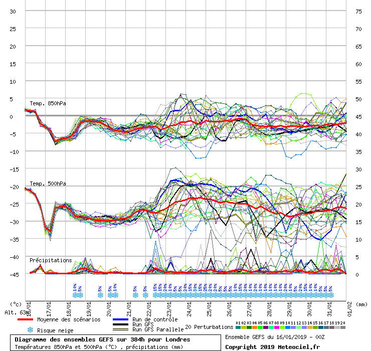
But overall an improvement on the 00Z set, in terms of cold, with fewer mild stragglers. (Albeit that the mild ones on the 06Z are that bit milder than on the 0Z!)
The cold clustering in the 22-25 Jan period seems a lot better than the 00Z, but I would still want to see some improvements!
No, this morning's. Comparing like with like, the 6Z is definitely a step in the right direction from the rather poor 0Z set, at least for London.
0Z
6Z
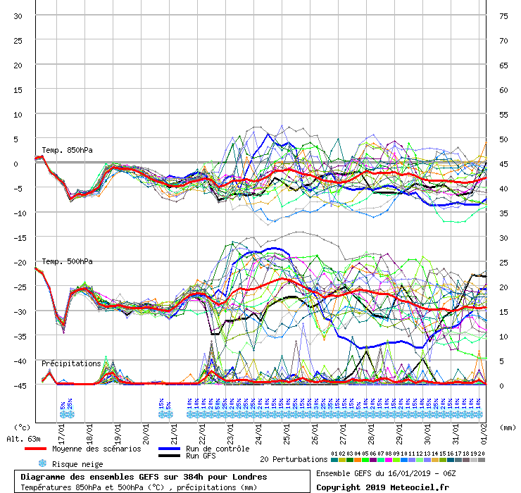
There are fewer mild runs, but the ones there are are more extremely mild, so the mean is only a little lower.
Not a massive improvement, but still an improvement.
I suspect a tipping point will be reached soon where one of those clusters disappears in the Jan 23-25 range, and the mean will shoot rapidly up or down.
Originally Posted by: Rob K