The Weather Outlook

Remove ads from site

some faraway beach
28 December 2016 10:36:09

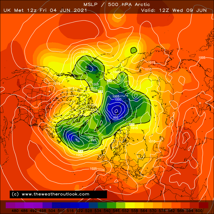
If only every model followed the UKMO and restricted access to 144 hrs, eh? What about this at just 5 days? A Pacific ridge and the bulk of the Polar vortex shifting away from N America. And a big red blob to our west instead of the usual blue lines.
 

What a happy place this would be right now, with a frozen landscape outside our windows and a snow-row of 7 in just 5 days' time on the London GEFS.

Instead commentary gets dominated by the ECM mean in 10 days' time, when everything gets diluted. I mean, if I were issuing a daily forecast on a website, it's what I'd use, because most of the time I'd be more or less right with very little effort. It's what average/mean weather is, after all. 

But to use it to make yourself upset, because out of its 51 members some (who knows how many or how plausibly) have found a way not to reload the cold in 10 days' time is just pointless in current circumstances. That is, if your aim is to enjoy colder winter weather rather than to forecast, mostly successfully, that the weather will probably be average in 10 days' time.


2 miles west of Taunton, 32 m asl, where "milder air moving in from the west" becomes SNOWMAGEDDON.

Well, two or three times a decade it does, anyway.

Joe Bloggs
28 December 2016 10:37:15

If only every model followed the UKMO and restricted access to 144 hrs, eh? What about this at just 5 days? A Pacific ridge and the bulk of the Polar vortex shifting away from N America. And a big red blob to our west instead of the usual blue lines.


What a happy place this would be right now, with a frozen landscape outside our windows and a snow-row of 7 in just 5 days' time on the London GEFS.

Instead commentary gets dominated by the ECM mean in 10 days' time, when everything gets diluted. I mean, if I were issuing a daily forecast on a website, it's what I'd use, because most of the time I'd be more or less right with very little effort. It's what average/mean weather is, after all. 

But to use it to make yourself upset, because out of its 51 members some (who knows how many or how plausibly) have found a way not to reload the cold in 10 days' time is just pointless in current circumstances. That is, if your aim is to enjoy colder winter weather rather than to forecast, mostly successfully, that the weather will probably be average in 10 days' time.

Originally Posted by: some faraway beach 

SUCH a good post.

All so true. 

Bertwhistle
28 December 2016 10:39:58

This at 132 from GEM has a little low over the Channel, with -5C uppers over S England.

http://www.theweatheroutlook.com/twodata/chart.aspx?chart=/charts/gem/132_mslp850.png?cb=154

Surely that could produce a southern surprise?


Bertie, Itchen Valley.

Retire while you can still press the 'retire now' button.

doctormog
28 December 2016 10:47:22

http://old.wetterzentrale.de/pics/Rtavn1082.gif 

The details will vary with each run. Beyond that, as many others have said the signs are encouraging, as they are on the ECM and UKMO.

The second cold blast still looks on target on the 06z GFS and beyond then all options are on the table, albeit some more likely than others. Something like the ECM by 240hrs would be very encouraging.

Originally Posted by: doctormog 

Unfortunately it's not like the ECM at that point nor indeed is it like the 00z GFS. 


Solar Cycles
28 December 2016 10:47:39


SUCH a good post.

All so true. 

Originally Posted by: Joe Bloggs 

But it's a model discussion thread and if a model ( thee main model ) shows a big +ve anomaly to our South even at 10+ days then it should be discussed, likewise if it was showing the polar opposite. Of course the usual caveats apply with any output at this range.

doctormog
28 December 2016 10:50:38

But it's a model discussion thread and if a model ( thee main model ) shows a big +ve anomaly to our South even at 10+ days then it should be discussed, likewise if it was showing the polar opposite. Of course the usual caveats apply with any output at this range.

Originally Posted by: Solar Cycles 

Thankfully none really is, there is a pretty high 500hPa positive anomaly to the west though: http://meteociel.fr/modeles/ecmwf/runs/2016122800/EDM101-240.GIF 


Solar Cycles
28 December 2016 10:53:19

This chart says otherwise, but like any charts at this range the usual caveats apply.

http://old.wetterzentrale.de/pics/Reem2401.gif

Charmhills
28 December 2016 10:54:29

You always know something is 'up' when temp anoms are essentially off the scale NE Canada...Interesting times ahead of you're after cold wx


https://twitter.com/MattHugo81/status/814017611197509632


Will see.


Loughborough, EM.

Knowledge is power.

Duane.

JACKO4EVER
28 December 2016 10:54:40
Some good night time frosts and a little wintryness in the North and East, otherwise a dry and cold couple of days entering into the new year. All in all a fairly standard U.K. Cold snap with temperatures gradually recovering thereafter.

Signs of interest in FI with perhaps another shot at cold from a northerly quadrant though as ever more runs needed.

doctormog
28 December 2016 10:57:13

This chart says otherwise, but like any charts at this range the usual caveats apply.

http://old.wetterzentrale.de/pics/Reem2401.gif

Originally Posted by: Solar Cycles 

No it doesn't! I just posted the anomaly chart for the mean data! 

It is not my interpretation it is a statistical fact.


roger63
28 December 2016 11:07:35

Another poor op  run from GFS .the reload on 7th Jan is very short lived and then the pattern flattens out.Lets see if the ENS is amore encouraging.

The Beast from the East
28 December 2016 11:09:19

poor GFS 06s. perhaps ok if you live in Scotland but once again we struggle to build proper HLB, a recurring theme for many decades now


Purley, Surrey, 70m ASL

"We have some alternative facts for you"

Kelly-Ann Conway - former special adviser to the President

Rob K
28 December 2016 11:10:49

This at 132 from GEM has a little low over the Channel, with -5C uppers over S England.

http://www.theweatheroutlook.com/twodata/chart.aspx?chart=/charts/gem/132_mslp850.png?cb=154

Surely that could produce a southern surprise?

Originally Posted by: Bertwhistle 

It's almost reminiscent of this: http://www.wetterzentrale.de/pics/archive/ra/2010/Rrea00120100106.gif

But obviously not quite as good. Very few charts are as good as that for this location!


Yateley, NE Hampshire, 73m asl

"But who wants to be foretold the weather? It is bad enough when it comes, without our having the misery of knowing about it beforehand." — Jerome K. Jerome

tallyho_83
28 December 2016 11:12:06

On 2nd Jan - ;Low pressure develops off the easter coast of Greenland and moves SE towards Iceland and then into Scotland and England - so a real northerly perhaps a double whammy? - High pressure retrogresses westwards allowing Arctic lows?


http://modeles7.meteociel.fr/modeles/gens/runs/2016122806/gens-3-1-108.png

http://modeles7.meteociel.fr/modeles/gens/runs/2016122806/gens-3-1-114.png

http://modeles7.meteociel.fr/modeles/gens/runs/2016122806/gens-3-1-120.png

http://modeles7.meteociel.fr/modeles/gens/runs/2016122806/gens-3-1-126.png

http://modeles7.meteociel.fr/modeles/gens/runs/2016122806/gens-3-1-132.png


Home Location - Vixen Tor Close, Okehampton, Devon (221m ASL)

---------------------------------------

Sean Moon

Magical Moon

www.magical-moon.com

roger63
28 December 2016 11:16:35

Some encouragement from the  GEFS ENS for 120h.More of the perts have the  little low develiping to the south with astronger north east flow.There is even the hint of snow for parts of the south.

http://www.meteociel.fr/modeles/gefs_cartes.php?ech=120&code=13&mode=2&carte=0


Hungry Tiger
28 December 2016 11:17:54

Or 1085mb over Greenland at +168z?

http://www.meteociel.fr/modeles/jma/runs/2016122712/J252-21.GIF?27-0


Imagine this reaching 1100mb? - Highest pressure I've ever seen is 1060mb over Greenland. So it's over done it? Otherwise it's quite a block anything above 1040 is high enough.


Originally Posted by: tallyho_83 

I think in December 2010 we had 1070 over Greenland.


Gavin S. FRmetS.

TWO Moderator.

Contact the TWO team - [email protected]

South Cambridgeshire. 93 metres or 302.25 feet ASL.


Solar Cycles
28 December 2016 11:18:07


No it doesn't! I just posted the anomaly chart for the mean data! 

It is not my interpretation it is a statistical fact.

Originally Posted by: doctormog 

Anomaly charts aren't the best tool to use as evidence though, still all of this is just conjecture due to the timescales and the next run may well show soemthing completely different  however the reassurgance of the the upstream pattern over NE Canada is more of a concern as this would stop any ridging northwards of heights in the the Atlantic.

doctormog
28 December 2016 11:31:22

Correct - as in you agree rather than it actually necessarily being correct. Don't get your opinion confused with what is "correct".

So we should ignore what is actually in the charts and focus on what might happen downstream if what is in the charts for another part of the world comes to fruition. Righteo.

The model output itself can be unreliable enough without having to resort to the Melanie School of Model Output Extrapolation for guidance on how to over/misinterpret it!

The "Ah but if that happened at Day 10 then this will inevitably follow at day X" is getting a little tedious now. I'm not sure what is going on here but the pseudonegativity in place of valid analysis is quite tiresome. Martin/Gibby at least offers proper analysis even if I don't agree with his conclusion, others might want to try actually providing some evidence to back up their assertions.

I posted an anomaly chart in reply to a comment about anomalies but seemingly that is not appropriate...


Bertwhistle
28 December 2016 11:33:15

Some encouragement from the  GEFS ENS for 120h.More of the perts have the  little low develiping to the south with astronger north east flow.There is even the hint of snow for parts of the south.

http://www.meteociel.fr/modeles/gefs_cartes.php?ech=120&code=13&mode=2&carte=0


Originally Posted by: roger63 

Well spotted; I just checked out your link to P13- that low developing on the slowing cold front is a theme on GEM also- and it enables HP to build back over the top of it with an easterly component becoming more established, different from the repeated recharge of NW-N-W-NW-N-W shown elsewhere. It will be interesting to see if the theme develops in the models over the next 24.


Bertie, Itchen Valley.

Retire while you can still press the 'retire now' button.

The Beast from the East
28 December 2016 11:34:56

http://modeles7.meteociel.fr/modeles/gens/runs/2016122806/gens-0-1-276.png

Control is ok, but again we rely on a mid latitude block holding in the right place for long enough


Purley, Surrey, 70m ASL

"We have some alternative facts for you"

Kelly-Ann Conway - former special adviser to the President

The Beast from the East
28 December 2016 11:37:33

http://modeles7.meteociel.fr/modeles/gens/runs/2016122806/gens-4-1-252.png

Pert 4 very retro 80s style. But I don think this is possible anymore with the northern jet these days.


Purley, Surrey, 70m ASL

"We have some alternative facts for you"

Kelly-Ann Conway - former special adviser to the President

Rob K
28 December 2016 11:38:53

Indeed, we are seeing lots of unfounded claims being made, one which comes up with great regularity is "the northern jet is too strong nowadays" when in fact the data show that the strength of the jet has decreased significantly in recent decades, as would be expected from the reduced temperature gradient with a warming arctic. Some people just believe what they want to believe if it fits their agenda.

What the charts are actually showing is a fairly blocked Atlantic pattern keeping winds mostly from a northerly quarter, even if we don't get proper high latitude blocking. After the first few hours of 2017, 850mb temperatures look to be below average for the rest of the GFS run, on average.

Short 06Z ensembles are out and still show a decent snow risk for my area: http://modeles7.meteociel.fr/modeles/gens/runs/2016122806/graphe3_1000_286_150___.gif


Edit... and while I was writing that, there it is again!


Pert 4 very retro 80s style. But I don think this is possible anymore with the northern jet these days.


What part of "the northern jet is weaker these days" is so hard to understand?


Yateley, NE Hampshire, 73m asl

"But who wants to be foretold the weather? It is bad enough when it comes, without our having the misery of knowing about it beforehand." — Jerome K. Jerome

The Beast from the East
28 December 2016 11:45:12

http://modeles7.meteociel.fr/modeles/gens/runs/2016122806/gens-18-1-324.png

Pert 18, shades of 30 years ago this day

Never going to happen


Purley, Surrey, 70m ASL

"We have some alternative facts for you"

Kelly-Ann Conway - former special adviser to the President

Bertwhistle
28 December 2016 11:53:19

http://modeles7.meteociel.fr/modeles/gens/runs/2016122806/gens-0-1-276.png

Control is ok, but again we rely on a mid latitude block holding in the right place for long enough


Originally Posted by: The Beast from the East 

The control looks amazing.

Follow from 252z to 342z. At the start, look what the little low does for a few frames; and the -10 850 therm. At the end, that European low could move N, if you look at the persistence and orientation of the high over SW Asia. IIRC that's what gave us a dump on 1.12.2010- embedded cold air after a low sank, then a re-introduction of moisture as it edged north once more.


Bertie, Itchen Valley.

Retire while you can still press the 'retire now' button.

roger63
28 December 2016 11:57:56

06h GEFS ENS have a slightly colder look to them in terms of the recharge at 240h.

Some minority but  spectacularly cold/snowy members.Try Pert 2 -Blizzard?

http://www.meteociel.fr/modeles/gefs_cartes.php?code=2&ech=360&mode=0&carte=0


Remove ads from site