ECM Op delivers a mobile westerly, followed eventually by a transient toppling high that regroups over Europe bringing a chilly light south easterly under HP influence by days 9 and 10. Looks very feasible.
GEM toys with something colder here:
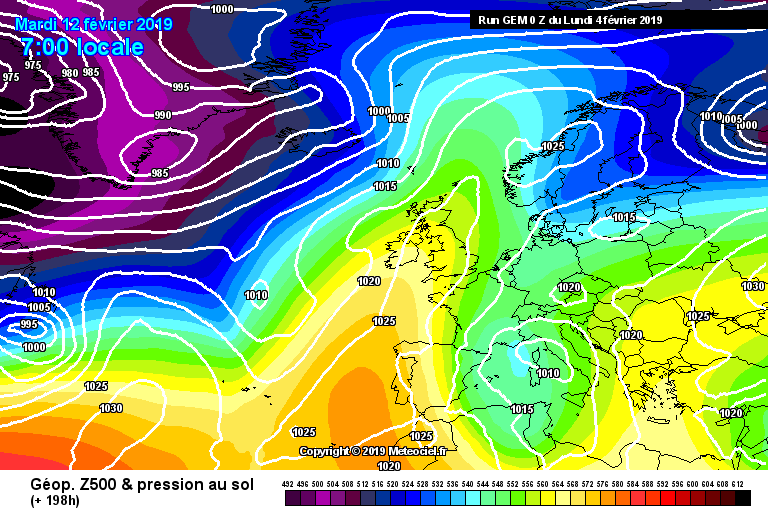
but then settles for something slightly more S than the ECM. All subtle and not without interest as we enter
what I call the business end of winter - February to mid March.
Originally Posted by: Whether Idle