Quantum
  • Quantum
  • Advanced Member Topic Starter
11 February 2020 19:14:59

Many have seen wintry showers over the past day or so, some will have seen some snow coverage especially on higher ground. However, in addition to the convective snow potential tonight and tommorow morning we also have a frontal system which could give some more prolonged snow. The risk is low, but the severity has the potential to be rather high.


Occluding ana warm front moving into cold air. These are some of the best snow makers in the UK. Don't worry about the 850hpa temps. -3C is cold enough provided:


  • Wind is relatively light to the north of the front

  • Front is coherant and strong. The bigger the temperature gradient the better

  • The track of the LP is just right. Too far north or south limits the risk of snow. From my experience the north midlands tend to be the biggest winners in this kind of scenario but we will see.


Twitter: @QuantumOverlord (general), @MedicaneWatch (medicane/TC stuff)
2023/2024 Snow days (approx 850hpa temp):
29/11 (-6), 30/11 (-6), 02/12 (-5), 03/12 (-5), 04/12 (-3), 16/01 (-3), 18/01 (-8), 08/02 (-5)

Total: 8 days with snow/sleet falling.

2022/2023 Snow days (approx 850hpa temp):

18/12 (-1), 06/03 (-6), 08/03 (-8), 09/03 (-6), 10/03 (-8), 11/03 (-5), 14/03 (-6)

Total: 7 days with snow/sleet falling.

2021/2022 Snow days (approx 850hpa temp):

26/11 (-5), 27/11 (-7), 28/11 (-6), 02/12 (-6), 06/01 (-5), 07/01 (-6), 06/02 (-5), 19/02 (-5), 24/02 (-7), 30/03 (-7), 31/03 (-8), 01/04 (-8)
Total: 12 days with snow/sleet falling.
Saint Snow
11 February 2020 19:34:45

We need one of your famous probability maps!!


Martin
Home: St Helens (26m asl) Work: Manchester (75m asl)
A TWO addict since 14/12/01
"How can wealth persuade poverty to use its political freedom to keep wealth in power? Here lies the whole art of Conservative politics."
Aneurin Bevan
idj20
11 February 2020 19:45:36

Another one that will completely bypass Kent. 

I've long since pulled the plug on this "Winter" and just want to experience the first bit of actual spring-like warmth as soon as possible. 


Folkestone Harbour. 
Quantum
  • Quantum
  • Advanced Member Topic Starter
11 February 2020 19:48:42

Originally Posted by: Saint Snow 


We need one of your famous probability maps!!


I'll do one tommorow night, I suspect the snow risk will transfer south somewhat, as it always seems to. So while S Scotland, NW England looks good now, it would not suprise me at all if we end up seeing snow in Sheffield.


Twitter: @QuantumOverlord (general), @MedicaneWatch (medicane/TC stuff)
2023/2024 Snow days (approx 850hpa temp):
29/11 (-6), 30/11 (-6), 02/12 (-5), 03/12 (-5), 04/12 (-3), 16/01 (-3), 18/01 (-8), 08/02 (-5)

Total: 8 days with snow/sleet falling.

2022/2023 Snow days (approx 850hpa temp):

18/12 (-1), 06/03 (-6), 08/03 (-8), 09/03 (-6), 10/03 (-8), 11/03 (-5), 14/03 (-6)

Total: 7 days with snow/sleet falling.

2021/2022 Snow days (approx 850hpa temp):

26/11 (-5), 27/11 (-7), 28/11 (-6), 02/12 (-6), 06/01 (-5), 07/01 (-6), 06/02 (-5), 19/02 (-5), 24/02 (-7), 30/03 (-7), 31/03 (-8), 01/04 (-8)
Total: 12 days with snow/sleet falling.
Caz
  • Caz
  • Advanced Member
11 February 2020 19:55:24

Originally Posted by: Saint Snow 


We need one of your famous probability maps!!


  Yes please Q!


Market Warsop, North Nottinghamshire.
Join the fun and banter of the monthly CET competition.
DEW
  • DEW
  • Advanced Member
11 February 2020 20:03:51

Originally Posted by: Quantum 


  • The track of the LP is just right. Too far north or south limits the risk of snow. From my experience the north midlands tend to be the biggest winners in this kind of scenario but we will see.


No, it isn't - it's too far north. When are we going to get a proper winter Channel low?


War does not determine who is right, only who is left - Bertrand Russell

Chichester 12m asl
KevBrads1
11 February 2020 20:17:19

Originally Posted by: Saint Snow 


We need one of your famous probability maps!!


We don't need one Saint for our area. It will be 0%. Let's face it, we should be doing better out of the current set up but it has been a bust.


MANCHESTER SUMMER INDEX for 2021: 238
Timelapses, old weather forecasts and natural phenomena videos can be seen on this site
http://www.youtube.com/channel/UCgrSD1BwFz2feWDTydhpEhQ/playlists
Saint Snow
11 February 2020 20:34:08

Originally Posted by: KevBrads1 


We don't need one Saint for our area. It will be 0%. Let's face it, we should be doing better out of the current set up but it has been a bust.


You make a depressingly valid point, Kevin


Martin
Home: St Helens (26m asl) Work: Manchester (75m asl)
A TWO addict since 14/12/01
"How can wealth persuade poverty to use its political freedom to keep wealth in power? Here lies the whole art of Conservative politics."
Aneurin Bevan
Heavy Weather 2013
11 February 2020 20:55:09

Originally Posted by: Saint Snow 


You make a depressingly valid point, Kevin


at least in the south we just knows it’s ain’t happening. It must be more painful up you end as you parameters don’t look too bad. 


This year it is trying so hard not to snow.


Mark
Beckton, E London
Less than 500m from the end of London City Airport runway.
Tim A
11 February 2020 21:08:41

Originally Posted by: KevBrads1 


We don't need one Saint for our area. It will be 0%. Let's face it, we should be doing better out of the current set up but it has been a bust.


My parents have reported issues in Oldham up to Saddleworth and top of M62 throughout today so there is some snow about. 


But it hasn,t  been a bust as who has ever forecast low level snow?  The air isnt cold enough. 


Tim
NW Leeds
187m asl


KevBrads1
11 February 2020 21:54:44

Originally Posted by: Tim A 


My parents have reported issues in Oldham up to Saddleworth and top of M62 throughout today so there is some snow about. 


But it hasn,t  been a bust as who has ever forecast low level snow?  The air isnt cold enough. 


For a start to have snow chances you need the preciptation in the first place and that is the point, there have been hardly any showers, the Irish Sea has been a convective dead zone.


Matt Hugo on Twitter says he has found it strange how quiet  the Irish Sea has been in terms of convection. 


MANCHESTER SUMMER INDEX for 2021: 238
Timelapses, old weather forecasts and natural phenomena videos can be seen on this site
http://www.youtube.com/channel/UCgrSD1BwFz2feWDTydhpEhQ/playlists
Quantum
  • Quantum
  • Advanced Member Topic Starter
11 February 2020 22:35:14

Originally Posted by: KevBrads1 


For a start to have snow chances you need the preciptation in the first place and that is the point, there have been hardly any showers, the Irish Sea has been a convective dead zone.


Matt Hugo on Twitter says he has found it strange how quiet  the Irish Sea has been in terms of convection. 


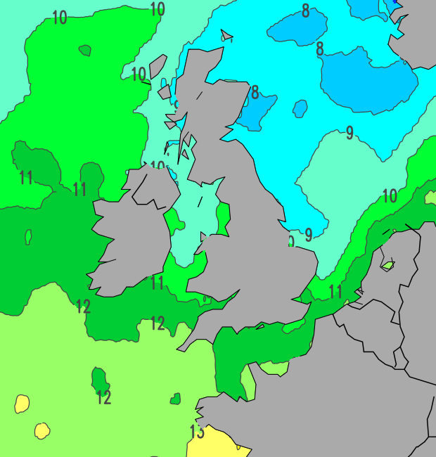
Irish sea is always less favourable for the lake effect.


SSTs are colder, airmass is warmer, fetch is shorter, moisture content is lower.


The Irish sea did have a lake effect today over the Pennine chain. The lake effect doesn't always give showers right at the coast, sometimes the buoyancy isn't quite enough and the mountains are needed for that little extra boost.


But yeh, Irish sea is pretty bad for convection. The cheshire gap is sometimes okay but keep this in mind:


  • North westerly winds mean a much longer fetch

  • North westerly winds are also often much colder

  • The cheshire gap is a convergence zone which provides an additional boost to the convection


To be honest this seems fairly normal for a returning maritime long fetch westerly. Ireland and Scotland gets plastered and England/Wales gets the crumbs.


Twitter: @QuantumOverlord (general), @MedicaneWatch (medicane/TC stuff)
2023/2024 Snow days (approx 850hpa temp):
29/11 (-6), 30/11 (-6), 02/12 (-5), 03/12 (-5), 04/12 (-3), 16/01 (-3), 18/01 (-8), 08/02 (-5)

Total: 8 days with snow/sleet falling.

2022/2023 Snow days (approx 850hpa temp):

18/12 (-1), 06/03 (-6), 08/03 (-8), 09/03 (-6), 10/03 (-8), 11/03 (-5), 14/03 (-6)

Total: 7 days with snow/sleet falling.

2021/2022 Snow days (approx 850hpa temp):

26/11 (-5), 27/11 (-7), 28/11 (-6), 02/12 (-6), 06/01 (-5), 07/01 (-6), 06/02 (-5), 19/02 (-5), 24/02 (-7), 30/03 (-7), 31/03 (-8), 01/04 (-8)
Total: 12 days with snow/sleet falling.
Tim A
11 February 2020 22:56:30

Originally Posted by: KevBrads1 


For a start to have snow chances you need the preciptation in the first place and that is the point, there have been hardly any showers, the Irish Sea has been a convective dead zone.


Matt Hugo on Twitter says he has found it strange how quiet  the Irish Sea has been in terms of convection. 


There have been lots of showers here and east of Manchester , seem to be developing over land . If it was 2c colder here we would have a good covering of snow. 


Tim
NW Leeds
187m asl


LeedsLad123
11 February 2020 23:11:38

Originally Posted by: Tim A 


There have been lots of showers here and east of Manchester , seem to be developing over land . If it was 2c colder here we would have a good covering of snow. 


yeah I’m pretty annoyed by these showers just being hail. They’ve certainly been frequent though.


Whitkirk, Leeds - 85m ASL.
Quantum
  • Quantum
  • Advanced Member Topic Starter
11 February 2020 23:41:37

Snow risk on thursday already trending south


Twitter: @QuantumOverlord (general), @MedicaneWatch (medicane/TC stuff)
2023/2024 Snow days (approx 850hpa temp):
29/11 (-6), 30/11 (-6), 02/12 (-5), 03/12 (-5), 04/12 (-3), 16/01 (-3), 18/01 (-8), 08/02 (-5)

Total: 8 days with snow/sleet falling.

2022/2023 Snow days (approx 850hpa temp):

18/12 (-1), 06/03 (-6), 08/03 (-8), 09/03 (-6), 10/03 (-8), 11/03 (-5), 14/03 (-6)

Total: 7 days with snow/sleet falling.

2021/2022 Snow days (approx 850hpa temp):

26/11 (-5), 27/11 (-7), 28/11 (-6), 02/12 (-6), 06/01 (-5), 07/01 (-6), 06/02 (-5), 19/02 (-5), 24/02 (-7), 30/03 (-7), 31/03 (-8), 01/04 (-8)
Total: 12 days with snow/sleet falling.
Russwirral
11 February 2020 23:46:43
Euro4 model has been forecasting as snow for the past 1-2 days... the 18z rolls out soon.

So long as the air to our south and east has cooled, we have a chance here on the wirral.

Just so long as the air doesnt come in off the sea... regardless of ssts, its always enough to modify the air to rain.


DEW
  • DEW
  • Advanced Member
12 February 2020 06:50:46

This https://www.snow-forecast.com/maps/static/uk/full looks like it'll be snow for northern hills


War does not determine who is right, only who is left - Bertrand Russell

Chichester 12m asl
Russwirral
12 February 2020 09:12:09

Euro4 model still going for widespread snow. Seemingly an upgrade to some parts.... however not much lying tho.

Lets not forget that mondays snow event was forecast for hills only and that turned out wrong too.

Could be some surprises tomorrow.


johncs2016
12 February 2020 09:17:14

Originally Posted by: Russwirral 


Euro4 model still going for widespread snow. Seemingly an upgrade to some parts.... however not much lying tho.

Lets not forget that mondays snow event was forecast for hills only and that turned out wrong too.

Could be some surprises tomorrow.


That may well be true as far as England is concerned, but didn't they say even beforehand that this snow which fell on Monday could get down to lower levels here in Scotland, at least at times?


What's the betting though, that this Thursday's snow event ends up being an England-only (along with Wales and Ireland) event in the end?


After all, it is usually the English who get the vast majority of "interesting" weather events which are going and any time that there is a southerly tracking low such as this one, it is normally just the English (along with the Welsh and Irish) who end up getting anything from that, with Scotland getting nothing (except for those few who live very close to the English border).


That is of course, unless what is being forecast is just rain in which case, there tends to be a better chance of us actually getting that here in this part of the world.


The north of Edinburgh, usually always missing out on snow events which occur not just within the rest of Scotland or the UK, but also within the rest of Edinburgh.
Russwirral
12 February 2020 09:31:12

Originally Posted by: johncs2016 


That may well be true as far as England is concerned, but didn't they say even beforehand that this snow which fell on Monday could get down to lower levels here in Scotland, at least at times?


Yes, i was referring to the intense feature than ran across the midlands on monday lunchtime. 


Users browsing this topic

Ads