moomin75
28 July 2021 06:48:27

Originally Posted by: White Meadows 


Nice Azores ridge asserting itself from 10th. This would be consistent with the Met office extended outlook. They could be mistaken of course, as they often are. I’m just pointing out what’s being suggested by the available data.


Let's hope so 🙏


Witney, Oxfordshire
100m ASL
DEW
  • DEW
  • Advanced Member
28 July 2021 07:10:38

No real change in the summary pattern fro the next two weeks, if anything a downgrade with more extensive rain for all the UK in week 2


GFS - current LP moving off to Norway by Fri 30th leaving a trough over the UK with N-ly winds slowly going round to W-ly before the next LP arrives centred N Ireland 990mb Fri 6th, followed by another 1010mb Bristol Channel Tue 10th. Then at last a ridge of HP Fri 13th from the SW to N Norway with the caveat that the Atlantic up by Greenland is still showing cyclogenesis


GEFS - In the S, cool with intermittent rain through to Fri13th, suggestions of a slight warming towards end. In the N, wet at first, then a colder and drier interlude around Tue 2nd, thereafter temps closer to norm but with rather more rain than in the S.


ECM - very similar to GFS.


No sign of a settled spell for the first half of August though no doubt there will be useable days from time to time.


War does not determine who is right, only who is left - Bertrand Russell

Chichester 12m asl
Taylor1740
28 July 2021 08:04:32
Looks like next Thursday - Saturday could be very Autumnal indeed with a deep low pressure system passing through central/Northern England.
NW Leeds - 150m amsl
GezM
  • GezM
  • Advanced Member
28 July 2021 08:40:55

Originally Posted by: DEW 


No sign of a settled spell for the first half of August though no doubt there will be useable days from time to time.


That sums up the scenario very well 


Living in St Albans, Herts (116m asl)
Working at Luton Airport, Beds (160m asl)
Sevendust
28 July 2021 08:58:33

Originally Posted by: Taylor1740 

Looks like next Thursday - Saturday could be very Autumnal indeed with a deep low pressure system passing through central/Northern England.


ECM op is a shocker.


GEFS ensemble set more sedate. Cool and rather unsettled but I suspect a few useable days in the south at any rate

Caz
  • Caz
  • Advanced Member
28 July 2021 11:16:45

Oh Moomin!  We’re driving to Southampton on the A34, just passed a sign for Whitney and the sky ahead is black!   Seriously!  


Market Warsop, North Nottinghamshire.
Join the fun and banter of the monthly CET competition.
Brian Gaze
28 July 2021 12:17:35

Originally Posted by: Sevendust 


I think Brian got fed up with the nonsense being posted!


Yes. I deleted the thread because I didn't have time to go through it and determine which accounts to vaporise. I'm unlikely to be so charitable next time.  


Brian Gaze
Berkhamsted
TWO Buzz - get the latest news and views 
"I'm not socialist, I know that. I don't believe in sharing my money." - Gary Numan
UncleAlbert
28 July 2021 13:31:01
My glass is half full.... so with respect to the GEFS over the last few days it has to be said that there is a recurrent, all be it rather subdued signal for something more settled as we move deep into week 2 of August.
Rob K
28 July 2021 14:36:59

Originally Posted by: Taylor1740 

Looks like next Thursday - Saturday could be very Autumnal indeed with a deep low pressure system passing through central/Northern England.


And guess when I'm going to the Yorkshire Dales for an MTB event 


Hopefully the ECM is overdoing that low pressure.


Yateley, NE Hampshire, 73m asl
"But who wants to be foretold the weather? It is bad enough when it comes, without our having the misery of knowing about it beforehand." — Jerome K. Jerome
Taylor1740
28 July 2021 19:31:12

Originally Posted by: Rob K 


And guess when I'm going to the Yorkshire Dales for an MTB event 


Hopefully the ECM is overdoing that low pressure.


Better for you on the ECM12Z more just normal unsettled showery weather, rather than full on washout. Looks like it's going to be quite a cool start to August, and given the outlook almost to the middle of August, likely to be quite a cool month overall unless we get a significant flip mid month which does seem to happen a lot these days.


NW Leeds - 150m amsl
DEW
  • DEW
  • Advanced Member
29 July 2021 07:06:55

WX summaries still show cool and damp (the latter esp week2) and the same goes for most of N Europe with NW Scotland and Norway definitely short on anything summery.


Jet - looping down over France to Fri 6th, then much closer to the UK - mostly as a narrow loop but straightening out to give a strong direct flow  across N England Tue 10th and Sat 14th


GFS - current LP moving off into Norway by Sat 31st; today's GFS also picks up the small LP running up the Channel tomorrow to join up with the one in Norway. As yesterday, this results in a period of N'ly winds gradually going round W-ly by Tue 3rd but any HP still well off in the Atlantic. New LPs in this W-ly flow  move through Sat 7th  Ireland and Wed 11th Hebrides both 1000 mb, Final frame Sat 14th shows a general area of LP with three centres in it stretching from Labrador, between N Scotland & Iceland, and on to Scandinavia.


GEFS - In the S, cool with intermittent rain and temps gradually rising to norm over the next fortnight (little disagreement on temps until Wed 11th when a greater spread starts to show) Scotland similar though with likelihood of heavier rain around and after Sat 7th. (Actually quite cold for Inverness Sun 1st)


ECM - advances the LP on Sat 7th by a day i.e. over Wales on Fri 6th; then the next LP is sooner and takes a more S-ly track and is approaching from mid-Atlantic Sun 8th with suggestion of some warmth being brought up from the S


War does not determine who is right, only who is left - Bertrand Russell

Chichester 12m asl
White Meadows
29 July 2021 13:44:37
Steady as she goes today with the settled and hot spell for the south on the way mid month 😎 ☀️
Gusty
29 July 2021 14:01:11

Originally Posted by: White Meadows 

Steady as she goes today with the settled and hot spell for the south on the way mid month 😎 ☀️


Top of the ensemble suite towards the end of the run. From little acorns and all that.....


https://www.wetterzentrale.de/en/show_diagrams.php?model=gfs&lid=ENS&var=2&bw=1&geoid=49909


Steve - Folkestone, Kent
Current conditions from my Davis Vantage Vue
https://www.wunderground.com/dashboard/pws/IFOLKE11 
Join Kent Weather on Facebook.
https://www.facebook.com/stevewall69/ 


Taylor1740
29 July 2021 14:35:31
Very much an outlier that GFS 6z run, I wouldn't be getting my hopes up just yet for a mid month improvement.
NW Leeds - 150m amsl
Sevendust
29 July 2021 15:58:19

Originally Posted by: Taylor1740 

Very much an outlier that GFS 6z run, I wouldn't be getting my hopes up just yet for a mid month improvement.


The op has some support within the scatter but the mean remains at average so I'm not excited at this stage 

Brian Gaze
29 July 2021 16:05:49

The UK's first ever July named storm. #StormEvert


Brian Gaze
Berkhamsted
TWO Buzz - get the latest news and views 
"I'm not socialist, I know that. I don't believe in sharing my money." - Gary Numan
carla
29 July 2021 16:18:39

Originally Posted by: Brian Gaze 


The UK's first ever July named storm. #StormEvert


I'm in a tent in st agnes 😅🙈


Holton le clay lincolnshire
NMA
  • NMA
  • Advanced Member
29 July 2021 16:45:43

I was capturing some images yesterday for an interpretive panel and used a long lens for some of this. Some of the higher hills of Dorset inland from Weymouth are covered in what must be hundreds of tents from large bell tents to the more normal styles but all vulnerable to wind. I've never seen anything like it, far more than last year and that was incredible. Many are located on the tops of hills with great views but terribly exposed to bad weather.


I like to think the landowners will make their customers aware of the wind dangers tonight.


Vale of the Great Dairies
South Dorset
Elevation 60m 197ft
johncs2016
29 July 2021 17:04:01

Originally Posted by: Brian Gaze 


The UK's first ever July named storm. #StormEvert


If my memory serves me right, this year will therefore be the fourth year in a row where at least one part of the UK will have experienced at least one named storm during the summer as well (last year, there was even two of them as Storm Ellen was quickly followed by Storm Francis).


I have noted though that once again, it is the southerners who are hogging all of the more interesting weather action from this. That has been ongoing for quite a while now (there has been some recent heavy rain here in Scotland as well but as per usual, Edinburgh got almost nothing at all from that as we generally don't get "interesting" weather here, and even that wet spell in the rest of Scotland has ended up being fairly short-lived compared to what is regularly happening down south).


This therefore, is only continuing to lend further weight to my argument that we really need to stop referring to the so-called "default" setup as being one which is wettest in the north and driest in the south, especially as I can't even remember the last time that this was actually the case, thus showing that this is clearly no longer the case any more as it once used to be.


All too often, I see model output which promises a change to wetter conditions in the north and drier conditions in the south, only for that to either completely fail to materialise, or for everything to be shunted further south so that it is the southerners who end up getting either most or all of the wet weather yet again. Furthermore, I have even lost count of how many times this has happened over the last year or so, as that has been happening so often.


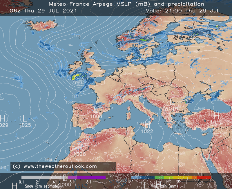
 Furthermore, I see nothing in the latest model output which suggests any sort of change to that scenario any time soon.


The north of Edinburgh, usually always missing out on snow events which occur not just within the rest of Scotland or the UK, but also within the rest of Edinburgh.
White Meadows
29 July 2021 17:05:57
Lovely sustained heat being shown on the 12z later in the month.
The evolving pattern has many of the hallmarks for perhaps record breaking heat in the south east.
Users browsing this topic

    Ads