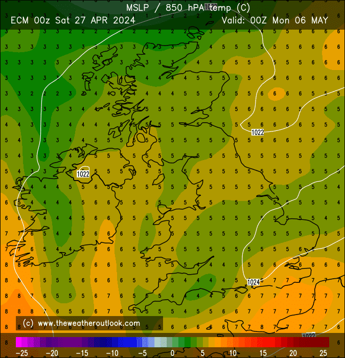
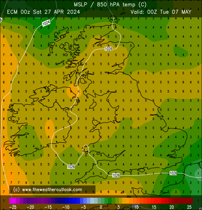
These 850s for the final two charts of the 12z ECM are truly extraordinary.
For reference, the days in late Sep 2011 with the highest 850s were both no higher than 15*C (I've looked on the French website and found no instances of the 16*C isotherm across the UK, but it doesn't show the 15*C one so the below charts show the situation the best).


I don't suppose anyone's aware of any higher 850s having occurred in the 2nd half of September before?
I'm especially wondering about 1906, which according to a book I own, saw an extreme drought even more severe than that of 1976, with summer temps persisting right the way through to mid-October. The all-time September max temp record of 35.6*C was set on 2nd.
The overall pattern of a strong and persistent ridge setting up across Europe actually makes a lot of sense based on an active period for tropical cyclones in the N. Atlantic coinciding with eastward-propagating tropical waves in the Pacific.
Essentially, these drive a lot of northward transport of atmospheric angular momentum, which amplifies the weather patterns in a configuration which favours UK/European ridge placement.
If the tropical waves were in the Indian Ocean, it'd be a very different story for our temperatures, with the ridge favoured to locate west of the UK & Europe.
Of course, we can in no way be sure that temps will become so impressively warm as the models are currently keen on - but I'll be shocked if there isn't at least some appreciably summer-like weather to be enjoyed across a large part of the UK.
All this, following a dry 7 days of weather with temps somewhat summer-like away from the far north this weekend, and then fresher to some extent or other early to mid-next week.
Unless you like it windy and/or wet in September, the outlook could hardly be more satisfying  .
.
If you have any problems or queries relating to TWO you can Email
[email protected] 🙂
https://twitter.com/peacockreports 2021's Homeland Extremes:
T-Max: 30.4°C 21st Jul | T-Min: -6.8°C New Years Day! | Wettest Day: 34.1mm 2nd Oct | Ice Days: 2 (27th Jan & 8th Feb)
Keep Calm and Forecast On