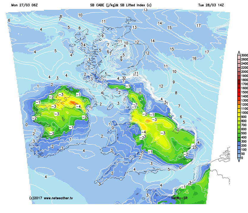
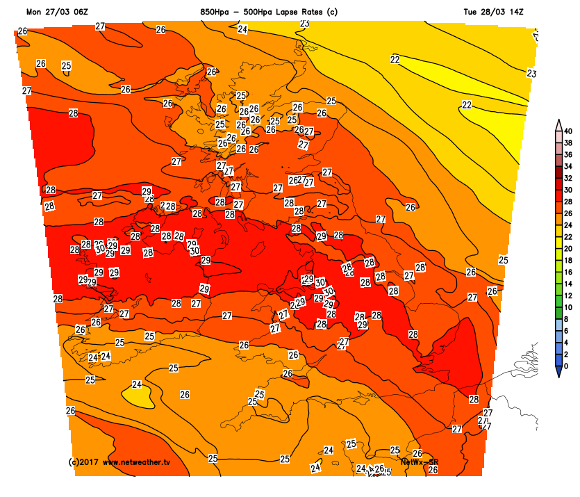
Likely to be a few thunderstorms firing off tomorrow afternoon, as high pressure collapses away and we bring in a more unstable air mass from the south west. CAPE and LI look pretty decent for this time of year, and combined with steep lapse rates, some could get a kick-off to the thunder season.
Also looks quite interesting given the weather we've just had as well - an anticyclonic warm spell, giving way to thunderstorms as the Atlantic tries to break through. Seems a bit like the break down of a summer warm spell! It's pretty unusual to get this in March.