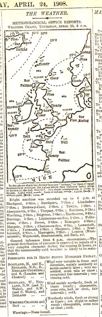
Late April 1908 was exceptionally wintry when slow moving low pressures and Arctic air combined to produce huge snowfalls in many parts of the south. The period 23rd-26th April produced snowfalls that would have been notable even in January. Norfolk and Suffolk: 30cm of lying snow on the 23rd; Epsom racecourse: 15cm on the 24th; Southampton 35cm on the 25th and Oxford 40cm on the 26th.
The 24th of April was exceptionally cold with a CET mean of just 0.5, one of the coldest CET days ever recorded for April.
23rd-25th April CET: 1.6
April 1908 CET: 6.0
-12.8C was recorded at Garforth (West Yorkshire) and at Perth on the 24th
-12.2C was recorded at Corstorphine(Edinburgh) on the 25th.
The last two days of April 1908 were considerably milder and this brought a rapid thaw to the lying snow causing serious flooding through meltwater.

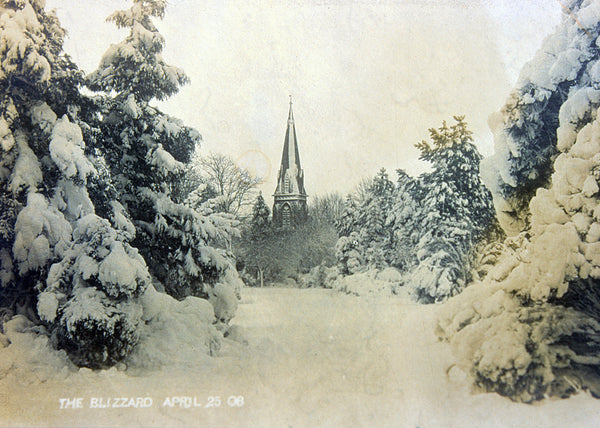
Here are some reports of snow depths and other info on the remarkable heavy snowfalls that occurred during late April 1908.
Knotty Ash: 6 inches (24th-26th)
Milton Bryant: Snow fell from 1.30 to 6pm on 23rd. 8 inches
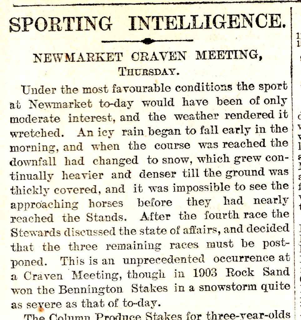
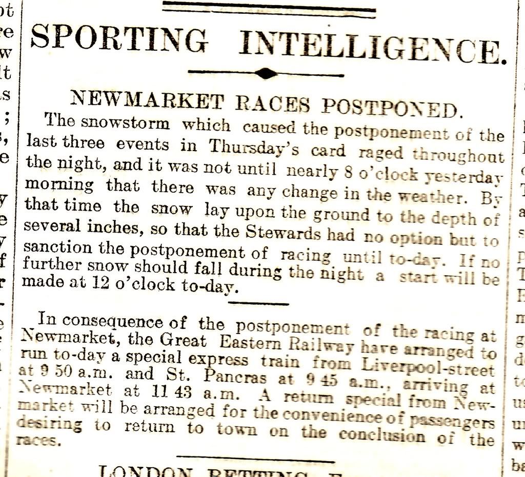
Newmarket: So severe was the snowstorm that racing stopped at 3.30pm on the 23rd
Hethersett: Heavy fall of snow, depth by morning of 24th was 9 inches.
Liskeard: 5 inches of snow on 23rd
Drunmore: 9 inches of snow on 23rd
24th April
Epsom: 6 inches melted by noon
Detling: 5 inches
Christchurch: 14 inches
Great Barford: 8 inches
Camden Square: 3.5 inches
Ticehurst: 2 inches
Broham: 12 inches
Dovercroft: 1.5 inches
Haslingden: 3 inches
Lampeter: 6 inches
Criccieth: 2 inches
Lurgan: 7 inches by noon
25th April
Headley House: 15 inches
West dean: 18 inches
Shrewton: 14 inches
Haslemere: 12 inches, 3ft drifts
Epsom: 5 inches
Freshwater: 14 inches
East Cowes: 10 inches
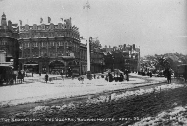
Bournemouth: 12 inches
Milford-on-Sea: 15 inches
Fordingbridge: 9 inches
Broughton: 18 inches
Alton: 15 inches
Barton Stacey: 24 inches
Newbury: 18 inches
Yattendon Court: 20 inches
Farnborough: 20 inches
Abingdon: 27 inches
Caversham: 16 inches
Bicester: 16 inches
Steeple Aston: 16 inches. 6ft drifts
Downton: 15 inches
Stratford-sub-Castle: 15 inches
Wilcot: 11.5 inches
Poole: 9 inches
Long Compton: 13 inches
Honington: 11 inches
Leamington: 8 inches
Coventry: 9 inches
Alderney: 13 inches
Some other reports
Meltham
Maxima was below 39.0F from 23rd to 25th
Snow fell on 4 consecutive days
9 inches
Max temp on 24th was 34.5F and noon temp was 25.6F
Northwood, Middlesex
19th April: NNW wind, frequent heavy snow showers
20th April: Sleet/snow squalls
21st April: Milder
22nd April: Rain towards evening
23rd: Rain turning to snow
24th: 3 inches of snow
25th: Heavy snow early morning. Further snow 10am-12pm, 4 inches
Oxford
23rd April: Rain turning to sleet, snowing heavily by 4pm.
24th April: 4 inches of snow on ground, afternoon snow showers.
25th April: 13 inches of snow by 4pm


MANCHESTER SUMMER INDEX for 2021: 238
Timelapses, old weather forecasts and natural phenomena videos can be seen on this site
http://www.youtube.com/channel/UCgrSD1BwFz2feWDTydhpEhQ/playlists